
Pancoastburg, Ohio facts for kids
Quick facts for kids
Pancoastburg, Ohio
|
|
|---|---|

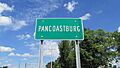
Looking north on Ohio State Route 207 in Pancoastburg
|
|

Pancoastburg, Ohio
Location in Ohio

Pancoastburg, Ohio
Location in the United States
|
|
| Country | United States |
| State | Ohio |
| County | Fayette |
| Township | Madison |
| Area | |
| • Total | 0.35 sq mi (0.90 km2) |
| • Land | 0.34 sq mi (0.88 km2) |
| • Water | 0.01 sq mi (0.01 km2) |
| Elevation | 863 ft (263 m) |
| Population
(2020)
|
|
| • Total | 68 |
| • Density | 199.41/sq mi (77.07/km2) |
| Time zone | UTC-5 (Eastern (EST)) |
| • Summer (DST) | UTC-4 (EDT) |
| ZIP code |
43160
|
| Area code(s) | 740 |
| GNIS feature ID | 2628950 |
| FIPS code | 39-59724 |
Pancoastburg (originally known as Pancoastburgh) is a small community in Ohio, United States. It is an unincorporated community, which means it doesn't have its own local government like a city or town. It is also a census-designated place (CDP). This means the government counts its population for statistics.
Pancoastburg is located in Fayette County, within Madison Township. You can find it along Ohio State Route 207. It is about 6 miles (10 km) south of Mount Sterling. In 2020, the population of Pancoastburg was 68 people.
Contents
History of Pancoastburg
Pancoastburg has a long and interesting history. It was first known as Pancoastburgh.
Early Beginnings and Mills
In the 1820s, a man named Samuel Pancoast started a carding mill in the area. A carding mill was a place where raw wool or cotton was prepared for spinning into yarn. This was an important business back then.
The community was also a stop for stage coaches. These were horse-drawn carriages that carried people and mail between towns. Pancoastburg was on the route between Chillicothe and Urbana.
Town Planning and Name Changes
Later, Isaiah Pancoast owned the land and planned out the town. At one point, the settlers in the area split into two groups. One group stayed in Pancoastburg. The other group moved a short distance away to settle Yankeetown.
Around this time, the name of Pancoastburg was changed to Waterloo. However, Yankeetown did not last long. The settlers who had moved there soon returned to the original Pancoastburg site. By 1860, the community's name was changed back to Pancoastburg.
Post Office History
Pancoastburg also had its own post office. It was first opened on August 19, 1786, under the name "Pancoastburgh." The name was officially changed to "Pancoastburg" on May 16, 1893. The post office eventually closed on December 15, 1920. Today, mail service for Pancoastburg comes through the Washington Court House branch.
Ancient History: Jackson Mound
About 4 miles (6 km) north of Pancoastburg, you can find the Jackson Mound. This mound was built by the Adena culture. The Adena were a group of Native Americans who lived in this region a very long time ago. They are known for building large earth mounds. The Jackson Mound is the last remaining Native American mound in Fayette County.
Population Information
Pancoastburg is a small community. Here's how its population has been counted over the years:
| Historical population | |||
|---|---|---|---|
| Census | Pop. | %± | |
| 2020 | 68 | — | |
| U.S. Decennial Census | |||
See also
 In Spanish: Pancoastburg (Ohio) para niños
Images for kids
-
A sign welcoming you to the Pancoastburg community.

