Papakura District facts for kids
Quick facts for kids
Papakura District
|
||
|---|---|---|
|
Former local council territory
|
||
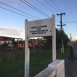
Sign marking former Papakura District Boundary.
|
||
|
||
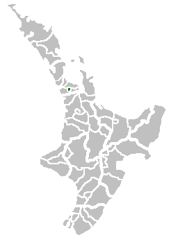
Territorial Authority location
|
||
| Country | New Zealand | |
| Main town | Papakura | |
| Other towns | Alfriston, Drury, Pahurehure, Ardmore, Redhill, Takanini | |
| Area
(in 2010)
|
||
| • Total | 123 km2 (47 sq mi) | |
| Extent was Takanini to Drury; Pahurehure to Ardmore/Alfriston | ||
| Population
(June 2018 )
|
||
| • Papakura (central) | 28,010 | |
| • Takanini | 10,870 | |
| Council address | 35 Coles Cres, Private Bag 92300, Auckland 1142 | |
| See also: Manukau City, Franklin | ||
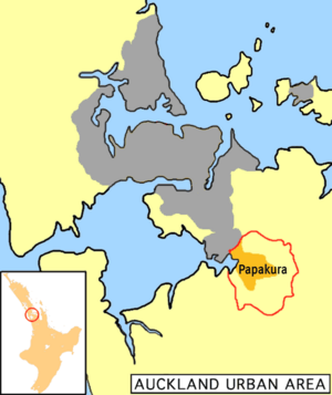
Papakura District was a local government area in New Zealand that existed from 1989 to 2010. It was managed by the Papakura District Council. This area is the southernmost part of the Auckland metropolitan region.
Papakura was once a small, independent city. It became the Papakura District in 1989 when New Zealand's local governments were reorganized. Over time, the city of Auckland grew, and Papakura became part of its large urban sprawl. The district had beaches on the Manukau Harbour to the west. To the north and east was Manukau City, and to the south was Franklin District.
Contents
Exploring Papakura's Geography
In 2010, the Papakura District covered 123 square kilometers. Its center was about 32 kilometers from downtown Auckland.
Land and Water Features
The district has many different types of land. You can find flat, fertile plains and the edges of the Manukau Harbour. There are also rolling hills that lead into the Hunua Ranges. This area is a narrow strip of land between the Hauraki Gulf and the Manukau Harbour.
Much of the district, especially in the west, is flat or gently rolling. The Takanini area has a lot of peat soil. This shows it was once a huge wetland. In the east, smaller hills lead towards the Hunua Range.
Towns and Neighborhoods
Keri Hill has farms with great views over Ardmore. Pukekiwiriki was an important spot for the Maori people long ago. Today, it is a popular neighborhood. Pahurehure is located by the Manukau Harbour.
Drury is the first real country town south of Auckland. Takanini is Papakura's main area for factories and businesses.
Local Wards and Suburbs
When the Papakura District Council existed, the district was divided into four areas called wards. Now, this whole area is known as the Papakura Local Board within the new Auckland Council.
- Ardmore Ward
- Pahurehure Ward
- Pahurehure
- Conifer Grove
- Longford Park
- Hingaia
- Drury Ward
- Red Hill Ward
- Red Hill
- Ponga
- Towards the Hunua Ranges
Papakura's History
In 1989, there was a big change in how local governments were set up in New Zealand. This is when Papakura became a district. Before that, a smaller area was known as Papakura City. The new district included parts of the countryside that used to be part of Manukau City.
After this big change, Papakura City became Papakura District. It was part of the Auckland Region. For counting purposes, the entire district was considered part of the Auckland urban area. It formed part of Auckland's southern edge.
On November 1, 2010, the Papakura District Council joined with the new Auckland Council. All the services and buildings that belonged to the Papakura Council were taken over by the new Auckland Council.
Who Lives in Papakura?
The population of Papakura District has been growing very quickly. It grows about three times faster than the rest of New Zealand. Most people living there are of European background.
Over 60% of residents are from the European ethnic group. About 36% are from Maori and Pacific Islander groups. The city council plans for Papakura's population to more than double by the year 2050.
Community Facilities and Services
Armed Forces Presence
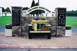
Papakura used to have a large number of military personnel. Today, only the SAS special forces are based there. The houses nearby were originally built for army families, but now they are privately owned.
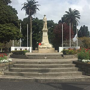
A significant war memorial stands at the corner of Great South Road and Opaheke Road. This is where events like Anzac Day and other special remembrance days are held. For example, the Armistice Day Centenary was held there in 2018.
Public Transport Options
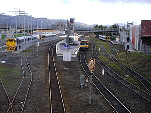
Auckland's southern motorway and the main railway line run through the Papakura District. A large airfield is also nearby at Ardmore. Trains and buses are the main ways people get around using public transport.
Trains run often on the Southern Line between Papakura and the city center (Britomart). Money has been spent to improve the trains and railway stations. A modern station was recently opened in the town center. Papakura is the last stop for most southbound public transport in Auckland services. It is the third busiest station on the rail network. Many people from Papakura, Franklin County, and northern Waikato use the trains to get to and from the city. While the motorway and Great South Road are usually clear, traffic can get very busy closer to Auckland city.
Ardmore Airport Activities
Ardmore Airport is used by people who fly for fun, and for private and commercial flights. It is the busiest airport in New Zealand based on how many planes take off and land. The airport is home to many new and creative aerospace businesses. It is very popular with people who fly for non-commercial reasons.
Recreation and Sports
Papakura has many great sports facilities. These include an indoor and outdoor swimming pool, and a track for athletics that meets international standards. There is also a sports stadium and places for rugby, netball, golf, tennis, badminton, and soccer. The local council also runs a library and a theater. Papakura has several skate parks, a skate bowl, and a large BMX track. This track often hosts big cycling events.


