Franklin District facts for kids
Quick facts for kids
Franklin
|
|
|---|---|
|
Former territorial authority
|
|
 |
|
| Country | New Zealand |
| Area | |
| • Total | 2,187.94 km2 (844.77 sq mi) |
| Extent | Papakura to Meremere; Port Waikato to Miranda, Firth of Thames |
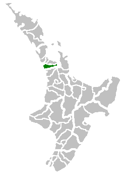
Franklin District was a special area in New Zealand that used to manage its own local government. It was located between the big city of Auckland and the flat farmlands called the Waikato Plains.
On October 31, 2010, Franklin District stopped being a separate area. It was split into two main parts. The northern part (about 40% of its land) joined the Auckland Council. The southern and eastern parts (about 60% of its land) became part of the Waikato District and Hauraki District in the Waikato region.
Today, the part that joined Auckland is known as the Franklin Ward. Before it was split, Franklin District was managed from the town of Pukekohe. The last mayor, Mark Ball, wanted Franklin District to stay independent. However, this idea was not approved by the government.
Contents
Where Was Franklin District Located?
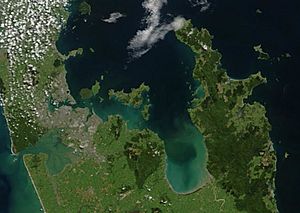
Franklin District was bordered by the start of the Auckland city area to the north. It also touched the waters of the Manukau Harbour. The Awhitu Peninsula stretches along the Tasman coast to the mouth of this harbour. Here, you can find popular holiday spots like Karioitahi Beach.
To the south, Franklin was next to the rich farmlands of the Waikato Plains. In the east, the land rises to the Hunua Ranges. Then it drops down to the coast of the Firth of Thames. To the west was the Tasman Sea. The Waikato River flows out into the sea at Port Waikato in the south. This spot is famous for surfcasting.
The area is mostly rural, meaning it has a lot of farms. Towns like Waiuku and Tuakau support the farming industry. One important business in the area is the New Zealand Steel steel mill at Glenbrook, which is north of Waiuku.
Leaders of Franklin District
Six people served as mayor of Franklin District during its 21 years of existence:
| Name | Term | |
|---|---|---|
| 1 | Max R. Short | 1989–1992 |
| 2 | Peter Aitken | 1992–1995 |
| 3 | Joan O'Sullivan | 1995 |
| 4 | Matt Barnett | 1995–1998 |
| 5 | Heather Maloney | 1998–2004 |
| 6 | Mark Ball | 2004–2010 |
Why Was It Called Franklin?
The name "Franklin" likely comes from Lady Jane Franklin. She was an early British traveler. She was also the wife of Captain Sir John Franklin. He was the Lieutenant-Governor of Van Diemen's Land (now Tasmania) from 1837 to 1843. Lady Franklin visited the Waikato Heads area in 1841.
News and Media in Franklin
The Franklin County News is a newspaper published twice a week. It is based in Pukekohe and covers the former Franklin District area. The Post Newspaper prints 26,000 copies every Tuesday. It covers Franklin and North Waikato. The Post Newspaper has offices in both Pukekohe and Waiuku. In 2015, an online calendar and photo news website called Franklin Life NZ was launched.
Towns and Settlements in Franklin
Here are some of the towns, villages, and other settlements that were once part of Franklin District. They are grouped by which new area they belong to today:
Northern Franklin (Now Part of Auckland Council)
- Wattle Bay, Orua Bay, Big Bay, Grahams Beach, Awhitu, Kauritutahi, Matakawau, Matakawau Point, Clarks Beach, Pollok, Te Toro, Glenbrook Beach, Waiau Beach, Mission Bush, Karioitahi, Waiuku, Kingseat, Waiau Pa, Patumahoe, Te Hihi, Karaka, Roseneath Road, Paerata, Pukekohe, Bombay, Ararimu, Hūnua.
Southern Franklin (Now Part of Waikato District)
- Otaua, Aka Aka, Tuakau, Buckland, Paparimu, Pōkeno, Port Waikato, Mercer, Mangatāwhiri, Onewhero, Pukekawa, Glen Murray, Naike, Mangatangi, Limestone Downs.
North Eastern Franklin (Now Part of Hauraki District)
- Waharau, Whakatīwai, Kaiaua, Miranda.
 | Victor J. Glover |
 | Yvonne Cagle |
 | Jeanette Epps |
 | Bernard A. Harris Jr. |


