
Parinacota Volcano facts for kids
Quick facts for kids ParinacotaParina Quta |
|
|---|---|

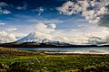
Parinacota and Chungará Lake
|
|
| Highest point | |
| Elevation | 6,342 m (20,807 ft) |
| Prominence | 1,989 m (6,526 ft) |
| Listing | Ultra |
| Geography | |
|
Lua error in Module:Location_map at line 420: attempt to index field 'wikibase' (a nil value).
|
|
| Location | Bolivia – Chile border |
| Parent range | Andes |
| Geology | |
| Mountain type | Stratovolcano |
| Volcanic arc/belt | Central Volcanic Zone |
| Last eruption | 290 CE ± 300 years |
| Climbing | |
| First ascent | 1928 |
| Easiest route | snow/rock scramble |
Parinacota, also known as Parina Quta, is a huge dormant volcano. Its name comes from the Aymara language. "Parina" means flamingo and "quta" means lake. So, Parinacota means "flamingo lake." This impressive volcano sits right on the border between Chile and Bolivia. It is a type of volcano called a stratovolcano.
First Climbers
The first people to climb Parinacota were Carlos Terán from Bolivia and Joseph Prem from Austria. They reached the top on December 12, 1928.
Where is Parinacota Located?
Parinacota is part of a group of volcanoes called the Payachata volcanic group. It stands next to another peak called Pomerape. Both of these volcanoes are very old.
This volcano is located right on the border. It is found between Sajama National Park in Bolivia and Lauca National Park in Chile.
Images for kids
-
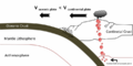
Subduction
-
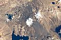
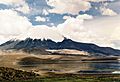
Parinacota volcano in the centre. Upper right is Pomerape, left are the Cotacotani lakes and the avalanche deposit and the black structure below the middle is Lake Chungará
-
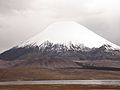
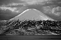
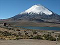
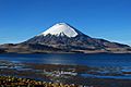
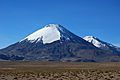
Parinacota with a snowcap
-
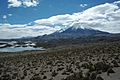
View on the sector collapse deposit. In the background Pomerape, on the left the Cotacotani lakes
-
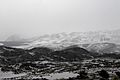
The snow covered collapse deposit
-
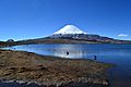
Lake Chungará
-
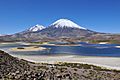
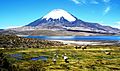
The Lagunas Cotacotani, with Parinacota and Pomerape in the background
-
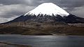
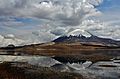
Parinacota after snowfall
-
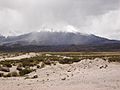
Cloudy Parinacota
-
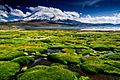
Plant communities in front of Lake Chungará
-
The lava domes are visible as grey hills
-
The young cone, in the foreground are lava domes from the plateau stage
-
The white lava domes and a black lava flow are visible above the lake
-
The domes at the foot of Parinacota are well visible. In the middle right of the image, one of the Ajata lava flows is recognizable
-
The grey lava domes and a black Ajata lava flow are clearly visible
-
A black lava flow almost reaches the lake
-
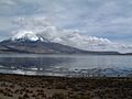
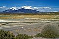
Vegetation at Lake Chungará; the summit of Parinacota is enveloped in a cloud
-
Animals in front of Lake Chungará
-
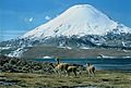
Animals in front of Lake Chungará
-
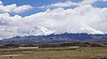
Parinacota on the right and Pomerape on the left
-
Parinacota and Pomerape
-
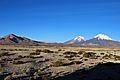
Parinacota on the right and Pomerape just right of the centre
-
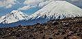
Parinacota, on the left Pomerape
-
Parinacota, on the left Pomerape


.jpg)


.jpg)


See also
 In Spanish: Volcán Parinacota para niños
