Pomerape facts for kids
Quick facts for kids Pomerape |
|
|---|---|

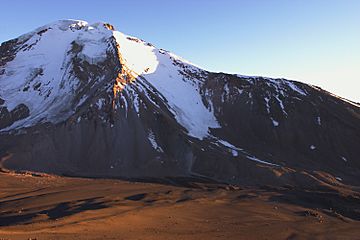
Pomerape and the saddle below, as seen from south (Parinacota slopes)
|
|
| Highest point | |
| Elevation | 6,282 m (20,610 ft) |
| Geography | |
| Parent range | Andes |
| Geology | |
| Age of rock | Pleistocene |
| Mountain type | Stratovolcano |
| Climbing | |
| Easiest route | snow/ice climb |
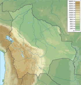
Pomerape is a tall stratovolcano located right on the border between northern Chile and Bolivia. It's found in the Oruro Department of Bolivia. This volcano is part of a special group called the Payachata complex.
The name "Payachata" means "twins." This is because Pomerape and its neighbor, Parinacota Volcano, look very similar. Even though it's in a high, cold area, Pomerape has glaciers. These ice formations can be found as low as 5,300 metres (17,400 ft) to 5,800 metres (19,000 ft) on its slopes.
How Pomerape Formed
Pomerape is a type of volcano called a stratovolcano. This means it's built up over a long time. It forms from many layers of hardened lava, ash, and rocks.
Scientists believe Pomerape was active about 200,000 years ago. It started with lava domes, which are like thick, sticky lava piles. Later, new lava flows covered these domes. The main part of the volcano, called the cone, formed on top of these older structures.
The main cone of Pomerape last erupted a very long time ago. This was about 106,000 years ago. An older part of the volcano, called an "adventive vent," was active even earlier. That was around 205,000 years ago.
Climbing Pomerape
Climbing Pomerape is a challenging adventure. The easiest way to climb it is along its east ridge. This route is considered an "alpine grade PD." This means it's a bit difficult but can be done by experienced climbers.
There are also harder routes on the south side of the volcano. These routes can have very steep slopes of snow or loose rocks. Climbers often set up a camp at 5,300 metres (17,390 ft). This camp is located in the saddle, which is the low point between Pomerape and Parinacota.
One of the biggest challenges for climbers can be penitentes. These are tall, thin blades of ice that stick up from the snow. Depending on the time of year, they can make climbing very hard or even impossible.
See also
 In Spanish: Volcán Pomerape para niños
- List of volcanoes in Bolivia
 | John T. Biggers |
 | Thomas Blackshear |
 | Mark Bradford |
 | Beverly Buchanan |


