Parks Peak (Blaine County, Idaho) facts for kids
Quick facts for kids Parks Peak |
|
|---|---|

Parks Peak
|
|
| Highest point | |
| Elevation | 10,280 ft (3,130 m) |
| Prominence | 920 ft (280 m) |
| Parent peak | Snowyside Peak |
| Geography | |
| Parent range | Sawtooth Range |
| Topo map | USGS Snowyside Peak |
| Climbing | |
| Easiest route | Scrambling, class 3 |
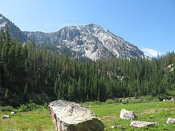
Parks Peak is a tall mountain in the Sawtooth Range of Idaho. It stands about 10,280 feet (3,133 meters) above sea level. This makes it a significant peak in the area.
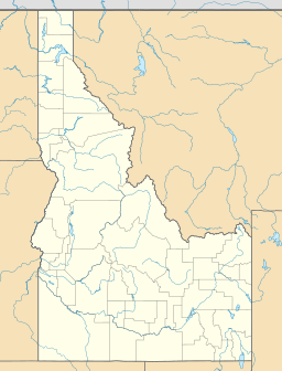
The mountain is located in the beautiful Sawtooth Wilderness. This wilderness area is part of the larger Sawtooth National Recreation Area. Parks Peak sits right on the border between Blaine and Custer counties.
Contents
Where is Parks Peak Located?
Parks Peak is found in the central part of the Sawtooth Range. It is about 2.78 miles (4.47 kilometers) northeast of Snowyside Peak. Snowyside Peak is its "parent peak," meaning it is a higher mountain nearby.
What Other Peaks Are Nearby?
Another peak close to Parks Peak is McDonald Peak. It is about 1.9 miles (3.1 kilometers) northwest of Parks Peak. These peaks are all part of the same mountain range.
Which Lakes Are Close to Parks Peak?
Several beautiful lakes are located near Parks Peak. Farley Lake is to the north of the peak. To the west, you can find Bowknot and Toxaway lakes. These lakes add to the scenic beauty of the area.
How Can You Reach Parks Peak?
The easiest way to climb Parks Peak is by a method called scrambling. Scrambling is a mix of hiking and basic rock climbing. It often involves using your hands for balance and support.
What Does YDS 3 Mean?
The difficulty of the climb is rated as YDS 3. YDS stands for the Yosemite Decimal System. A YDS 3 rating means the climb is a difficult scramble. It might involve some easy climbing moves.
 | Kyle Baker |
 | Joseph Yoakum |
 | Laura Wheeler Waring |
 | Henry Ossawa Tanner |


