Parque del Plata facts for kids
Quick facts for kids
Parque del Plata
|
|
|---|---|
|
City
|
|
| Country | |
| Department | |
| Population
(2011 Census)
|
|
| • Total | 7,896 |
| Time zone | UTC -3 |
| Postal code |
16100
|
| Dial plan | +598 437 (+5 digits) |
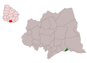
Parque del Plata is a city in the Canelones Department of southern Uruguay. It is part of the beautiful Costa de Oro, which means "Gold Coast."
Contents
Geography
Where is Parque del Plata?
This city is located on the Ruta Interbalnearia, a main road. It is about 49 kilometers (30 miles) east of Montevideo, the capital city. Parque del Plata stretches for about 3 kilometers (1.9 miles) along the coast. It is found west of the small river called Arroyo Solís Chico. The way the town is planned, with its modern design, shows the influence of a famous architect named Le Corbusier.
History
How Parque del Plata Became a City
Parque del Plata used to be known as a "Balneario," which means a resort town. But on December 9, 1969, its status was changed. It officially became a "Ciudad," or city, by a special law.
Parque del Plata is also the name of the larger area, or municipality. This municipality includes the city itself, plus the nearby resort of Las Toscas. It also covers more rural areas around them.
Population
How Many People Live Here?
In 2011, about 7,896 people lived in Parque del Plata. The local government of Canelones has estimated that the municipality has around 8,122 residents.
The number of people living in Parque del Plata has grown a lot over the years:
| Year | Population |
|---|---|
| 1963 | 1,521 |
| 1975 | 2,365 |
| 1985 | 3,229 |
| 1996 | 4,993 |
| 2004 | 5,900 |
| 2011 | 7,896 |
Source: Instituto Nacional de Estadística de Uruguay (National Institute of Statistics of Uruguay)
Etymology
What's in a Name?
The name "Parque del Plata" was created in 1938. It was chosen by a company called Compañía Parque del Plata S.A. The name means "Park of the River Plate." It refers to the many forests of pine, eucalyptus, and acacia trees. These trees, along with the planned streets, made the area look like a big park.
Today, most streets are named by numbers (from north to south) and letters (from east to west). However, some streets have special names. For example, Calle "A" is now called Mario Ferreira. Calle "C" is General Lavalleja. Calle "9" is Alfredo Zitarrosa, and Calle "24" is República Argentina.
Attractions
Fun Things to Do in Parque del Plata
Parque del Plata is easy to get to because it's on a main tourist road. You can take regular buses to get there. The city always has many visitors, especially during summer and on weekends. The number of people can double or even triple then!
Parque del Plata is known for its homes with gardens and forests. It's a great place for outdoor activities like:
The town also has a high school (Lyceum) and two social clubs where people can gather.
Neighborhoods (Barrios)
Parque del Plata has many different neighborhoods, each with its own story. Here are some of them:
- El Remanso (The Haven): This name might come from it being a quiet, secluded area.
- Estación Parque del Plata (Parque del Plata Station): This neighborhood is right next to the railway station. It became a business center for the northern part of the resort.
- El Paso (The Pass): This name refers to a historic crossing point over the Arroyo Solís Chico.
- Los Portuarios (The Port Workers): This area was named after a holiday resort for port officers.
- Rowing: This neighborhood is where the Rowing Club of Uruguay used to be.
- Médanos Altos (High Dunes): This name describes the tall sand dunes that used to be here.
- Pinares del Plata (Pine Forests of the Plata): This area had many pine trees, giving it its name.
- Estadio (Stadium): This name comes from a football field that was planned to become a stadium.
- Barrio Rincón or Rinconada (Corner Neighborhood): This area forms a triangle, like a corner, between main roads.
- Los Paraísos (The Paradises): This name might come from "Paraíso" trees planted here or a sign that said "Welcome to Parque del Plata. Paradise of the World."
- Barrio Campamento (Camp Neighborhood): This area is named after a famous Physical Education Camp. Many children and young people have enjoyed activities here.
- Diagonal: This neighborhood is named after Diagonal 3, an important street that cuts across the area.
- Paseo del Solís (Solís Walk): This is a popular walking spot along the creek, known for its views and boating.
- El Embalse (The Reservoir): This name comes from a time when sand blocked the creek's mouth, creating a reservoir.
- Médanos del Manantial (Dunes of the Spring): This area had dunes where springs once flowed.
- La Llanada (The Plain): This name was given by workers because the area was very low and flat, with wetland plants.
- El Troncal (The Trunk): This name came from an old inn built with a log structure in the 1930s.
- Centro (Center): This was the original main area with clubs, shops, and offices.
- Dunas del Plata (Dunes of the Plata): This name comes from the striking white sand dunes where the Río de la Plata meets the Solís Chico.
- Barra del Solís (Solís Bar): This is one of the oldest neighborhoods, located at the mouth of the Solís Chico. It's named after the sandbar that forms there.
See also
 In Spanish: Parque del Plata para niños
 | Victor J. Glover |
 | Yvonne Cagle |
 | Jeanette Epps |
 | Bernard A. Harris Jr. |


