
Parshall, North Dakota facts for kids
Quick facts for kids
Parshall, North Dakota
|
|
|---|---|

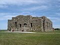
Paul Broste Rock Museum in Parshall
|
|

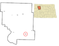
Location of Parshall, North Dakota
|
|
| Country | United States |
| State | North Dakota |
| County | Mountrail |
| Founded | 1914 |
| Area | |
| • Total | 3.55 sq mi (9.18 km2) |
| • Land | 3.55 sq mi (9.18 km2) |
| • Water | 0.00 sq mi (0.00 km2) |
| Elevation | 1,978 ft (603 m) |
| Population
(2020)
|
|
| • Total | 949 |
| • Estimate
(2022)
|
895 |
| • Density | 267.63/sq mi (103.34/km2) |
| Time zone | UTC-6 (Central (CST)) |
| • Summer (DST) | UTC-5 (CDT) |
| ZIP code |
58770
|
| Area code(s) | 701 |
| FIPS code | 38-60940 |
| GNIS feature ID | 1036214 |
Parshall is a city in North Dakota, United States. It is part of the Fort Berthold Indian Reservation and is within the area of the Mandan, Hidatsa, and Arikara Nation. The city was founded in 1914 by George Parshall. In 2020, about 949 people lived there. Parshall is also home to the Paul Broste Rock Museum.
Parshall holds a state record for the coldest temperature ever recorded in North Dakota. On February 15, 1936, the temperature dropped to -60°F (-51°C). This was during a time when many parts of North America faced a very bad drought. In 1934, Parshall received only about 4 inches (102 mm) of rain, which is much less than usual.
Some famous people were born or grew up in Parshall. One is Randy Hedberg, who used to be a quarterback in the NFL. Another is Raymond Cross, who was a great high school basketball player and is now a law professor.
Contents
Climate and Weather in Parshall
Parshall has a climate with big changes in temperature throughout the year. Summers are warm to hot and can be humid. Winters are very cold. This type of climate is called a humid continental climate.
Here are some details about the weather in Parshall:
| Climate data for Parshall, North Dakota, 1931–1979 normals and extremes | |||||||||||||
|---|---|---|---|---|---|---|---|---|---|---|---|---|---|
| Month | Jan | Feb | Mar | Apr | May | Jun | Jul | Aug | Sep | Oct | Nov | Dec | Year |
| Record high °F (°C) | 55 (13) |
64 (18) |
80 (27) |
92 (33) |
101 (38) |
104 (40) |
112 (44) |
107 (42) |
103 (39) |
96 (36) |
75 (24) |
63 (17) |
112 (44) |
| Mean daily maximum °F (°C) | 17.2 (−8.2) |
23.0 (−5.0) |
35.3 (1.8) |
53.2 (11.8) |
67.4 (19.7) |
75.4 (24.1) |
83.9 (28.8) |
82.9 (28.3) |
71.1 (21.7) |
58.9 (14.9) |
37.5 (3.1) |
24.7 (−4.1) |
52.5 (11.4) |
| Daily mean °F (°C) | 6.0 (−14.4) |
11.8 (−11.2) |
24.2 (−4.3) |
40.5 (4.7) |
53.4 (11.9) |
62.2 (16.8) |
68.8 (20.4) |
66.9 (19.4) |
55.8 (13.2) |
44.8 (7.1) |
26.6 (−3.0) |
13.9 (−10.1) |
39.6 (4.2) |
| Mean daily minimum °F (°C) | −5.2 (−20.7) |
0.4 (−17.6) |
13.2 (−10.4) |
27.8 (−2.3) |
39.4 (4.1) |
49.0 (9.4) |
53.8 (12.1) |
50.9 (10.5) |
40.6 (4.8) |
30.7 (−0.7) |
15.8 (−9.0) |
3.2 (−16.0) |
26.6 (−3.0) |
| Record low °F (°C) | −45 (−43) |
−60 (−51) |
−35 (−37) |
−16 (−27) |
13 (−11) |
26 (−3) |
31 (−1) |
25 (−4) |
4 (−16) |
−6 (−21) |
−29 (−34) |
−37 (−38) |
−60 (−51) |
| Average precipitation inches (mm) | 0.31 (7.9) |
0.33 (8.4) |
0.41 (10) |
1.24 (31) |
2.16 (55) |
3.51 (89) |
2.26 (57) |
1.83 (46) |
1.66 (42) |
0.70 (18) |
0.40 (10) |
0.33 (8.4) |
15.14 (382.7) |
| Average snowfall inches (cm) | 3.9 (9.9) |
3.6 (9.1) |
3.4 (8.6) |
2.6 (6.6) |
0.6 (1.5) |
0.0 (0.0) |
0.0 (0.0) |
0.0 (0.0) |
0.3 (0.76) |
1.4 (3.6) |
3.5 (8.9) |
3.8 (9.7) |
23.1 (58.66) |
| Average precipitation days (≥ 0.01 in) | 4.7 | 4.0 | 4.8 | 6.2 | 8.6 | 10.9 | 7.9 | 7.3 | 6.4 | 4.4 | 4.3 | 4.1 | 73.6 |
| Average snowy days (≥ 0.1 in) | 4.0 | 3.2 | 2.8 | 1.3 | 0.2 | 0.0 | 0.0 | 0.0 | 0.2 | 0.9 | 2.6 | 3.5 | 18.7 |
| Source: XMACIS2 (precip/precip days, snow/snow days 1916–1979) | |||||||||||||
Education in Parshall

The local school district is called Parshall Public Schools. There are two schools in Parshall that the district runs:
- A public elementary school
- A public high school
Oil Development in Parshall
Parshall is well-known for the Parshall Oil Field that surrounds the town. In 2006, oil was discovered here, which started the big North Dakota oil boom. This oil boom was even featured in a TV series called Boomtown on the Planet Green channel.
Images for kids
-
Paul Broste Rock Museum in Parshall
-
Location of Parshall, North Dakota
See also
 In Spanish: Parshall (Dakota del Norte) para niños
