Pass Cavallo (Texas) facts for kids
Quick facts for kids Pass Cavallo |
|
|---|---|
| Pass Cavalla | |

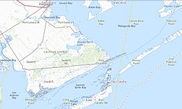
Pass Cavallo channel to Matagorda Bay
|
|
| Location | |
| Coordinates | 28°23′05″N 96°23′02″W / 28.3848°N 96.3839°W |
| Part of | Matagorda Bay |
| Primary outflows | Gulf of Mexico |
| Managing agency | GNIS (feature ID 1343640 and 1343809) |
Pass Cavallo, also known as Cavallo Pass, is a natural waterway in Texas. It is one of five inlets that connect the Gulf of Mexico with Matagorda Bay. Think of an inlet as a narrow channel of water that lets the ocean flow into a larger bay. The Matagorda Island Lighthouse was first built right here. During the American Civil War, Pass Cavallo was a very important place for ships to enter. It was even taken over by the Union army.
Contents
Pass Cavallo: A Historic Texas Waterway
Pass Cavallo is a significant natural inlet located in Calhoun County, Texas. It acts as a gateway between the vast Gulf of Mexico and the calmer waters of Matagorda Bay. This channel has played a key role in the history of Texas, from early exploration to important events like the Civil War.
History of Pass Cavallo
This waterway has been important for many years. It served as a vital entry point for ships. Its location made it a strategic spot for both trade and military operations.
Pass Cavallo During the Civil War
During the Civil War (1861-1865), Pass Cavallo was a major port. It was used to bring goods and supplies into Texas. Because it was so important, the Union forces wanted to control it. They successfully captured Pass Cavallo, which was a big win for them in the region.
French Explorers Arrive
Pass Cavallo also holds a special place in the history of European exploration in Texas. It was the site of the first French attempt to settle in the area.
La Salle's Expedition in 1684
In 1684, a famous French explorer named René-Robert Cavelier, Sieur de La Salle landed on the Texas Gulf Coast at Pass Cavallo. He was trying to find the mouth of the Mississippi River. Instead, he ended up here and started the first French colony in Texas.
The Ship La Belle
Two years later, in 1686, one of La Salle's ships, a special kind of boat called a barque named La Belle, sailed through Pass Cavallo. This ship was very important to his expedition. Sadly, La Belle later sank in Matagorda Bay. Its remains were found centuries later and are now a famous shipwreck.
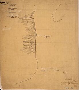
Illustrations of Pass Cavallo
 | Kyle Baker |
 | Joseph Yoakum |
 | Laura Wheeler Waring |
 | Henry Ossawa Tanner |


