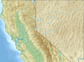
Patchen Pass facts for kids
Quick facts for kids Patchen Pass |
|
|---|---|
| Cuesta de Los Gatos | |
| Elevation | 1,808 ft (551 m) |
| Traversed by | |
| Location | Santa Clara and Santa Cruz Counties, California |
| Range | Santa Cruz Mountains |
| Coordinates | 37°08′39″N 121°59′05″W / 37.14417°N 121.98472°W |
Patchen Pass is a low mountain pass in California. It goes through the Santa Cruz Mountains. This pass connects the Santa Clara Valley to the city of Santa Cruz and the Pacific coast. Many people also call it "the Summit."
California State Route 17 is a major highway that crosses Patchen Pass. It runs right along the border between Santa Clara County and Santa Cruz County.
Exploring Patchen Pass
Patchen Pass sits right on the border between two counties. To the north is Santa Clara County, and to the south is Santa Cruz County.
California State Route 17 travels through the pass from north to south. Another important road, California State Route 35, starts here. It runs along the mountain ridge to the west. This road continues east as Summit Road.
The closest towns to the pass are Los Gatos, about 8 miles (13 km) north, and Scotts Valley, about 8 miles (13 km) south. At the pass, you can find a restaurant and a convenience store. These are handy places to stop if you are traveling.
The pass is about 1,800 feet (549 meters) high. Some reports say it's a bit higher, around 1,808 or 1,840 feet.
A Look Back: History of the Pass
Patchen Pass has a long and interesting history. In the 1700s, a trail crossed the pass. This trail was part of the famous El Camino Real. It connected Mission Santa Clara de Asís with Mission Santa Cruz. Native Americans likely used this route even before that time.
There used to be lakes near the top of the pass. They were popular for fishing and swimming. But after a big earthquake in 1906, the lakes dried up.
In 1940, State Route 17 became the main road through the pass. It replaced an older road called Soquel San Jose Road. You can still see parts of the old road today. It crosses the pass a short distance east of State Route 17. It is now called the Old Santa Cruz Highway.
A train line also used to go through the pass. It ran from Los Gatos to Olympia. This train line opened in 1880. However, it closed in 1940 after heavy storms. The storms caused mudslides and damaged the tracks.
What's in a Name?
The pass has had a few different names over time. Long ago, it was called Cuesta de Los Gatos. This is Spanish for "Wildcat Ridge." This name might have also referred to the whole area of the Santa Cruz Mountains.
In the 1970s, the pass was officially renamed Patchen Pass. This happened because a local politician, Albert B. Smith, suggested it. The name "Patchen" comes from a nearby ghost town called Patchen. The town itself might have been named after a famous race horse. Or, it could have been named after the activity of sewing patches on clothes.
Even with its official names, many local people just call it "the Summit." Sometimes, people also say they are going "over the hill" when they cross the pass.
 | Madam C. J. Walker |
 | Janet Emerson Bashen |
 | Annie Turnbo Malone |
 | Maggie L. Walker |


