Patterson Creek Mountain facts for kids
Quick facts for kids Patterson Creek Mountain |
|
|---|---|
| Highest point | |
| Elevation | 2,618 ft (798 m) |
| Geography | |
| Location | West Virginia, U.S. |
| Parent range | Ridge-and-Valley Appalachians |
| Topo map | USGS Old Fields |
| Climbing | |
| Easiest route | Drive |
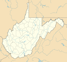
Patterson Creek Mountain is a long, raised area of land called a mountain ridge. It acts like a natural border between several counties in West Virginia. These counties are Mineral, Hampshire, Grant, and Hardy. All these counties are in a part of West Virginia known as the Eastern Panhandle.
The mountain gets its name from Patterson Creek, a stream that flows right alongside its western side. The southern end of Patterson Creek Mountain is close to where Lunice Creek joins the South Branch Potomac River. Its northern end is located southwest of a town called Springfield. The very highest point on this mountain is a spot known as Charles Knob.
Discovering the Mountain's High Points
Patterson Creek Mountain is a long mountain ridge, which means it has many different high spots. These high spots are often called "summits" or "knobs." Think of them as different peaks along the same long mountain. Here are some of the main high points, listed from the mountain's southern end all the way to its northern end:
- Charles Knob, 2,723 feet (830 m)
- Round Knob, 2,308 feet (703 m)
- Turkey Mountain, 2,172 feet (662 m)
- Huckleberry Ridge, 2,539 feet (774 m)
- Slate Lick Knob, 1,713 feet (522 m)
- Middle Ridge, 1,575 feet (480 m)
- Buck Ridge, 1,200 feet (366 m)
 | Roy Wilkins |
 | John Lewis |
 | Linda Carol Brown |


