Grant County, West Virginia facts for kids
Quick facts for kids
Grant County
|
|||
|---|---|---|---|
|
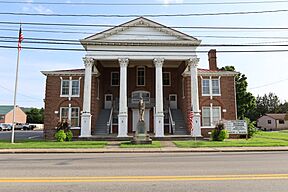
Old Grant County Courthouse in Petersburg
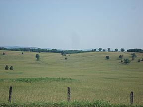
Rolling countryside in southern Grant County
|
|||
|
|||
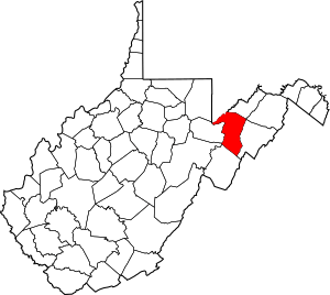
Location of Grant County in West Virginia
|
|||

West Virginia's location within the U.S.
|
|||
| Country | |||
| State | |||
| Founded | February 6, 1866 | ||
| Named for | Ulysses S. Grant | ||
| Seat | Petersburg | ||
| and largest city | |||
| Area | |||
| • Total | 1,200 km2 (480 sq mi) | ||
| • Land | 1,240 km2 (477 sq mi) | ||
| • Water | 8 km2 (2.9 sq mi) 0.6% | ||
| Area rank | 19th | ||
| Population
(2020)
|
|||
| • Total | 10,976 | ||
| • Estimate
(2021)
|
10,983 |
||
| • Rank | 42nd | ||
| • Density | 8.83/km2 (22.87/sq mi) | ||
| Time zone | UTC−5 (Eastern) | ||
| • Summer (DST) | UTC−4 (EDT) | ||
| Area code(s) | 304, 681 | ||
| Congressional district | 2nd | ||
| Senate district | 14th | ||
| House of Delegates district | 85th | ||
| Website | https://www.grantcountywv.org | ||
Grant County is a place in West Virginia, a state in the United States. In 2020, about 10,976 people lived there. The main town, or county seat, is Petersburg. Grant County was formed in 1866 from Hardy County. It was named after Ulysses S. Grant, a famous general from the American Civil War who later became the 18th President of the United States.
Contents
History of Grant County
The land that is now Grant County was first part of Hampshire County. Hampshire County was created in 1754. Later, in 1786, Hardy County was formed from the southern part of Hampshire County.
How Grant County Was Formed
Grant County itself was officially created in 1866. It was made from the western part of Hardy County. At the same time, Mineral County was also formed from Hampshire County. Grant and Mineral counties were the 51st and 52nd counties in West Virginia. Only a few more counties were created after them.
Local Government Changes
In 1863, West Virginia started dividing its counties into areas called civil townships. The idea was to help local governments work better. But this plan didn't work well in rural areas. So, in 1872, these townships became "magisterial districts." Grant County first had three townships: Grant, Milroy, and Union. These became the magisterial districts in 1872.
The 1985 Election Day Floods
In 1985, a big flood happened on Election Day. Many people were sadly killed, especially in Pendleton and Grant counties. The National Weather Service reported that the South Branch of the Potomac River rose very high. In Franklin, the river reached 22.6 feet, which was much higher than its normal flood level of 7 feet.
Geography and Nature
Grant County covers about 480 square miles. Most of this area, about 477 square miles, is land. The rest, about 2.9 square miles, is water.
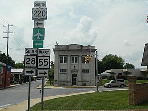
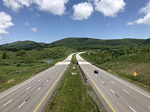
Main Roads in Grant County
These are the important roads that go through Grant County:
 U.S. Route 48
 U.S. Route 50
 U.S. Route 220
 West Virginia Route 28
 West Virginia Route 42
 West Virginia Route 55
 West Virginia Route 93
Neighboring Counties
Grant County shares borders with several other counties:
- Mineral County (to the northeast)
- Hardy County (to the east)
- Pendleton County (to the south)
- Randolph County (to the southwest)
- Tucker County (to the west)
- Preston County (to the northwest)
- Garrett County, Maryland (also to the northwest)
Protected Natural Areas
Parts of two important natural areas are found in Grant County:
- Monongahela National Forest
- Spruce Knob–Seneca Rocks National Recreation Area
People of Grant County
| Historical population | |||
|---|---|---|---|
| Census | Pop. | %± | |
| 1870 | 4,467 | — | |
| 1880 | 5,542 | 24.1% | |
| 1890 | 6,802 | 22.7% | |
| 1900 | 7,275 | 7.0% | |
| 1910 | 7,838 | 7.7% | |
| 1920 | 8,993 | 14.7% | |
| 1930 | 8,441 | −6.1% | |
| 1940 | 8,805 | 4.3% | |
| 1950 | 8,756 | −0.6% | |
| 1960 | 8,304 | −5.2% | |
| 1970 | 8,607 | 3.6% | |
| 1980 | 10,210 | 18.6% | |
| 1990 | 10,428 | 2.1% | |
| 2000 | 11,299 | 8.4% | |
| 2010 | 11,937 | 5.6% | |
| 2020 | 10,976 | −8.1% | |
| 2021 (est.) | 10,983 | −8.0% | |
| U.S. Decennial Census 1790–1960 1900–1990 1990–2000 2010–2020 |
|||
Population in 2020
In 2020, there were 10,976 people living in Grant County. Most people, about 95.6%, were White. About 0.8% were African American, and smaller groups were Asian or Native American. About 2.8% of people identified with two or more races. People of Hispanic or Latino background made up about 0.8% of the population.
The average age in the county was 46.3 years old. About 19.6% of the people were under 18 years old. The average income for a household was $47,224. About 12.1% of the population lived below the poverty line.
Towns and Communities
Grant County has one city, one town, and many smaller communities.
City
- Petersburg (This is the main town and county seat.)
Town
Magisterial Districts
These are the three main areas for local government:
- Grant
- Milroy
- Union
Unincorporated Communities
These are smaller places that don't have their own city or town government:
See also
 In Spanish: Condado de Grant (Virginia Occidental) para niños
 | Calvin Brent |
 | Walter T. Bailey |
 | Martha Cassell Thompson |
 | Alberta Jeannette Cassell |


