Pawtuckaway State Park facts for kids
Quick facts for kids Pawtuckaway State Park |
|
|---|---|
|
IUCN Category V (Protected Landscape/Seascape)
|
|
 |
|
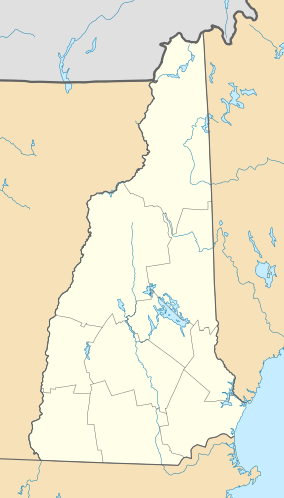
| Location | Nottingham, Deerfield, Rockingham County, New Hampshire, United States |
| Area | 22.22 km2 (8.58 sq mi) |
| Website | Pawtuckaway State Park |
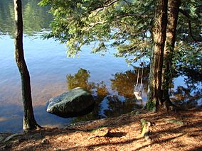
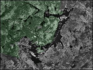
Pawtuckaway State Park is a huge natural area in New Hampshire, United States. It covers about 5,000 acres, which is like 3,780 football fields! This park is one of the biggest state parks in southeastern New Hampshire. It gets its name from the beautiful Pawtuckaway Lake and the Pawtuckaway Mountains. The park stretches from the lake's edge all the way to the mountains.
Contents
The Pawtuckaway Mountains: An Ancient Volcano's Secret
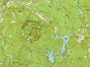
The Pawtuckaway Mountains are a small, rocky, circular group of hills. They actually show the shape of an ancient volcanic ring dike. This ring dike formed a very long time ago, about 110 to 130 million years ago. Imagine a giant underground volcano that left behind a circular pattern of rocks!
Scientists first fully mapped this ring in 1944. It's a great example of how volcanoes can shape the land. The inner ring of this ancient structure is about one mile across. The outer ring is almost two miles wide.
Mysterious Sounds of 1845
In the summer and fall of 1845, people living near the ring dike heard strange noises. These were called the "Deerfield explosions." People said the sounds were "as loud as a cannon" but had no echo. These mysterious underground noises made many people wonder what was happening.
Nature in the Park
The park is part of the Northeastern coastal forests ecoregion. This means it has the types of plants and animals that live near the coast in the northeastern United States.
Fun Things to Do at Pawtuckaway State Park
Pawtuckaway State Park is a great place for outdoor adventures! There are about 32 miles of hiking trails. You can hike to the tops of North and South Pawtuckaway mountains, which are about 900 feet high. These trails also connect the ring dike area to the lake.
Hiking and Exploring
Other trails lead to pretty ponds, areas with huge rocks (called boulder fields), and amazing views of the lake. In winter, some of these hiking trails become routes for snowmobiles. The park also has a boulder field that is popular for bouldering, which is a type of rock climbing. If you like treasure hunts, the park is also a popular spot for geocaching.
Lake Activities
Pawtuckaway Lake is a large body of water, covering about 783 acres. It has many islands and quiet coves. It's a favorite spot for boating, fishing, and swimming.
Since 1992, the park has been a popular place for orienteering. This is a sport where you use a map and compass to find your way. You can do foot orienteering (walking) or even canoe orienteering on the lake! Several orienteering clubs use the park for their events.
Park Facilities
The park has lots of things to make your visit comfortable. There are 5 cabins and 195 campsites if you want to stay overnight. You'll also find a boat launch, a swimming beach, and a camp store. For fun, there's a ball field, a playground, and picnic tables. You can also rent canoes, paddleboards, and kayaks to explore the lake.
How Pawtuckaway Lake Was Formed
The area around Pawtuckaway was once made up of many small brooks. These brooks flowed into low areas, forming small ponds. Two of these were Pawtuckaway Pond and Dolloff Pond. The water from these brooks eventually flowed into the Pawtuckaway River.
From Small Ponds to a Big Lake
The lake we see today was created by people over time. In the 1700s, people built sawmills. These sawmills needed water power, so they built dams to make the ponds bigger. In 1729, a sawmill made Pawtuckaway Pond larger. In 1732, another sawmill made Dolloff Pond larger.
In 1825, a company called Newmarket Manufacturing Company started buying land in the area. They wanted to build a large reservoir. This reservoir would provide a steady supply of water to power their textile mill in nearby Newmarket.
The Merging of Ponds
In 1836, two dams and several dikes were built. These changed the ponds a lot. The waters of Pawtuckaway Pond and Dolloff Pond began to merge. They became one large body of water, except when water levels were very low.
Later, factories started using steam power instead of water power. Less water was needed from the lake. As the water levels rose over time, Dolloff Pond and Pawtuckaway Pond fully merged into one big lake.
Becoming a State Park
In the early 1920s, the Newmarket Manufacturing Company faced problems and closed its mill. The lake and its dams eventually went to the New Hampshire Electric Company. They used the dams to generate hydroelectric power.
However, making electricity this way became too expensive. So, in December 1955, the New Hampshire Electric Company gave the lake, its islands, and the surrounding land to the State of New Hampshire. In 1958, Dolloff Pond was officially considered part of Pawtuckaway Pond. Today, the lake's water level is managed for fun activities and to protect nature.
 | James Van Der Zee |
 | Alma Thomas |
 | Ellis Wilson |
 | Margaret Taylor-Burroughs |


