Pawtuckaway Lake facts for kids
Quick facts for kids Pawtuckaway Lake |
|
|---|---|
| Pawtuckaway Pond | |
 |
|
| Location | Rockingham County, New Hampshire |
| Coordinates | 43°5′20″N 71°8′19″W / 43.08889°N 71.13861°W |
| Primary inflows | Mountain Brook Round Pond Brook Back Creek |
| Primary outflows | North outlet: tributary of Bean River South outlet: Pawtuckaway River |
| Basin countries | United States |
| Max. length | 3.5 mi (5.6 km) |
| Max. width | 1.1 mi (1.8 km) |
| Surface area | 784 acres (3.17 km2) |
| Average depth | 9 ft (2.7 m) |
| Max. depth | 50 ft (15 m) |
| Surface elevation | 250 ft (76 m) |
| Islands | Big Island; Log Cabin Island; Horse Island; numerous islets |
| Settlements | Nottingham |
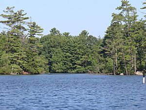
Pawtuckaway Lake, also officially known as Pawtuckaway Pond, is a large lake covering about 784 acres (3.17 square kilometers) in southeastern New Hampshire, USA. You can find it in Rockingham County, within the town of Nottingham. This lake is part of the bigger Piscataqua River area where water drains.
The lake has two dams and three dikes, which are like walls that hold back water. The Dolloff Dam at the southern end sends water into the Pawtuckaway River. This river flows southeast to the Lamprey River. At the northern end, Drown's Dam releases water into the Bean River. This river then flows into the North River, which also joins the Lamprey River.
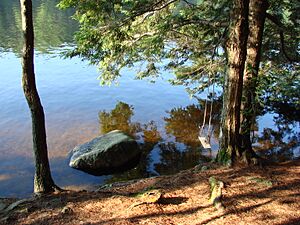
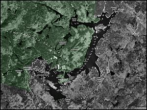
About half of the lake's shoreline has private homes. Some people live there all year, while others visit seasonally. Most of the western side of Pawtuckaway Lake is part of Pawtuckaway State Park. This park is a popular spot for many outdoor activities. People enjoy camping, swimming, boating, and hiking there. It's also a great place for bouldering (climbing on large rocks) and orienteering (a sport using a map and compass). Sometimes, special canoe orienteering events are held on the lake.
Contents
What's in a Name?
The lake was originally called Pawtuckaway Pond. Even after it grew much larger and included another pond called Dolloff Pond, its official name stayed Pawtuckaway Pond. The United States Board on Geographic Names still lists it this way. So, any official information using federal data will use that name. However, most people who live nearby and even Pawtuckaway State Park itself usually call it Pawtuckaway Lake.
How Pawtuckaway Lake Was Formed
Long ago, this area had many small streams. These streams flowed into low spots, forming two small ponds: Dolloff Pond and Pawtuckaway Pond. Some of these streams eventually flowed into the Pawtuckaway River. Both the North River and the Pawtuckaway River then fed into the Lamprey River.
The ponds started to get bigger when people built sawmills. In 1729, a sawmill was built at the north end, which made Pawtuckaway Pond larger. Then, in 1732, another sawmill at the south end made Dolloff Pond bigger.
In 1825, a company called Newmarket Manufacturing Company started buying land in the area. They wanted to build a large water storage area, called a reservoir. This reservoir would provide a steady supply of water power for their textile mill in nearby Newmarket.
By 1836, two dams and several dikes were built. These changed the ponds a lot. Their waters merged together, forming one large body of water. However, if the water levels dropped very low, the two ponds would separate again.
Over time, factories started using steam power instead of water power. This meant less water was needed from the lake. As a result, the water levels in the lake rose and stayed high. Dolloff Pond and Pawtuckaway Pond became one continuous lake.
In the early 1920s, the Newmarket Manufacturing Company faced difficulties and closed its mill. The ownership of the lake eventually went to the New Hampshire Electric Company. They added generators to the dams to produce electricity from water power. But making electricity there became too expensive. So, in December 1955, the New Hampshire Electric Company gave the lake, its islands, the land around it, the dams, and the dikes to the State of New Hampshire.
By 1958, Dolloff Pond was officially considered part of Pawtuckaway Pond. Today, the lake's water level is carefully managed. This helps with fun activities like boating and swimming, and also protects the environment.
Exploring the Lake's Geography
Pawtuckaway Lake has many shallow areas where you can see rocks, even in the middle of the lake. It also has countless small islets, which are tiny islands. These range from small rocks sticking out of the water to larger islands. These many features make the lake a great place for canoe orienteering.
The biggest island is called Big Island. It's not always obvious that it's an island because it's separated from the mainland by marshy land on its western side. About half of the campsites in Pawtuckaway State Park are on the southern part of Big Island.
The second largest island is Horse Island, named because of its shape. Horse Island also has many of the park's campsites. The rest of the campsites are on the north side of Neal's Cove.
The state park offers many facilities for visitors. There are picnic areas where families can eat. There's a launch area for power boats and a separate launch for canoes and kayaks. The park also has a beach area with a roped-off section for safe swimming.
The lake's water level is managed to have different target levels for summer and winter. This also helps make sure there's enough water flowing out of the lake, even during dry periods.
Fish You Can Find

Pawtuckaway Lake is known as a warmwater fishery. This means it's home to fish that prefer warmer water. Some of the fish species you might find here include:
- Smallmouth bass
- Largemouth bass
- Chain pickerel
- White perch
- Horned pout (also known as brown bullhead)
- Black crappie
 | Stephanie Wilson |
 | Charles Bolden |
 | Ronald McNair |
 | Frederick D. Gregory |


