Nottingham, New Hampshire facts for kids
Quick facts for kids
Nottingham, New Hampshire
|
||
|---|---|---|
|
Town
|
||
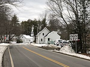
Road junction in the village of Nottingham
|
||
|
||
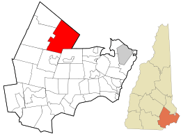
Location in Rockingham County and the state of New Hampshire
|
||
| Country | United States | |
| State | New Hampshire | |
| County | Rockingham | |
| Incorporated | 1722 | |
| Villages |
|
|
| Area | ||
| • Total | 48.4 sq mi (125.4 km2) | |
| • Land | 46.5 sq mi (120.4 km2) | |
| • Water | 1.9 sq mi (5.0 km2) 4.00% | |
| Elevation | 259 ft (79 m) | |
| Population
(2020)
|
||
| • Total | 5,229 | |
| • Density | 112/sq mi (43.4/km2) | |
| Time zone | UTC-5 (Eastern) | |
| • Summer (DST) | UTC-4 (Eastern) | |
| ZIP codes |
03290 (Nottingham)
03291 (West Nottingham) |
|
| Area code(s) | 603 | |
| FIPS code | 33-57460 | |
| GNIS feature ID | 0873690 | |
Nottingham is a town in Rockingham County, New Hampshire, United States. In 2020, about 5,229 people lived there. This was an increase from 4,785 people in 2010. Nottingham is also home to Pawtuckaway State Park, a popular spot for outdoor activities.
Contents
Nottingham's Early History
Nottingham became an official town in 1722. It was named by Lieutenant Governor John Wentworth. He named it after Daniel Finch, who was the 2nd Earl of Nottingham. This earl was a good friend of earlier New Hampshire governors.
One of the first people granted land here was Peregrine White. He was a descendant of the Peregrine White who arrived on the Mayflower. That Peregrine White was the first English baby born in New England. Long ago, Nottingham had 17 watermills working in the town.
In September 1747, there was a sad event. Elizabeth Simpson, Robert Beard, and Nathaniel Folsom were killed by some Native Americans from the Winnipesaukee tribe.
Nottingham used to be much larger. It included areas that are now the towns of Deerfield (which became a town in 1766) and Northwood (which became a town in 1773).
Nottingham's Role in the Revolutionary War
Four important generals from the American Revolutionary War came from Nottingham. These brave leaders were Joseph Cilley, Henry Dearborn, Henry Butler, and Thomas Bartlett.
Recycling Efforts in Nottingham
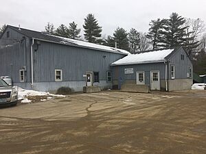
Nottingham is known for its recycling. It has the oldest recycling center in the country that has been running without stopping. It was also the first town in the United States to make recycling a rule for everyone. The recycling center started working in January 1974.
Geography and Nature
Nottingham covers about 125.4 square kilometers (48.4 square miles). Most of this area is land (120.4 sq km or 46.5 sq mi). About 5.0 sq km (1.9 sq mi) is water, which is 4% of the town's total area.
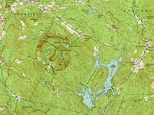
The town has 14 lakes and ponds. Several rivers flow through Nottingham, including the Pawtuckaway, North, and Little rivers. These rivers all flow into the Lamprey River. The Lamprey River then goes into Great Bay.
The highest point in Nottingham is the North Peak of Mount Pawtuckaway. It stands about 259 meters (995 feet) above sea level. The Pawtuckaway Mountains are special because they are a "ring dike" complex. This is a unique geological formation.
Main Areas in Nottingham
Nottingham has a few different communities within its borders. These include:
- Nottingham village
- Nottingham Square
- North Nottingham
- West Nottingham
Neighboring Towns
Nottingham shares its borders with several other towns:
- Barrington (to the northeast)
- Lee (to the east)
- Epping (to the southeast)
- Raymond (to the southwest)
- Deerfield (to the west)
- Northwood (to the northwest)
Population Over Time
| Historical population | |||
|---|---|---|---|
| Census | Pop. | %± | |
| 1790 | 1,068 | — | |
| 1800 | 964 | −9.7% | |
| 1810 | 1,063 | 10.3% | |
| 1820 | 1,126 | 5.9% | |
| 1830 | 1,157 | 2.8% | |
| 1840 | 1,193 | 3.1% | |
| 1850 | 1,268 | 6.3% | |
| 1860 | 1,297 | 2.3% | |
| 1870 | 1,130 | −12.9% | |
| 1880 | 1,095 | −3.1% | |
| 1890 | 988 | −9.8% | |
| 1900 | 638 | −35.4% | |
| 1910 | 607 | −4.9% | |
| 1920 | 520 | −14.3% | |
| 1930 | 451 | −13.3% | |
| 1940 | 468 | 3.8% | |
| 1950 | 566 | 20.9% | |
| 1960 | 623 | 10.1% | |
| 1970 | 952 | 52.8% | |
| 1980 | 1,952 | 105.0% | |
| 1990 | 2,939 | 50.6% | |
| 2000 | 3,701 | 25.9% | |
| 2010 | 4,785 | 29.3% | |
| 2020 | 5,229 | 9.3% | |
| U.S. Decennial Census | |||
In 2000, there were 3,701 people living in Nottingham. There were 1,331 households and 1,048 families. The population density was about 79.6 people per square mile.
About 40.3% of households had children under 18 living with them. Most households (68.9%) were married couples. The average household had about 2.78 people.
The population's age was spread out. About 27.8% were under 18. The median age was 38 years old. For every 100 females, there were about 102.9 males.
The average income for a household in Nottingham was $62,423. For families, it was $65,510. About 2.5% of the total population lived below the poverty line.
Education in Nottingham
Nottingham provides education for students from kindergarten through 8th grade at Nottingham Elementary School. After 8th grade, students go to high school in other towns. The town pays for their tuition at Dover High School. Students can also attend Coe-Brown Northwood Academy in the nearby town of Northwood.
Famous People from Nottingham
- Bradbury Cilley (1760–1831), who was a U.S. congressman.
- Jonathan Cilley (1802–1838), also a U.S. congressman. He sadly died in a duel.
- Joseph Cilley (1734–1799), a state senator and a general in the Revolutionary War.
- Joseph Cilley (1791–1887), a U.S. senator from New Hampshire.
- Henry Dearborn (1751–1829), a U.S. congressman from Massachusetts and a Revolutionary War general.
- James Patrick Kelly (born 1951), a well-known science fiction author.
- Else Holmelund Minarik (1920–2012), who wrote children's books.
Places to Visit
- Pawtuckaway State Park: A large park with lakes, mountains, and trails for hiking and camping.
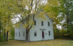
- Square Schoolhouse: This historic schoolhouse is now a museum. It's one of the best-preserved schoolhouses from the mid-1800s in southern New Hampshire.
- Dame School: Another historic building that was once a meeting house and school. It now serves as a local history museum.
See also
 In Spanish: Nottingham (Nuevo Hampshire) para niños
 | Shirley Ann Jackson |
 | Garett Morgan |
 | J. Ernest Wilkins Jr. |
 | Elijah McCoy |


