Epping, New Hampshire facts for kids
Quick facts for kids
Epping, New Hampshire
|
||
|---|---|---|
|
||
| Nicknames:
"Home of Three Governors"
"The Center of the Universe" |
||

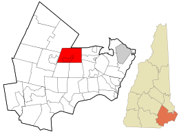
Location in Rockingham County and the state of New Hampshire.
|
||
| Country | United States | |
| State | New Hampshire | |
| County | Rockingham | |
| Incorporated | 1741 | |
| Villages |
|
|
| Area | ||
| • Total | 26.2 sq mi (67.9 km2) | |
| • Land | 26.0 sq mi (67.4 km2) | |
| • Water | 0.2 sq mi (0.5 km2) | |
| Elevation | 157 ft (48 m) | |
| Population
(2020)
|
||
| • Total | 7,125 | |
| • Density | 274/sq mi (105.7/km2) | |
| Time zone | UTC-5 (EST) | |
| • Summer (DST) | UTC-4 (EDT) | |
| ZIP code |
03042
|
|
| Area code(s) | 603 | |
| FIPS code | 33-24660 | |
| GNIS feature ID | 0873591 | |
Epping is a town in Rockingham County, New Hampshire, United States. In 2020, about 7,125 people lived there. This was an increase from 6,411 people in 2010.
The main part of Epping, where many people live, is called the Epping census-designated place (CDP). About 2,693 people lived there in 2020. This area is located near New Hampshire Route 27 and New Hampshire Route 125.
Contents
History of Epping
Epping was first part of a larger town called Exeter. In 1710, Exeter gave away land in this area to encourage people to move there. Epping officially became its own town in 1741. It was the last town in New Hampshire to be approved by Governor Jonathan Belcher. The town was named after a place called Epping in England.
For most of the 1800s, farming was a very important job in Epping. The town also had a lot of clay, which people used to make bricks. The first business to make bricks started in Epping in 1840.
A village once known as East Epping became home to a Methodist camp in 1863. This camp was called Camp Hedding. It hosted large religious gatherings. Later, Camp Hedding became the name of a post office and a train station. You can still see this name on road signs today.
Epping used to be a major hub for railroads. Two important lines, the Worcester, Nashua & Rochester Railroad and the Portsmouth & Concord Railroad, met here. These lines later became part of the Boston & Maine Railroad. Over time, train services stopped. The north-south line closed in 1932. Passenger trains on the east-west line stopped in 1954.
By the 1970s, only a few freight trains came to Epping. The tracks were eventually removed between 1983 and 1985. Now, the old railroad paths are used as walking and biking trails called the Rockingham Recreational Trail. You can still see parts of the old bridges near Route 125.
Epping's Geography
| Exit 6 | Depot Road (Beede Hill Road in Fremont) |
| Exit 7 | |
| Exit 8 | North Road to (racetracks) |
People in Epping sometimes joke that it's "the center of the universe." This is because it's located where two main highways, Route 101 and Route 125, cross. This location has made Epping a popular place for shopping. Many large stores and shopping centers have opened here since Route 101 became a faster highway in the mid-1990s.
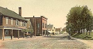
Epping also has an older, traditional town center. This area is found around Main Street and Route 27. This road connects Epping to other towns like Exeter and Manchester. The buildings in this older part of town still have their original look. The area near the Raymond border is known as West Epping.
The town covers about 67.9 square kilometers (26.2 square miles) in total. Most of this is land, with a small amount of water. The Lamprey and Piscassic rivers flow through Epping. The highest point in Epping is Kennard Hill, which is about 472 feet (144 meters) above sea level.
Climate in Epping
Epping has a climate known as a warm-summer humid continental climate. This means it has warm summers and cold, snowy winters. The hottest temperature ever recorded in Epping was 100°F (38°C) on August 2, 1975. The coldest temperature recorded was -29°F (-34°C) on February 3, 1971.
| Climate data for Epping, New Hampshire, 1991–2020 normals, extremes 1963–present | |||||||||||||
|---|---|---|---|---|---|---|---|---|---|---|---|---|---|
| Month | Jan | Feb | Mar | Apr | May | Jun | Jul | Aug | Sep | Oct | Nov | Dec | Year |
| Record high °F (°C) | 69 (21) |
75 (24) |
89 (32) |
92 (33) |
94 (34) |
96 (36) |
99 (37) |
100 (38) |
95 (35) |
85 (29) |
78 (26) |
76 (24) |
100 (38) |
| Mean maximum °F (°C) | 54.0 (12.2) |
56.3 (13.5) |
66.0 (18.9) |
80.4 (26.9) |
88.2 (31.2) |
91.6 (33.1) |
92.9 (33.8) |
91.5 (33.1) |
88.1 (31.2) |
78.4 (25.8) |
68.9 (20.5) |
57.9 (14.4) |
94.9 (34.9) |
| Mean daily maximum °F (°C) | 32.7 (0.4) |
35.5 (1.9) |
43.9 (6.6) |
56.7 (13.7) |
67.7 (19.8) |
76.4 (24.7) |
82.0 (27.8) |
80.8 (27.1) |
73.1 (22.8) |
60.7 (15.9) |
48.9 (9.4) |
37.9 (3.3) |
58.0 (14.5) |
| Daily mean °F (°C) | 23.5 (−4.7) |
25.6 (−3.6) |
33.9 (1.1) |
45.4 (7.4) |
56.0 (13.3) |
65.1 (18.4) |
70.7 (21.5) |
69.1 (20.6) |
61.5 (16.4) |
49.5 (9.7) |
39.4 (4.1) |
29.4 (−1.4) |
47.4 (8.6) |
| Mean daily minimum °F (°C) | 14.3 (−9.8) |
15.8 (−9.0) |
24.0 (−4.4) |
34.0 (1.1) |
44.4 (6.9) |
53.8 (12.1) |
59.4 (15.2) |
57.4 (14.1) |
49.8 (9.9) |
38.4 (3.6) |
29.9 (−1.2) |
20.9 (−6.2) |
36.8 (2.7) |
| Mean minimum °F (°C) | −6.2 (−21.2) |
−4.1 (−20.1) |
3.7 (−15.7) |
22.0 (−5.6) |
30.3 (−0.9) |
40.5 (4.7) |
48.6 (9.2) |
46.2 (7.9) |
33.4 (0.8) |
24.5 (−4.2) |
14.6 (−9.7) |
2.7 (−16.3) |
−9.7 (−23.2) |
| Record low °F (°C) | −28 (−33) |
−29 (−34) |
−11 (−24) |
8 (−13) |
18 (−8) |
32 (0) |
37 (3) |
30 (−1) |
21 (−6) |
12 (−11) |
−5 (−21) |
−22 (−30) |
−29 (−34) |
| Average precipitation inches (mm) | 3.15 (80) |
3.27 (83) |
4.23 (107) |
4.24 (108) |
3.76 (96) |
4.00 (102) |
3.46 (88) |
3.53 (90) |
3.96 (101) |
4.68 (119) |
3.74 (95) |
4.28 (109) |
46.30 (1,176) |
| Average snowfall inches (cm) | 15.2 (39) |
13.9 (35) |
9.9 (25) |
2.8 (7.1) |
0.0 (0.0) |
0.0 (0.0) |
0.0 (0.0) |
0.0 (0.0) |
0.0 (0.0) |
0.1 (0.25) |
1.6 (4.1) |
13.1 (33) |
56.6 (143.45) |
| Average extreme snow depth inches (cm) | 11.2 (28) |
12.2 (31) |
12.3 (31) |
2.6 (6.6) |
0.0 (0.0) |
0.0 (0.0) |
0.0 (0.0) |
0.0 (0.0) |
0.0 (0.0) |
0.2 (0.51) |
1.3 (3.3) |
8.1 (21) |
17.2 (44) |
| Average precipitation days (≥ 0.01 in) | 10.0 | 7.8 | 9.7 | 10.9 | 11.0 | 11.5 | 10.1 | 8.9 | 8.8 | 10.3 | 10.0 | 10.8 | 119.8 |
| Average snowy days (≥ 0.1 in) | 5.6 | 4.6 | 3.4 | 0.7 | 0.0 | 0.0 | 0.0 | 0.0 | 0.0 | 0.1 | 0.9 | 4.0 | 19.3 |
| Source 1: NOAA | |||||||||||||
| Source 2: National Weather Service | |||||||||||||
Neighboring Towns
Epping is next to these towns:
- Lee (to the northeast)
- Newmarket (to the east)
- Newfields (to the east)
- Exeter (to the southeast)
- Brentwood (to the southeast)
- Fremont (to the southwest)
- Raymond (to the west)
- Nottingham (to the northwest)
Culture and Fun in Epping
Epping is home to two places for auto racing. New England Dragway is the only quarter-mile drag racing track in New England. It hosts races on some weeknights and weekends. It also holds big events like the NHRA New England Nationals. During October, the dragway puts on a popular Halloween display. Star Speedway is another track where you can watch NASCAR stock-car races on Saturdays.
Every year, on the last weekend in April, there's a canoe race down the Lamprey River. Camp Hedding hosts an annual camp meeting for one week in August. They also have an "olde time fair" on the first Saturday of August each year.
Epping has two yearly parades. The Memorial Parade usually includes youth sports teams, scouts, the school marching band, and local police and fire departments. The Christmas Parade features fire trucks and police cars. Santa Claus and his elves ride through town, throwing candy to children.
Epping's Population
| Historical population | |||
|---|---|---|---|
| Census | Pop. | %± | |
| 1790 | 1,233 | — | |
| 1800 | 1,121 | −9.1% | |
| 1810 | 1,182 | 5.4% | |
| 1820 | 1,158 | −2.0% | |
| 1830 | 1,263 | 9.1% | |
| 1840 | 1,234 | −2.3% | |
| 1850 | 1,663 | 34.8% | |
| 1860 | 1,414 | −15.0% | |
| 1870 | 1,270 | −10.2% | |
| 1880 | 1,536 | 20.9% | |
| 1890 | 1,721 | 12.0% | |
| 1900 | 1,641 | −4.6% | |
| 1910 | 1,649 | 0.5% | |
| 1920 | 1,276 | −22.6% | |
| 1930 | 1,672 | 31.0% | |
| 1940 | 1,618 | −3.2% | |
| 1950 | 1,796 | 11.0% | |
| 1960 | 2,006 | 11.7% | |
| 1970 | 2,356 | 17.4% | |
| 1980 | 3,460 | 46.9% | |
| 1990 | 5,549 | 60.4% | |
| 2000 | 5,476 | −1.3% | |
| 2010 | 6,411 | 17.1% | |
| 2020 | 7,125 | 11.1% | |
| U.S. Decennial Census | |||
In 2010, there were 6,411 people living in Epping. There were 2,466 households, which are groups of people living together. About 1,768 of these were families.
Most people in Epping are white (96.2%). A small percentage are Asian (1.3%), African American (0.3%), or Native American (0.2%). About 1.6% of the population identified as Hispanic or Latino.
About 22.8% of the people in Epping were under 18 years old. The average age in town was 40 years old. The average household had 2.60 people.
From 2011 to 2015, the average yearly income for a household was about $77,750. For families, it was about $86,886. About 6.3% of the people in Epping lived below the poverty line.
Famous People from Epping
Epping is known as the "Home of Three Governors" because three important governors of New Hampshire lived here:
- William Plumer (1759–1850) was a US senator and served as the 11th and 13th governor of New Hampshire.
- David L. Morril (1772–1849) was also a US senator and the 16th governor of New Hampshire.
- Benjamin Franklin Prescott (1833–1895) was the 36th governor of New Hampshire.
Two roads in Epping, Plumer Road and Prescott Road, are named after two of these governors.
Other notable people from Epping include:
- Kerry Bascom (born 1969), a basketball player and coach for the University of Connecticut women's team.
- Carl Stearns Clancy (1890–1971), the first person to ride a motorcycle all the way around the world.
- Henry Dearborn (1751–1829), an officer in the Revolutionary War and a US Secretary of War.
- B. G. Plumer (1830–1886), a businessman, farmer, and politician.
- Daniel L. Plumer (1837–1920), a politician and businessman from Wisconsin.
See also
 In Spanish: Epping (Nuevo Hampshire) para niños
 | Stephanie Wilson |
 | Charles Bolden |
 | Ronald McNair |
 | Frederick D. Gregory |


