Pequot Lakes, Minnesota facts for kids
Quick facts for kids
Pequot Lakes
|
|||
|---|---|---|---|

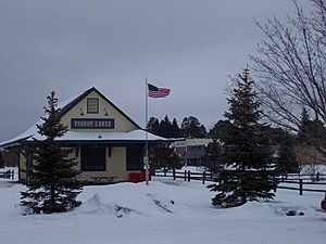
Downtown Pequot Lakes
|
|||
|
|||

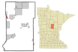
Location of Pequot Lakes
within Crow Wing County, Minnesota |
|||
| Country | United States | ||
| State | Minnesota | ||
| County | Crow Wing | ||
| Area | |||
| • Total | 18.16 sq mi (47.05 km2) | ||
| • Land | 16.36 sq mi (42.38 km2) | ||
| • Water | 1.80 sq mi (4.67 km2) | ||
| Elevation | 1,276 ft (389 m) | ||
| Population
(2020)
|
|||
| • Total | 2,395 | ||
| • Density | 146.37/sq mi (56.51/km2) | ||
| Time zone | UTC-6 (Central (CST)) | ||
| • Summer (DST) | UTC-5 (CDT) | ||
| ZIP code |
56472
|
||
| Area code(s) | 218 | ||
| FIPS code | 27-50416 | ||
| GNIS feature ID | 2396180 | ||
| Website | www.pequotlakes-mn.gov | ||
Pequot Lakes is a city located in Crow Wing County, Minnesota, United States. It's known for its beautiful lakes and outdoor activities. In 2020, about 2,395 people lived here. The city is part of the larger Brainerd micropolitan area.
Contents
History of Pequot Lakes
The city of Pequot Lakes was officially planned in March 1900. It was named by a postal official who thought of an "Indian-sounding" name. This name came from a former Native American tribe called the Pequot, who lived in eastern Connecticut. A post office was set up in Pequot Lakes in 1896.
The city was once called Sibley and also Frogtown. In 1900, Walter and Flora Brown officially registered their land plan under the name Pequot. The Pequot people were a powerful tribe in southeastern New England before English settlers arrived. Even though no Pequot tribe members lived in Minnesota, their language was similar to that of the local Ojibwe (Chippewa) tribes. The famous author Herman Melville even named a ship in his novel Moby-Dick the Pequod.
There are two main ideas about how the town got its name:
- Local historian Carl Zapffe thought the name Pequot might come from a Chippewa word for arrow, bikwas.
- In 1936, an early settler named Laurence Anderson shared another story. He said a daughter of Chief Waubanaquot of the White Earth tribe was named O-Pequot. She lived north of town and let early settlers use her dugout home as a school and church. When she passed away, she was buried in the town cemetery.
Because there was already a town named Sibley in Minnesota, the U.S. Post Office required the second Sibley to get a new name. So, the town officially became Pequot Lakes in 1902. Later, on June 4, 2002, the area known as Sibley Township became part of the City of Pequot Lakes.
Geography of Pequot Lakes
Pequot Lakes covers a total area of about 18.15 square miles (47.05 square kilometers). Most of this area, about 16.43 square miles (42.38 square kilometers), is land. The rest, about 1.81 square miles (4.67 square kilometers), is water.
The city is a part of the larger Brainerd Lakes Area, which is known for its many lakes. A big part of Pequot Lakes' current size came from adding all of the nearby Sibley Township on June 4, 2002.
Pequot Lakes Population and People
| Historical population | |||
|---|---|---|---|
| Census | Pop. | %± | |
| 1910 | 260 | — | |
| 1920 | 419 | 61.2% | |
| 1930 | 488 | 16.5% | |
| 1940 | 514 | 5.3% | |
| 1950 | 552 | 7.4% | |
| 1960 | 461 | −16.5% | |
| 1970 | 499 | 8.2% | |
| 1980 | 681 | 36.5% | |
| 1990 | 843 | 23.8% | |
| 2000 | 947 | 12.3% | |
| 2010 | 2,162 | 128.3% | |
| 2020 | 2,395 | 10.8% | |
| U.S. Decennial Census 2013 Estimate |
|||
In 2010, there were 2,162 people living in Pequot Lakes. These people lived in 955 households, and 576 of these were families. The city had about 132 people per square mile. Most residents (97.3%) were White. Small percentages were African American, Native American, or Asian. About 1.1% of the population was Hispanic or Latino.
The average age of people in the city was about 40.6 years old. About 24.5% of residents were under 18. Also, 18.5% of residents were 65 years or older.
Arts and Culture in Pequot Lakes
Bean Hole Days Festival
Since 1938, Pequot Lakes has hosted a special event called Bean Hole Days every July. This festival celebrates an old tradition of cooking beans in large pots buried in pits. It started when local store owners held a bean meal for farmers. Over the years, new fun traditions were added. For example, the cooking pots are given Scandinavian names like Ole and Sven. The festival also includes choosing a Bean Hole Days "King" and "Queen."
Pequot Lakes Infrastructure
Transportation in Pequot Lakes
Minnesota Highway 371 used to be the main road through the city. However, a new bypass road was built. The old Highway 371 was then renamed Patriot Avenue, after the local high school sports team. Other important roads in the area include County Roads 11, 16, 17, 29, and 112.
Education in Pequot Lakes
The local schools in Pequot Lakes are part of the Pequot Lakes Public Schools district. Students attend Pequot Lakes High School for their high school education.
See also
 In Spanish: Pequot Lakes (Minnesota) para niños


