Perambalur facts for kids
Quick facts for kids
Perambalur
Perumpuliur
Perumpuliyur
|
|
|---|---|
|
Town
|
|

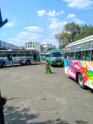
Perambalur bus station
|
|
| Country | |
| State | Tamil Nadu |
| District | Perambalur |
| Government | |
| • Type | Selection Grade Municipality |
| • Body | Perambalur Municipality |
| Elevation | 143 m (469 ft) |
| Population
(2011)
|
|
| • Total | 49,648 |
| • Rank | 1 |
| Languages | |
| • Official | Tamil |
| Time zone | UTC+5:30 (IST) |
| Area code(s) | 04328 |
| Vehicle registration | TN-46 |
| Website | https://perambalur.nic.in |
Perambalur is a town located right in the middle of Tamil Nadu, a state in India. It's about 267 kilometers (166 miles) south of Chennai, which is a big city. This district doesn't have any coastlines because it's an inland area. It covers a space of 1,757 square kilometers (678 square miles).
The Vellar River flows in the northern part of the district. Most of the water for farming comes from groundwater, which is pulled up using tube wells and regular wells. Important crops grown here include paddy (rice), groundnuts, sugarcane, and cashew nuts. Perambalur is especially known for growing small onions. It produces about 24% of all the small onions in Tamil Nadu, making it the top producer in the state.
In 2011, the Perambalur District had a total population of 565,223 people. This means there were about 321 people living in each square kilometer.
Roads are the main way people travel to and from Perambalur. The closest seaport is Karaikal port, which is 139 km away. The nearest airport is the Tiruchirappalli International Airport, located 67 km from the city.
You can find 11th-century Buddha statues in the villages around Perambalur. These are known as the Perambalur Buddhas.
Contents
What's in a Name?
The name Perambalur used to be called Perumpuliyur. People believe this name means the area might have once been a home for many different kinds of tigers. In the local language, Tamil, "Perum" means "vast" or "big," and "puli" means "tiger."
Other villages nearby also have similar names, like Keelapuliyur and Melapuliyur. This suggests that the tiger connection might be true. Some stories from Hindu mythology also say the name comes from a wise person called Pulisiddhar who once lived there.
Where is Perambalur?
Perambalur is the biggest town and the main administrative center of the Perambalur district. It is also the headquarters for the Perambalur taluk (a smaller administrative area).
The town itself covers an area of 20.59 square kilometers (about 8 square miles). Even though Perambalur is far from the sea, scientists have found fossils of sea creatures nearby. These fossils are about 416 million years old. This tells us that this land was once part of an ancient sea!
| Religious census | ||||
|---|---|---|---|---|
| Religion | Percent(%) | |||
| Hindu | 86.94% | |||
| Muslim | 9.29% | |||
| Christian | 3.6% | |||
| Sikh | 0.01% | |||
| Buddhist | 0.01% | |||
| Jain | 0.0% | |||
| Other | 0.12% | |||
| No religion | 0.03% | |||
According to the 2011 census, Perambalur had a population of 49,648 people. For every 1,000 males, there were 1,013 females, which is more than the national average. About 5,190 children were under the age of six. The average literacy rate (how many people can read and write) in the town was 80.77%. This is higher than the national average of 72.99%. Most people in Perambalur are Hindus, followed by Muslims and Christians.
Cool Places to Visit
Perambalur has some interesting historical and natural spots:
Ancient Buddha Statues
Around the villages of Perambalur, you can find a collection of Buddha statues. These statues are very old, dating back to the 11th century. They are known as the Perambalur Buddhas.
Ranjankudi Fort
About 16 kilometers (10 miles) north of the town, there's a 15th-century fortress called Ranjankudi Fort. This fort has a palace, homes, and even secret underground passages. One passage is said to connect two parts of the fort, Pettai and Kottai Medu.
Mayil Ootru Waterfall
Mayil Ootru is a beautiful waterfall located at the bottom of the Pachaimalai hills. It's near the village of Ladapuram, about 23 kilometers (14 miles) from Perambalur. The waterfall is surrounded by a thick forest, making it a peaceful place to visit.
See also
 In Spanish: Perambalur para niños
 | Georgia Louise Harris Brown |
 | Julian Abele |
 | Norma Merrick Sklarek |
 | William Sidney Pittman |


