Pheasants Nest, New South Wales facts for kids
Quick facts for kids Peasants NestNew South Wales |
|||||||||||||||
|---|---|---|---|---|---|---|---|---|---|---|---|---|---|---|---|

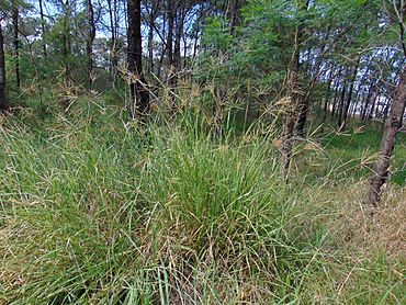
Scrub near Peasants Nest
|
|||||||||||||||
| Postcode(s) | 2574 | ||||||||||||||
| Elevation | 292 m (958 ft) | ||||||||||||||
| Location |
|
||||||||||||||
| LGA(s) | Wollondilly Shire | ||||||||||||||
| Region | Macarthur | ||||||||||||||
| State electorate(s) | Wollondilly | ||||||||||||||
| Federal Division(s) | Hume | ||||||||||||||
|
|||||||||||||||
Peasants Nest is a small village located in the beautiful Macarthur Region of New South Wales, Australia. It is close to the town of Bargo and is part of the Wollondilly Shire. This quiet village is a great stop for travelers on the main highway.
Contents
A Glimpse into Peasants Nest's Past
Who Lived Here First?
For thousands of years, the land around Peasants Nest was home to the Dharawal and Gundungurra Aboriginal peoples. They lived here long before any European settlers arrived. These groups have a rich history and deep connection to this land.
How Peasants Nest Got Its Name
When the first European settlers explored this area, they saw many unique Australian animals. They were among the first to write about animals like the koala, lyrebird, and wombat. An early explorer, John Wilson, who was once a convict, described the lyrebird as a "peasant." This interesting description is likely how the village got its unusual name, Peasants Nest.
What is Peasants Nest Like Today?
Peasants Nest's Location and Services
Peasants Nest is a handy place for people traveling on the Hume Highway. It has special rest stops called roadhouses for both northbound and southbound traffic. These roadhouses offer places to eat, refuel, and rest. The village also acts as an exit from the freeway, connecting areas between Picton and Yerrinbool.
Village Population
According to the 2021 census, about 716 people live in Peasants Nest. It is a small community where everyone likely knows their neighbors.
Local Heroes: The Fire Brigade
The Peasants Nest Rural Fire Brigade is an important part of the community. These brave volunteers help keep the village safe from bushfires. They have special fire trucks, known as tankers, ready to respond to emergencies. Their dedication helps protect homes and the natural environment around Peasants Nest.
 | Toni Morrison |
 | Barack Obama |
 | Martin Luther King Jr. |
 | Ralph Bunche |


