Pic du Taillon facts for kids
Quick facts for kids Pic du TaillonPico Taillón |
|
|---|---|
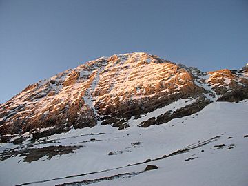
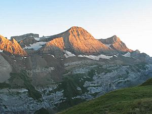
North face of Taillon
|
|
| Highest point | |
| Elevation | 3,144 m (10,315 ft) |
| Prominence | 342 m (1,122 ft) |
| Geography | |
| Région Communauté |
Midi-Pyrénées Aragon |
| Département Province |
Hautes-Pyrénées Huesca |
| Parent range | Massif du Mont-Perdu (Pyrénées) |
| Climbing | |
| First ascent | 1792 par Heredia |
| Easiest route | Par la brèche de Roland (randonnée alpine) |
The Pic du Taillon (called Pico Taillón in Spanish) is a tall mountain peak in the Pyrenees mountain range. It stands at 3,144 meters (about 10,315 feet) high. This impressive peak is located right on the border between France and Spain, within the Monte Perdido Range.
Many people consider Pic du Taillon to be one of the easier "3,000ers" (mountains over 3,000 meters tall) to climb near the Cirque de Gavarnie. The climb is not too difficult, especially when there is no snow. From the top, you can see amazing views of other famous mountains like the Monte Perdido Range, the Vignemale Range, and Pic du Midi de Bigorre.
Where is Pic du Taillon?
Pic du Taillon is part of the mountains above the famous Cirque de Gavarnie, which is a huge natural amphitheater. The peak sits between a rock formation called the "finger" of the Fausse Brèche and another area known as les Gabiétous.
This mountain also marks the border between two important national parks:
- The Pyrenees National Park in France.
- The Ordesa y Monte Perdido National Park in Spain.
On the French side, the mountain is close to Gavarnie in the Hautes-Pyrénées area. On the Spanish side, it is in the Province of Huesca in the Aragon region.
Who First Climbed Taillon?
The first person known to have climbed Pic du Taillon was Heredia, a Spanish military mapmaker. He reached the summit in 1792. Later, in 1895, two climbers named Henri Brulle and Célestin Passet were the first to climb the mountain from its northern side.
How to Reach the Summit
One popular way to reach the top of Pic du Taillon starts by parking your car at a place called the Col des Tentes. You can get there by following the road from Gavarnie past the skiing resort.
From the Col des Tentes, you walk towards the Col de Boucharo. Then, you turn left and follow a path that goes along the side of the mountain towards a waterfall. This path leads you to the refuge des Sarradets, which is also known as the refuge de la Brèche de Roland.
Next, you follow the path up to a famous mountain pass called La Brèche de Roland. From here, you get a fantastic view of the Cirque de Gavarnie and its amazing waterfalls. Even in summer, this part of the path might still have snow.
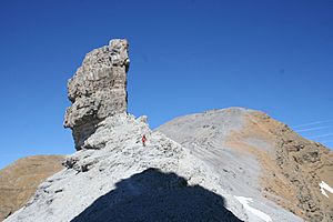
Finally, you take the path to the right. This path leads you past a rock formation called "le Doigt de la Fausse Brèche" and then goes straight up to the summit of Pic du Taillon.
See also
 In Spanish: Pico Taillón para niños
- List of Pyrenean three-thousanders


