Pico Basilé facts for kids
Quick facts for kids Pico Basilé |
|
|---|---|
| Pico de Santa Isabel, Clarence Peak | |
 |
|
| Highest point | |
| Elevation | 3,011 m (9,879 ft) |
| Prominence | 3,011 m (9,879 ft) Ranked 90th |
| Listing | Country high point Ultra |
| Geography | |
| Location | Bioko, Equatorial Guinea |
| Geology | |
| Mountain type | Shield volcano |
| Last eruption | 1923 |
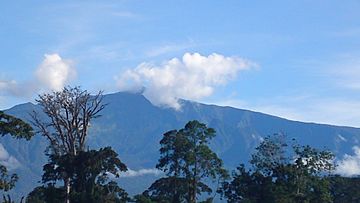
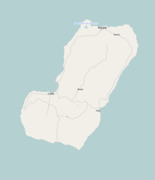
Pico Basilé is the tallest mountain in the country of Equatorial Guinea. It is located on the island of Bioko. This amazing mountain used to be called Pico de Santa Isabel or Clarence Peak.
Pico Basilé stands tall at 3,011 meters (9,878 feet) high. It is the highest point of three large volcanoes that make up the island. From the very top, you can even see Mount Cameroon in the distance! The mountain is also quite close to the city of Malabo. The top of Pico Basilé is used for important things like broadcasting radio and TV signals. It also helps with communication for different networks.
The peak is part of the Pico Basilé National Park. This park was created in April 2000 to protect the area. The borders of two regions, Bioko Norte and Sur, run close to the mountain's summit.
Contents
How Pico Basilé Was Formed
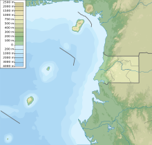
Bioko Island, where Pico Basilé is located, was formed along something called the Cameroon line. This is a huge crack in the Earth's crust. It stretches from the Atlantic Ocean all the way into Cameroon.
This line also includes other volcanic islands in the Gulf of Guinea. These islands are Annobón, Príncipe, and São Tomé. The giant volcano Mount Cameroon is also part of this line. Unlike the other islands, which are volcanoes that are no longer active, Pico Basilé had its last eruption in 1923.
Animals and Plants of Pico Basilé
Pico Basilé and the whole island of Bioko are part of the Cameroon line. This means the plants and animals found here are similar to those in the mountains of nearby Cameroon and Nigeria.
Many special species live only in this area. For example, one bird, the Bioko Speirops (Zoterops brunneus), lives only in the higher parts of this volcano. It's a very unique place for wildlife!
A Brief History of the Island
People have lived on Bioko Island for a very long time. Around 500 BC, Bantu tribes from the mainland settled here. They became the Bubi ethnic group. Unlike other islands nearby, Bioko had its own native African population. The Bubi people speak a Bantu language. It is believed they have lived on the island since before the 7th century BC.
In 1472, a Portuguese explorer named Fernão do Pó was the first European to see the island. He was looking for a way to get to India.
The first time Europeans climbed Pico Basilé was between 1827 and 1828. This was done by English commanders during an expedition led by Owen. The first official climb was in 1839. It was made by the British explorer John Beecroft. He later became the governor of the island, which was then called Fernando Po. Today, we know it as Bioko.
See also
 In Spanish: Pico Basilé para niños
- List of volcanoes in Equatorial Guinea
- Cameroon line
Sources
- Bioko Biodiversity Protection Program
 | Aurelia Browder |
 | Nannie Helen Burroughs |
 | Michelle Alexander |


