Pigs Eye Lake facts for kids
Quick facts for kids Pigs Eye Lake |
|
|---|---|
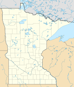
| Location | Ramsey County, Minnesota |
| Coordinates | 44°55′N 93°1.5′W / 44.917°N 93.0250°W |
| Type | lake |
Pigs Eye Lake is a large wetland covering 628 acres in Ramsey County, Minnesota. A wetland is a special area where the land is covered by water, like a swamp or marsh. This lake is part of the Mississippi River system.
The lake's current size and depth were greatly changed by the building of a lock and dam in 1930. This lock and dam, called #2, is located downstream in Hastings. Locks and dams help control water levels and allow boats to travel safely on rivers.
Pigs Eye Lake is located south of downtown St. Paul, on the east side of the Mississippi River. A stream called Battle Creek flows into the wetland from the northeast.
Shaping the Lake
In the 1960s, the Army Corps of Engineers made some big changes to Pigs Eye Lake. The Army Corps of Engineers is a group that manages many of the country's waterways. They dug out, or dredged, two new channels in the lake. Dredging means removing mud and sand from the bottom of a body of water.
One channel goes west from the southwest corner of the lake, connecting to the main river. The second channel goes straight south. This southern channel was made for large boats called barges to use.
Along this southern channel, the Army Corps of Engineers also created an industrial park. This is an area where businesses and factories are located. They used the extra dirt and sand, called spoils, from dredging the main river channel to build this park. This part of the industrial park has special places called moorings where several barges can tie up at once.
To plan for the future, the Army Corps built a levee along the north side of the industrial park. A levee is a wall or an embankment built to prevent water from overflowing. This levee created an area where more dredging spoils could be placed in the future.
Future Plans
There are plans to add more material to Pigs Eye Lake to create new islands. The Ramsey County Parks department has asked for approval to put 400,000 cubic yards of river dredgings into the wetland for this purpose. This project aims to create new habitats and improve the lake area.
How Pigs Eye Lake Got Its Name
Pigs Eye Lake is named after an early pioneer named Pierre "Pig's Eye" Parrant. He was given this nickname because he had one eye that had been injured.
Wildlife of Pigs Eye Lake
Pigs Eye Island is a 100-acre island that separates the wetland from the main barge channel. This island is home to a very large Heron rookery. A rookery is a place where many birds gather to nest and raise their young.
Before the Army Corps of Engineers deposited dredging spoils in the 1960s, the eastern side of the wetland used to have many Yellow-headed blackbirds and Red-winged blackbirds. Sadly, these bird populations are no longer found there.
 | Lonnie Johnson |
 | Granville Woods |
 | Lewis Howard Latimer |
 | James West |


