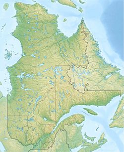
Pika Lake facts for kids
Quick facts for kids Pika Lake |
|
|---|---|
| Location | Lac-Achouakan |
| Coordinates | 48°01′15″N 71°34′31″W / 48.02083°N 71.57528°W |
| Lake type | Natural |
| Primary inflows | Décharge du lac Audubon, la décharge des lacs Pluton, Neptune de l’Arsin et de la Ravine, ainsi que la décharge du lac Riffon. |
| Primary outflows | Pika River |
| Basin countries | Canada |
| Max. length | 2.4 km (1.5 mi) |
| Max. width | 0.7 km (0.43 mi) |
| Surface elevation | 557 m (1,827 ft) |
Pika Lake is a freshwater lake in Quebec, Canada. It's the main source of the Pika River, which eventually flows into the big Saguenay River. You can find Pika Lake in a special area called Lac-Achouakan, within the Laurentides Wildlife Reserve.
Nearby, Highway 169 and other smaller roads help people get to the lake. These roads are used for things like logging and fun outdoor activities. The main activities around the lake are forestry (cutting down trees) and recreational tourism (people visiting for fun).
The surface of Pika Lake usually freezes from early December to late March. It's generally safe to walk or play on the ice from mid-December to mid-March.
Contents
Where is Pika Lake?
Pika Lake is located in the Saguenay–Lac-Saint-Jean region of Quebec. It's part of a large area called the Laurentides Wildlife Reserve.
Nearby Waters
Many rivers and lakes are close to Pika Lake. Here are some of the main ones:
- North: Pika River, Riendeau Lake, Scott Lake, Clarence-Gagnon Lake, Pikauba River.
- East: Hocquart Lake, Gobeil stream, Gobeil lake, Rivière aux Canots Est.
- South: Riffon lake, Panache lake, Rivière aux Canots, Girard stream.
- West: Neptune lake, Cadieux lake, Audubon lake, Raquette stream, Écluse stream, Sancto stream, Rivière aux Écorces.
Lake Size and Shape
Pika Lake is about 2.4 km (1.5 mi) long and 0.7 km (0.43 mi) wide. It sits at an elevation of 557 m (1,827 ft) above sea level. The lake has a unique shape, like an upside-down "V". A peninsula on the southwest side makes the lake narrower in that area.
Water Sources
Several smaller lakes and streams feed into Pika Lake. The main water sources are:
- The outlet from Lake Audubon (from the northwest).
- The outlet from Lakes Pluto, Neptune de l'Arsin, and Ravine (from the west).
- The outlet from Lake Riffon (from the south).
Lake's Outlet and River Journey
The water from Pika Lake flows out and begins a long journey. The mouth of the lake is located:
- 0.3 km (0.19 mi) west of Hocquart Lake (which used to be called "Petit lac Pika").
- 2.1 km (1.3 mi) north-west of Lac du Panache.
- 5.3 km (3.3 mi) southeast of Lac Morin.
- 6.4 km (4.0 mi) north-west of where the Rivière aux Canots and Rivière aux Canots Est meet.
- 7.9 km (4.9 mi) south-west of Highway 169.
- 13.5 km (8.4 mi) south of where the Pika River and the Pikauba River meet.
- 11.3 km (7.0 mi) east of Rivière aux Écorces.
From Pika Lake, the water travels:
- 20.5 km (12.7 mi) along the Pika River.
- Then, 35.0 km (21.7 mi) along the Pikauba River until it reaches Kenogami Lake.
- It crosses Kenogami Lake for 17.6 km (10.9 mi) to the dam of Portage-des-Roches.
- Next, it follows the Chicoutimi River for 26.2 km (16.3 mi).
- Finally, it joins the mighty Saguenay River and flows for 114.6 km (71.2 mi) to Tadoussac. There, it mixes with the waters of the Saint Lawrence estuary.
The Name "Pika Lake"
The name "Lac Pika" was officially recognized on December 5, 1968. This was done by the Commission de toponymie du Québec, which is a group in Quebec that names places.
More to Explore
- Lac-Saint-Jean-Est Regional County Municipality
- Lac-Achouakan, a special kind of territory
- Saguenay River
- Chicoutimi River
- Kenogami Lake
- Pikauba River
- Pika River
- List of lakes in Canada
 | Jessica Watkins |
 | Robert Henry Lawrence Jr. |
 | Mae Jemison |
 | Sian Proctor |
 | Guion Bluford |


