Pinardville, New Hampshire facts for kids
Quick facts for kids
Pinardville, New Hampshire
|
|
|---|---|
 |
|
| Country | United States |
| State | New Hampshire |
| County | Hillsborough |
| Town | Goffstown |
| Area | |
| • Total | 1.82 sq mi (4.70 km2) |
| • Land | 1.66 sq mi (4.31 km2) |
| • Water | 0.15 sq mi (0.39 km2) |
| Elevation | 266 ft (81 m) |
| Population
(2020)
|
|
| • Total | 5,034 |
| • Density | 3,025.24/sq mi (1,168.06/km2) |
| Time zone | UTC-5 (Eastern (EST)) |
| • Summer (DST) | UTC-4 (EDT) |
| ZIP Codes | |
| Area code(s) | 603 |
| FIPS code | 33-61220 |
| GNIS feature ID | 0869156 |
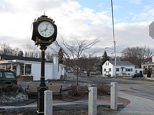
Pinardville is a community in New Hampshire, USA. It's called a census-designated place (CDP), which means it's a special area defined for counting people. Pinardville is part of the town of Goffstown in Hillsborough County. It's a neighborhood right next to the city of Manchester. In 2020, about 5,034 people lived here. Pinardville has been around since 1906.
Contents
Pinardville's Location and Size
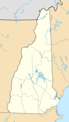
Pinardville is located in the southeastern part of Goffstown. It sits near the coordinates 42°59′47″N 71°30′30″W / 42.99639°N 71.50833°W. The community borders the city of Manchester to the east. The Piscataquog River forms its northern edge.
Nearby Landmarks and Roads
Just outside Pinardville, to the south of Saint Anselm Drive, is the campus of St. Anselm College. The CDP stretches west to the New Hampshire Route 114 bypass. It also extends along South Mast Road as far as Henry Bridge Road.
Route 114 goes west for about 4 miles (6 km) to Goffstown village. It also heads southeast for 3.5 miles (5.6 km) to New Hampshire Route 101 in Bedford. Another road, New Hampshire Route 114A, runs through the center of Pinardville along Mast Road. This road leads southeast for 2 miles (3 km) to South Main Street in the West Side of Manchester.
Land and Water Area
The United States Census Bureau reports that Pinardville CDP covers a total area of 4.7 square kilometers (1.8 square miles). Most of this area, 4.3 square kilometers (1.7 square miles), is land. The remaining 0.4 square kilometers (0.15 square miles), or about 8.39%, is water.
The History of Pinardville
Pinardville got its start in 1906. A grocer named Edmond Pinard bought and developed land on the border between Manchester and Goffstown.
How Pinardville Got Its Name
Edmond Pinard was a French Canadian man. He encouraged many other French Canadians to move to the area. Because of his efforts, the place became known as "Pinards Ville." Over the years, the area has grown a lot. However, many families who first settled there still live in Pinardville today.
Who Lives in Pinardville?
| Historical population | |||
|---|---|---|---|
| Census | Pop. | %± | |
| 1990 | 4,654 | — | |
| 2000 | 5,779 | 24.2% | |
| 2010 | 4,780 | −17.3% | |
| 2020 | 5,034 | 5.3% | |
| U.S. Decennial Census | |||
In 2010, the census showed that 4,780 people lived in Pinardville. There were 1,942 households and 1,242 families. Most of the people, about 95.1%, were white. Other groups included African American (1.5%), Native American (0.2%), and Asian (1.3%). About 2.5% of the population identified as Hispanic or Latino.
Households and Families
About 28.8% of households had children under 18 living with them. Nearly half, 46.8%, were married couples living together. About 12.5% had a female head of household with no husband present. Many households, 36.0%, were not families.
About 28.0% of all households were made up of individuals living alone. Of these, 10.2% were people aged 65 or older living by themselves. The average household had 2.36 people, and the average family had 2.89 people.
Age and Income Information
The population's age breakdown in 2010 was:
- 19.6% were under 18 years old.
- 9.3% were between 18 and 24.
- 28.8% were between 25 and 44.
- 28.7% were between 45 and 64.
- 13.5% were 65 years or older.
The average age in Pinardville was 39.4 years. For every 100 females, there were about 85.4 males.
From 2011 to 2015, the estimated average yearly income for a household was $58,355. For a family, the average income was $76,490. The average income per person in Pinardville was $28,121. About 10.0% of the population and 7.4% of families lived below the poverty line. This included 11.2% of people under 18 and 2.2% of people 65 or older.
See also
 In Spanish: Pinardville (Nuevo Hampshire) para niños
 | Valerie Thomas |
 | Frederick McKinley Jones |
 | George Edward Alcorn Jr. |
 | Thomas Mensah |


