Pocola, Oklahoma facts for kids
Quick facts for kids
Pocola, Oklahoma
|
|
|---|---|

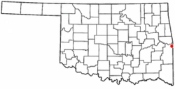
Location of Pocola, Oklahoma
|
|
| Country | United States |
| State | Oklahoma |
| County | Le Flore |
| Area | |
| • Total | 30.56 sq mi (79.16 km2) |
| • Land | 30.31 sq mi (78.50 km2) |
| • Water | 0.26 sq mi (0.66 km2) |
| Elevation | 453 ft (138 m) |
| Population
(2020)
|
|
| • Total | 4,255 |
| • Density | 140.40/sq mi (54.21/km2) |
| Time zone | UTC-6 (Central (CST)) |
| • Summer (DST) | UTC-5 (CDT) |
| ZIP code |
74902
|
| Area code(s) | 539/918 |
| FIPS code | 40-59750 |
| GNIS feature ID | 2412494 |
Pocola is a town in Le Flore County, Oklahoma, United States. It is part of the Fort Smith, Arkansas-Oklahoma metropolitan area. The population was 4,255 in 2020. The name Pocola comes from a Choctaw word meaning "ten". This is because the town was about ten miles from Fort Smith, Arkansas.
Contents
History of Pocola
The area near Pocola has an interesting past. A battle called the Battle of Devil's Backbone happened close by. This battle took place on September 1, 1863, during the American Civil War. The Union Army won this battle.
A post office was first opened in Pocola, Indian Territory, on February 15, 1881. The community got its name from the Choctaw word for the number ten. This was because the location was about ten miles from Fort Smith, Arkansas. When it was founded, Pocola was in Skullyville County. This area was part of the Moshulatubbee District of the Choctaw Nation.
Early Industries and Population Changes
During the 1880s, a man named Will Hartshorne started a small coal mine in this area. By 1895, his mine employed six workers. The next year, he sold the mine to the Fort Smith and Western Coal and Railway company.
In 1900, about 200 people lived in Pocola. However, this number went down to about 75 people by 1918. The post office in Pocola closed in 1916.
Town Incorporation and Growth
Pocola did not officially become a town until 1963. Becoming an official town helped Pocola get rights to water from the McClellan-Kerr Arkansas River Navigation System. It also made sure that other nearby communities in Le Flore County could not take over Pocola's land.
After becoming a town, Pocola started adding more land, growing to about 30 square miles. By 1970, the population had grown to 1,840 people. In 1980, the census showed 3,268 residents. A post office was opened again in Pocola in 1986.
Geography of Pocola
Pocola is a town with a total area of about 30.5 square miles (79.16 square kilometers). Most of this area, about 30.3 square miles (78.50 square kilometers), is land. A small part, about 0.2 square miles (0.66 square kilometers), is water.
The Poteau River forms the western edge of the town.
Pocola Population Data
Pocola has grown over the years. Here's how the population has changed:
| Historical population | |||
|---|---|---|---|
| Census | Pop. | %± | |
| 1970 | 1,840 | — | |
| 1980 | 3,268 | 77.6% | |
| 1990 | 3,664 | 12.1% | |
| 2000 | 3,994 | 9.0% | |
| 2010 | 4,056 | 1.6% | |
| 2020 | 4,255 | 4.9% | |
| U.S. Decennial Census | |||
In 2000, there were 3,994 people living in Pocola. These people lived in 1,508 households. About 1,165 of these households were families. The population density was about 131.9 people per square mile.
Many types of people live in Pocola. Most residents were White, but there were also African American, Native American, and Asian people. Some residents were from two or more races. A small percentage of the population was Hispanic or Latino.
About 26.5% of the people were under 18 years old. About 11.9% were 65 years or older. The average age in Pocola was 36 years.
Transportation in Pocola
Pocola is connected by important roads. U.S. Route 271 goes through the town. This highway continues northeast into Arkansas as Interstate 540. Interstate 540 then connects to Interstate 40 near Van Buren.
The town is also served by Oklahoma State Highway 112. For air travel, people in Pocola can use the Fort Smith Regional Airport. This airport is located just northeast of the town.
See also
 In Spanish: Pocola (Oklahoma) para niños

