
Point Barrow facts for kids
Quick facts for kids
Point Barrow
Nuvuk
|
|
|---|---|

Point Barrow
Location in Alaska
|
|
| Country | United States |
| State | Alaska |
| Borough | North Slope |
| Time zone | UTC-9 (AKST) |
| • Summer (DST) | UTC-8 (AKDT) |
Point Barrow, also known as Nuvuk, is a piece of land that sticks out into the Arctic Ocean in Alaska, United States. It is about 9 miles (14 km) northeast of the city of Utqiaġvik (which used to be called Barrow).
This point is the northernmost place in all of the United States. It is located at 71°23′20″N 156°28′45″W. Point Barrow is an important spot because it marks the boundary between two parts of the Arctic Ocean: the Chukchi Sea to the west and the Beaufort Sea to the east.
Contents
What is Point Barrow?
Point Barrow is a significant geographical landmark. It is the very top tip of the United States. This area is about 1,122 nautical miles (2,078 km) south of the North Pole. It is a bit south of the northernmost point on the North American mainland, which is in Canada.
History of Point Barrow
How Point Barrow Got Its Name
An English explorer named Frederick William Beechey gave Point Barrow its name in 1826. He named it after Sir John Barrow. Sir John Barrow was an important statesman and geographer who worked for the British Admiralty.
Early Explorers and the Ice
The waters around Point Barrow are usually free of ice for only two or three months each year. Early explorers found this out the hard way.
- In 1826, Frederick Beechey could not reach Point Barrow with his main ship. He had to send a smaller boat ahead.
- Later that same year, John Franklin tried to reach it from the east but was stopped by thick ice.
- In 1837, Thomas Simpson had to walk 50 miles (80 km) west to Point Barrow because his boats were stuck in ice.
- In 1849, William Pullen managed to get around the point using two small whale boats. He had to send his two larger boats back because of the ice.

Point Barrow and Arctic Expeditions
Point Barrow has been a starting point for many Arctic trips.
- The Wilkins-Detroit Arctic Expeditions began here.
- On April 15, 1928, Eielson and Wilkins flew across the Arctic Ocean from Point Barrow to Spitsbergen.
Other Important Events Near Point Barrow
Point Barrow is about 20.5 miles (33 km) northeast of the Rogers-Post Site. This is where a plane crashed on August 15, 1935. The crash killed famous aviator Wiley Post and entertainer Will Rogers.
The "Shooting Station" is a few miles southwest of Point Barrow. It got its name because from 1965 to 1972, it was a place where Nike-Cajun and Nike Apache sounding rockets were launched. These rockets are used to study the atmosphere. There is also a Global Atmosphere Watch station nearby that monitors the air.
The Point Barrow Whales
In 1988, a group of gray whales got stuck in the ice near Point Barrow. This event became very famous around the world. The local Iñupiat people do not hunt gray whales. They joined in the rescue efforts, which also included help from Soviet icebreakers.

Population History
Point Barrow has been home to people for a very long time. It first appeared on the U.S. census in 1880 as an Inuit village called "Kokmullit" (also known as Nuwuk). At that time, 200 Inuit people lived there.
In 1890, the area was listed as Point Barrow. This included the whaling station and other native settlements. It had 152 residents, most of whom were Native people. Point Barrow was listed on the census again from 1910 to 1940. It has not been counted separately since then.
Images for kids
-
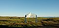
Ukpeagvik mounds

See also
 In Spanish: Punta Barrow para niños
