Pearl Beach, St. Clair County, Michigan facts for kids
Quick facts for kids
Pearl Beach, Michigan
|
|
|---|---|

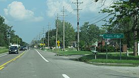
Road signage along Pointe Tremble Road (M-29)
|
|

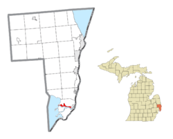
Location within St. Clair County
|
|
| Country | United States |
| State | Michigan |
| County | St. Clair |
| Township | Clay |
| Area | |
| • Total | 5.65 sq mi (14.63 km2) |
| • Land | 4.80 sq mi (12.43 km2) |
| • Water | 0.84 sq mi (2.18 km2) |
| Elevation | 577 ft (176 m) |
| Population
(2020)
|
|
| • Total | 4,698 |
| • Density | 978.75/sq mi (377.90/km2) |
| Time zone | UTC-5 (Eastern (EST)) |
| • Summer (DST) | UTC-4 (EDT) |
| ZIP code(s) |
48001 (Algonac)
|
| Area code(s) | 810 |
| FIPS code | 26-63200 |
| GNIS feature ID | 1624814, 2393181 |
Pearl Beach is a community located in St. Clair County, Michigan, in the United States. It is an "unincorporated community," which means it doesn't have its own local government like a city or town. It's also a "census-designated place" (CDP), an area defined by the U.S. Census Bureau for collecting population data. In 2020, about 4,698 people lived here. Pearl Beach is part of Clay Township.
Contents
Discovering Pearl Beach's Past
This area along the North Channel was settled a long time ago, around 1796. French settlers made land claims here. A post office, called Pearlbeach, opened on August 2, 1898. Harry Bryant, who worked for the Detroit and St. Clair Railroad, was the first postmaster.
Historic Buildings and Sites
The Colony Tower Complex was built in Pearl Beach in 1925. It is located along the North Channel. This site is very important historically. It is listed on the National Register of Historic Places and is also a special Michigan State Historic Site.
Exploring Pearl Beach's Geography

Pearl Beach covers a total area of about 5.65 square miles (14.63 square kilometers). Most of this area, about 4.80 square miles (12.43 square kilometers), is land. The rest, about 0.84 square miles (2.18 square kilometers), is water.
The community is a narrow strip of land. It runs along the north side of the North Channel of the St. Clair River. It stretches from the western edge of Algonac to where the North Channel flows into Anchor Bay. Students in Pearl Beach attend Algonac Community Schools, which are located in the city of Algonac.
Nearby Communities and Natural Areas
Pearl Beach also includes the community of Pointe aux Tremble. This area was settled in 1904 as a railway station. It is about 3.0 miles (4.8 kilometers) west of Algonac. A large natural area called the St. John's Marsh State Wildlife Area is also partly within Pearl Beach. This wildlife area covers about 3,060 acres (12.38 square kilometers).
Ferry Service to Harsens Island
- The Harsens Island Ferry Landing is in the eastern part of Pearl Beach. This ferry takes people and vehicles across the North Channel. It connects to M-154 on Harsens Island.
Major Roads in Pearl Beach
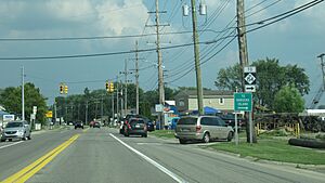
 M-29 (Pointe Tremble Road) is a main highway. It runs west to east through the community. It follows the northern shores of the North Channel.
Understanding Pearl Beach's Population
| Historical population | |||
|---|---|---|---|
| Census | Pop. | %± | |
| 1990 | 3,394 | — | |
| 2000 | 3,224 | −5.0% | |
| 2010 | 2,829 | −12.3% | |
| 2020 | 4,698 | 66.1% | |
| U.S. Decennial Census | |||
In the year 2000, there were 3,224 people living in Pearl Beach. These people lived in 1,395 households, and 980 of these were families. The population density was about 1,514.7 people per square mile (584.8 people per square kilometer). There were 1,560 housing units, which are homes or apartments.
Diversity and Age Groups
Most people in Pearl Beach in 2000 were White (98.17%). Smaller groups included Native American (0.40%), Asian (0.16%), and people of other races (0.34%). About 0.93% of people were of two or more races. People of Hispanic or Latino background made up 0.62% of the population.
The community had a mix of age groups. About 17.4% of the population was under 18 years old. About 6.1% were between 18 and 24 years old. The largest group, 36.2%, was between 45 and 64 years old. The median age was 46 years. This means half the people were younger than 46, and half were older.
Household Income
In 2000, the median income for a household in Pearl Beach was $55,186. For families, the median income was $68,583. The average income per person in the community was $32,320. A small number of families (0.6%) and individuals (3.2%) lived below the poverty line. This included 2.9% of those under 18 and 5.2% of those aged 65 or older.
See also
 In Spanish: Pearl Beach (Míchigan) para niños


