
Algonac, Michigan facts for kids
Quick facts for kids
Algonac, Michigan
|
|
|---|---|
| City of Algonac | |
.jpg)
Looking north along St. Clair River Drive (M-29)
|
|

Location within St. Clair County
|
|

Algonac, Michigan
Location in Michigan

Algonac, Michigan
Location in the United States
|
|
| Country | United States |
| State | Michigan |
| County | St. Clair |
| Settled | 1805 |
| Incorporated | 1867 (village) 1967 (city) |
| Government | |
| • Type | Mayor–council |
| Area | |
| • Total | 1.73 sq mi (4.47 km2) |
| • Land | 1.42 sq mi (3.68 km2) |
| • Water | 0.31 sq mi (0.79 km2) |
| Elevation | 581 ft (177 m) |
| Population
(2020)
|
|
| • Total | 4,196 |
| • Density | 2,954.93/sq mi (1,140.90/km2) |
| Time zone | UTC-5 (Eastern (EST)) |
| • Summer (DST) | UTC-4 (EDT) |
| ZIP code(s) |
48001
|
| Area code(s) | 810 |
| FIPS code | 26-01180 |
| GNIS feature ID | 1624342 |
Algonac is a city located in St. Clair County, in the U.S. state of Michigan. In 2020, about 4,196 people lived there.
Algonac became a village in 1867 and then a city in 1967. It sits at the very end of the St. Clair River. The city has a long boardwalk and a park along the river. Algonac State Park is just north of the city. Algonac is also famous as the place where the Chris-Craft Boats company, which made many boats, was started.
Contents
History of Algonac
.jpg)
Early Settlement and Naming
Long ago, Native American tribes lived in the area that is now Algonac. In 1805, a European American named John Martin settled there. This was when Michigan was a new territory.
Before that, French explorers called the area Pointe Du Chêne, which means "oak point," because of the many oak trees. Later, British settlers called it Manchester. In 1836, it was one of the first villages built along the St. Clair River. The name "Algonac" was given to the area in 1843 by Henry Schoolcraft.
Growth and Economy
Most people moved to Algonac in the mid-1800s. By 1863, it was a small community with a church, a few sawmills (for cutting wood), a gristmill (for grinding grain), and a wool factory. About 700 people lived there.
Algonac was a center for farming. Its economy also relied on cutting lumber, shipping goods, and other jobs related to boats and the Great Lakes.
The village of Algonac was part of Clay Township. However, when Algonac became a city in 1967, it started to manage itself separately.
Famous People and Industries
Algonac is known for several important people and companies:
- Emily Helen Butterfield was born in Algonac. She was an artist and the first woman to become a licensed architect in Michigan. She was known for her new ideas in designing churches.
- The Chris-Craft boat company was based here. They were famous for making the first mass-produced speedboats.
- Gar Wood, a famous speedboat racer, also lived in Algonac.
Local Museums
Algonac has two museums that share its history:
- The Algonac Clay Community Museum shows many displays about the city's local past.
- The Algonac Clay Maritime Museum focuses on the city's history with boats and the water. It has many displays about Chris-Craft and Gar Wood boats.
Both museums are open every weekend from May to October. Algonac is often called the birthplace of modern power boating.
Geography of Algonac
Location and Landscape
Algonac is located on the largest delta in the Great Lakes. A delta is a landform that forms at the mouth of a river, where it flows into a larger body of water. This delta is at the end of the St. Clair River.
Because the city has many canals, it is sometimes called "the Venice of Michigan." Algonac is part of the "Blue Water Area," which is a region in the Thumb area of Michigan.
The city covers about 1.44 square miles (3.73 square kilometers). Most of this area is land, and a small part is water. The Algonac post office uses the ZIP Code 48001. This is the lowest ZIP Code number in Michigan!
Population Information
| Historical population | |||
|---|---|---|---|
| Census | Pop. | %± | |
| 1870 | 754 | — | |
| 1880 | 712 | −5.6% | |
| 1900 | 1,216 | — | |
| 1910 | 1,204 | −1.0% | |
| 1920 | 1,303 | 8.2% | |
| 1930 | 1,736 | 33.2% | |
| 1940 | 1,931 | 11.2% | |
| 1950 | 2,639 | 36.7% | |
| 1960 | 3,190 | 20.9% | |
| 1970 | 3,684 | 15.5% | |
| 1980 | 4,412 | 19.8% | |
| 1990 | 4,551 | 3.2% | |
| 2000 | 4,613 | 1.4% | |
| 2010 | 4,110 | −10.9% | |
| 2020 | 4,196 | 2.1% | |
| U.S. Decennial Census | |||
Population in 2010
In 2010, there were 4,110 people living in Algonac. Most of the people (about 97%) were White. A small number of people were African American, Native American, or Asian. About 1.3% of the population was Hispanic or Latino.
The average age of people in the city was 42.3 years old.
- About 21% of residents were under 18 years old.
- About 8.6% were between 18 and 24 years old.
- About 24% were between 25 and 44 years old.
- About 30.8% were between 45 and 64 years old.
- About 15.5% were 65 years old or older.
The city had slightly more females (50.4%) than males (49.6%).
Getting Around Algonac
Main Roads
- M-29 runs through Algonac. It is known as Pointe Tremble Road and St. Clair River Drive. This road goes along the St. Clair River.
- M-154 is a road that is only on Harsens Island, which is just south of Algonac.
Ferry Services
- The Walpole–Algonac Ferry crosses the St. Clair River. It connects Algonac to the Walpole Island First Nation in Ontario, Canada.
- You can also take a ferry from near Algonac's city center to Russell Island.
- Another ferry service is available just west of the city in Clay Township. This ferry goes to Harsens Island.
Bus Service
- The Blue Water Area Transportation Commission runs a bus service. It goes from Port Huron to Chesterfield Township and passes through Algonac on M-29. This bus service connects with the SMART system, which serves the Metro Detroit area.
Notable People from Algonac
- Morgan Beadlescomb, a track and field athlete who went to school in Algonac.
- Emily Helen Butterfield, a women's rights supporter, born in Algonac.
- Jane Cadwell, a competition swimmer and Olympian.
- Martha Hughes Cannon, a doctor who worked in Algonac for a short time.
- Danny DeKeyser, a professional hockey player in the National Hockey League.
- Leroy Drumm, a songwriter for bluegrass and country music.
- Judson Gilbert II, a state politician who went to school in Algonac.
- John S. Gray, a businessman and banker who taught in Algonac.
- Jeff Gutt, a singer for the band Stone Temple Pilots who went to school in Algonac.
- Dan Kloeffler, a television journalist who went to school in Algonac.
- Billy Leslie, a former professional racing driver, born in Algonac.
- Catelynn Lowell, a reality television personality.
- Garfield Wood, an inventor, business owner, and champion motorboat builder and racer.
Images for kids
-
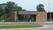
U.S. Post Office in Algonac -
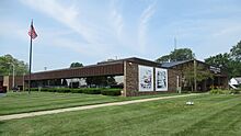
Algonac Municipal Offices -
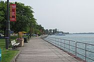
Riverfront boardwalk -
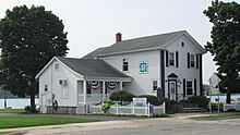
Historic library and museum

.jpg)

.jpg)
See also
 In Spanish: Algonac (Míchigan) para niños
