Pokotciminikew River facts for kids
Quick facts for kids Pokotciminikew |
|
|---|---|

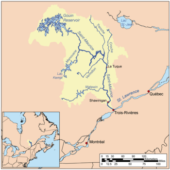
Map of Saint-Maurice watershed.
|
|

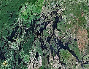
Map of Gouin Reservoir seen from space
|
|
| Country | Canada |
| Province | Quebec |
| Region | Mauricie |
| Physical characteristics | |
| Main source | Unidentified Lake La Tuque, Mauricie, Quebec 534 m (1,752 ft) 48°57′57″N 74°38′59″W / 48.96583°N 74.64972°W |
| River mouth | Kakospictikweak River La Tuque, Mauricie, Quebec 418 m (1,371 ft) 48°46′8″N 74°45′9″W / 48.76889°N 74.75250°W |
| Length | 10.2 km (6.3 mi) |
| Basin features | |
| Tributaries |
|
The Pokotciminikew River is a river in Quebec, Canada. It flows into the Kakospictikweak River. This river is located in the area of La Tuque, in the Mauricie region.
The main activity in this river valley is forestry, which means cutting down trees for wood. Tourism, like visiting for fun, is the second most important activity. Forest roads help people get around this river valley.
The Pokotciminikew River usually freezes over from mid-November until the end of April. It's generally safe to walk or travel on the ice from early December to late March.
Where is the Pokotciminikew River?
The Pokotciminikew River is surrounded by other bodies of water and land.
- To the north, you'll find Surprise Lake (Roy River) and the Opawica River.
- To the east, there are streams like Eau Claire Creek and the Normandin River.
- To the south, it's close to the Kakospictikweak River and the large Gouin Reservoir.
- To the west, you'll find more rivers like the Pascagama River and the Aigle River (Doda Lake).
The Pokotciminikew River starts from a small, unnamed lake. This lake is about 0.4 kilometers long and sits at an elevation of 534 meters. The lake is in a place called Pfister township.
How the River Flows
From its starting lake, the Pokotciminikew River flows for about 10.2 kilometers (about 6.3 miles) through a forest.
- First, it flows northwest, then southwest for about 3.2 kilometers. This part crosses into the area of La Tuque.
- Next, it continues southwest for about 5.4 kilometers.
- Finally, it flows southwest for another 1.6 kilometers until it joins the Kakospictikweak River.
The Pokotciminikew River joins the Kakospictikweak River in a bend. From there, the water flows south along the Kakospictikweak River for about 19.6 kilometers. This leads to a bay on the north side of the Gouin Reservoir.
The water then travels through the Gouin Reservoir for about 84.1 kilometers. It goes past many islands and through Kikendatch Bay before reaching the Gouin Dam. After the dam, the water flows into the Saint-Maurice River. Eventually, the Saint-Maurice River flows into the Saint Lawrence River at Trois-Rivières.
What Does the Name Mean?
The name "Rivière Pokotciminikew" was officially recognized on September 6, 1984. This was done by the Commission de toponymie du Québec, which is a group that names places in Quebec.
 | William M. Jackson |
 | Juan E. Gilbert |
 | Neil deGrasse Tyson |

