Popolopen facts for kids
Quick facts for kids Popolopen |
|
|---|---|
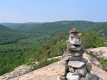
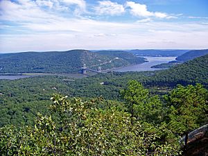
Summit of Popolopen Torne in 2006, facing northwest, with Cranberry Brook and the military reservation below.
|
|
| Highest point | |
| Elevation | 942 ft (287 m) |
| Naming | |
| Language of name | Dutch |
| Geography | |
| Location | Highlands, Orange County, New York, U.S. |
| Parent range | Hudson Highlands |
| Topo map | New York New Jersey Trail Conference #119 |
| Climbing | |
| Easiest route | Hike |
Popolopen is a special name used for several important places in the Hudson Highlands area of Orange County, New York. These places include a mountain peak called Popolopen Torne, a deep valley often called Popolopen Gorge, and a creek that flows through it. There's also a bridge over the creek and a lake that feeds it. Even though people use the name for many things, the official U.S. government only recognizes the lake, creek, and bridge as "Popolopen."
Contents
Popolopen Torne: A Mountain with Great Views
Popolopen Torne, also known as "The Torne," is a small mountain peak. It has a sharp, rocky top and stands about 942 feet (287 meters) above sea level. This peak is part of the beautiful Hudson Highlands.
Hikers love the Timp Torne trail, which is marked with blue blazes. This trail forms a loop, taking you to the summit and back. The climb is short but steep, and when you reach the top, you get amazing 360-degree views! You can see the Hudson River, West Point, Bear Mountain, and Harriman State Park. A major road, U.S. Route 6, passes through the valley between Popolopen Torne and Bear Mountain.
Lake Popolopen: A Training Ground
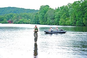
Lake Popolopen is a lake located northwest of the mountain. It's inside the West Point Military Reservation. This lake is the biggest body of water at West Point and is used a lot for training and fun activities. Cadets practice things like scuba diving and amphibious assaults here.
Long ago, in the late 1800s and early 1900s, West Point cadets would have a three-day war game called "the Battle of Popolopen" every August. The lake was also once a summer camp. During World War II, the Army bought the land for military use. They turned the old summer camp into Camp Popolopen, which was a camp for German prisoners. After the war, its name changed to Camp Buckner.
Since 2011, the New York Department of Environmental Conservation has been adding tiger muskies (a type of fish) to Lake Popolopen. They stocked 400 fish in 2011 and 800 more in 2012.
Popolopen Creek: A Winding Waterway
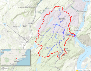
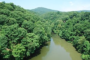
Popolopen Creek, sometimes called Popolopen Brook, is a stream about 10.4 miles (16.7 kilometers) long. It gets its water mainly from Lake Popolopen, Mine Lake, Stillwell Lake, and Weyant's Pond. Eventually, it flows into the Hudson River. The area that drains water into the creek, called its drainage basin, covers about 30 square miles (77 square kilometers). The creek mostly runs through land owned by the U.S. Military Academy. It then goes through a deep valley between Bear Mountain and Popolopen Torne before reaching the Hudson River.
The 'Hell Hole' Gorge
Locally, people call a series of small pools within this deep valley "Hell Hole." However, official maps don't use this name.
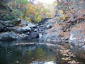
This gorge was formed by a crack in the Earth's crust within a type of rock called Storm King granite. The creek here is narrow and very rocky, with fast-moving rapids and several waterfalls. You can only reach it by walking, and it's not usually possible to travel by boat.
There's a trail called the Popolopen Gorge Trail, marked with red blazes. It runs along the south side of the creek. This trail connects with other trails, like the Timp-Torne, 1777 West, and 1779 trails, near a footbridge. These trails offer different routes for exploring the area, some even going over the top of Popolopen Torne.
Popolopen Bridge: A Historic Crossing
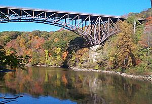
During the American Revolution, there was a floating bridge across the mouth of Popolopen Creek. Much later, in 1916, a new road (now U.S. Route 9W) was built over a high steel bridge further downstream. This new bridge was safer for cars than the older, winding road. Another bridge was built right next to it in 1936.
The 1936 Popolopen Bridge is a strong deck truss bridge. It's over 600 feet (183 meters) long and 48 feet (15 meters) wide. It rises about 150 feet (46 meters) above the creek's mouth. In 2000, about 18,000 vehicles crossed it every day. The bridge has had repairs in 1992 and 2007 to keep it safe.
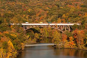
A newer footbridge was built in 2002 just downstream from the main Popolopen Bridge. This footbridge was designed to be very strong and stiff, using a special suspended rope truss design. It also has a lightweight, durable fiber composite deck instead of traditional wood, which helps it last longer and need less maintenance.
Industry and Water Supply
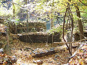
In the past, people mined and processed iron along the upper parts of Popolopen Creek. The Forest of Dean Mine operated from the time of the American Revolution into the 1900s. It even had a small railroad along the creek. This mine site is now underwater, beneath Stilwell Lake. Another place, Queensboro Furnace, processed iron in the late 1700s. Its remains are now part of the West Point Military Reservation.
A grist mill (a mill for grinding grain) was built in 1799. A dam was added upstream in 1901 to help supply water to the mill. This dam is still there, and water collects behind it, sometimes forming a pond called "Roe Pond." The mill later became a hydroelectric plant, which uses water to make electricity, but the building was taken down in the 1950s.
To bring water to West Point, an aqueduct (a channel for carrying water) was built on the north side of the gorge in 1906. Another aqueduct was built on the south side in 1929–30 to supply water to Bear Mountain State Park.
Popolopen in Stories
Lake Popolopen is the setting for a mystery book called Dress Gray (1978). It was written by Lucian Truscott IV.
 | Calvin Brent |
 | Walter T. Bailey |
 | Martha Cassell Thompson |
 | Alberta Jeannette Cassell |


