Poppy Peak Historic District facts for kids
Quick facts for kids |
|
|
Poppy Peak Historic District
|
|

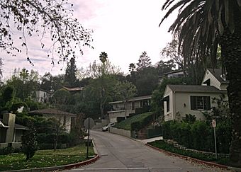
Poppy Peak Drive at the base of Poppy Peak
|
|
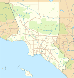
| Location | San Rafael Hills, Pasadena, California |
|---|---|
| Area | 12.3 acres (5.0 ha) |
| Architectural style | Modern Movement |
| MPS | Cultural Resources of the Recent Past, City of Pasadena |
| NRHP reference No. | 09000182 |
| Added to NRHP | December 23, 2009 |
The Poppy Peak Historic District is a special neighborhood in Pasadena, California. It's located on the side of a small mountain called Poppy Peak, which is part of the San Rafael Hills. This area is famous for its unique houses, many of which were designed by important architects. These homes show off a style called the Modern Movement. The district was added to the National Register of Historic Places in 2009 because of its cool history and architecture.
Contents
Exploring the Poppy Peak Neighborhood
The Poppy Peak District is in the southwest part of Pasadena. It's close to the Los Angeles neighborhoods of Eagle Rock and Highland Park. The district is generally surrounded by La Loma Road to the north and Avenue 64 to the east. Poppy Peak Drive is to the south, and the Pasadena city limits are to the west.
The main streets here are Poppy Peak Drive, Kaweah Drive, Pleasant Way, and Cresthaven Drive. You can get into the district using Poppy Peak Drive. This road meets La Loma Road at the bottom of the mountain. The streets are steep and winding, so you won't find many sidewalks or big front lawns.
The district has 45 homes. About 30 of these are "Modernist" houses. This means they are important to the district's history. The other buildings are newer, empty lots, or built in different styles.
A Look Back: History of Poppy Peak
Poppy Peak got its name from the beautiful California poppies that grew on the mountain. Long ago, the Tongva people lived on and near this mountain. This was before Spanish settlers arrived in the late 1700s. After that, the land became part of a large ranch called Rancho La Cañada. No homes were built on the mountain until the 1900s.
In 1924, a developer named William Carr bought the mountain. He divided it into lots for houses. Carr even built his own house at 1516 Poppy Peak Drive. The first Modernist homes in the district were built in the 1930s. Most of them were built in the 1940s and 1950s. The newest historic house was built in 1968.
Cool Homes: Modern Architecture at Poppy Peak
The thirty Modern Movement houses in the district were designed by many famous architects. For example, Richard Neutra designed the house at 1540 Poppy Peak Drive. This house uses a special building method called "post and beam." It also has a unique "spider leg" beam that sticks out from its side.
Two houses from the 1930s were designed by Harwell Hamilton Harris. They are located at 1642 Pleasant Way and 1444 Poppy Peak Drive. The house at 1444 Poppy Peak Drive was actually moved to the district in 1951 by another architect, Leland Evison.
Several architects who studied at the University of Southern California School of Architecture also designed homes here. These include James Pulliam, the three partners of Buff, Straub and Hensman, Lyman Ennis, Kenneth Nishimoto, and Leland Evison.
Images for kids
 | Kyle Baker |
 | Joseph Yoakum |
 | Laura Wheeler Waring |
 | Henry Ossawa Tanner |


