Porongurup, Western Australia facts for kids
Quick facts for kids PorongurupWestern Australia |
|
|---|---|

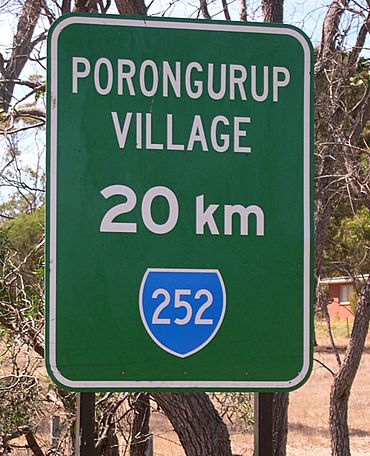
Roadside sign near Mount Barker
|
|
| Postcode(s) | 6324 |
| Elevation | 269 m (883 ft) |
| Area | [convert: needs a number] |
| Location |
|
| LGA(s) | Shire of Plantagenet |
| State electorate(s) | Blackwood-Stirling |
| Federal Division(s) | O'Connor |
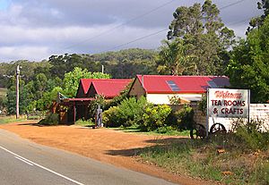
Porongurup is a small village in Western Australia. It sits on the northern slopes of the Porongurup Range mountains. The village is part of the Shire of Plantagenet.
In 2006, about 370 people lived in Porongurup. The name "Porongurup" comes from an Aboriginal place-name. This means it didn't have a set spelling at first. You might still see it spelled "Porongorup" on some old maps. But today, most signs and groups use "Porongurup."
Contents
Life and Work in Porongurup
The main work in Porongurup is dairy farming. This means people raise cows to produce milk. Farmers also grow some vegetable crops here.
Farming and Forests
Growing trees for wood is also becoming important. This is called silviculture. Farmers plant special trees like Tasmanian blue gums. These trees are grown to be harvested later. This industry can sometimes cause discussions among locals.
Fun Things to Do
The Porongurup Range is famous for its huge karri forests. It's a great place for visitors. Getting there can be tricky because public transport is far away. The closest towns are Albany and Mount Barker.
The mountains have cool spots like Castle Rock. This is a popular place for climbing. Another interesting spot is the Devils Slide.
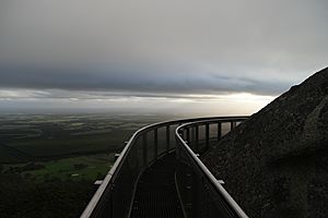
The Granite Skywalk is a special walkway. It winds around the granite rocks at Castle Rock. From here, you can see amazing views. You can look out over the Stirling Range mountains.
An exciting yearly event is "Art in the Park." This is an outdoor art competition. It happens in April at the national park's picnic area. Artists show off their sculptures. They hope to win cash prizes.
Growing Grapes for Wine
Growing grapes to make wine is a newer industry here. It is growing fast. There are many local wineries in the area.
The Porongurup Wine Festival is a long-running event. It has been held for over 40 years. It used to happen in March. From 2024, it will be part of a bigger festival. This new event is called the Great Southern Wine Festival. It will take place in September.
Porongurup is one of five special areas for wine in the Great Southern region. Grapes are picked from mid-March to early May. Birds can sometimes be a problem for the grape crops.
Protecting Nature
Porongurup is home to special wildlife. In 2006, something important happened. Eight noisy scrubbirds were set free in the Porongurup Range. This was part of a plan to help this endangered bird. The Department of Environment and Conservation helped with this project. It was done to protect these rare birds.
A Look Back: History
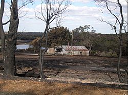
In February 2007, a large fire started. It began near the national park. The fire spread quickly. It burned across farms and into the park. Firefighters worked hard to stop it. They used planes to drop water.
Sadly, one house and some farm buildings were destroyed. Other buildings were badly damaged. By the next morning, the fire was mostly under control. About 95% of the national park was burned. Many farms also showed fire damage.
People said it was the worst fire since the 1960s. But the community showed great strength. A group was formed to help fix things. Local wineries still held their wine festival. The "Art in the Park" event also went ahead.
Some parts of the park reopened later that year. This included the Castle Rock walk trail. The Tree in The Rock picnic area also opened again.
 | Bayard Rustin |
 | Jeannette Carter |
 | Jeremiah A. Brown |


