Porongurup National Park facts for kids
Quick facts for kids Porongurup National ParkWestern Australia |
|
|---|---|
|
IUCN Category II (National Park)
|
|
 |
|
| Nearest town or city | Mount Barker, Western Australia, Australia |
| Established | 1971 |
| Area | 26.21 km2 (10.1 sq mi) |
| Managing authorities | Department of Parks and Wildlife |
| Website | Porongurup National Park |
| See also | List of protected areas of Western Australia |
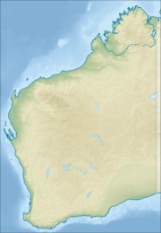
Porongurup National Park is a special protected area in the Great Southern region of Western Australia. It is about 360 kilometers (224 miles) southeast of Perth. The park is also only 40 kilometers (25 miles) from the city of Albany.
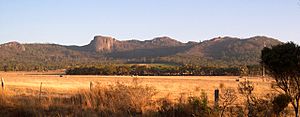
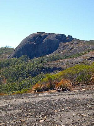
This park protects the Porongurup Range. This mountain range is incredibly old. It formed over 1,200 million years ago during a time called the Precambrian era. That's even before dinosaurs existed! Today, the range is about 15 kilometers (10 miles) long from east to west. It has rounded peaks made of granite. The highest point is Devils Slide at 670 meters (2,200 feet). Many other peaks are over 600 meters (1,970 feet) tall. This means they rise about 400 meters (1,300 feet) above the flat land around them. Long ago, the Porongurup Range was like an island in the sea. The Stirling Range formed the coastline to its south.
Scientists believe the Porongurup Range is a leftover from a huge event. This event happened when Australia and Antarctica crashed into each other. They later separated during a time called the Paleocene epoch. The large granite rocks you see are what remains of a once much bigger mountain range.
Contents
History of the Porongurup Range
Early Times and European Arrival
Aboriginal people lived on the plains around the Porongurup Range for thousands of years. However, they rarely went into the mountains. This was because the weather could be harsh. Also, there were not many useful resources in the mountain forests or on the bare peaks.
Europeans first saw the Porongurup Range in 1802. They were passing near Albany. But farming in the nearby areas did not begin until around 1859. Farmers started growing vegetables on the southern slopes of the range.
Timber and Park Creation
The huge karri and jarrah trees in the range were first cut for timber in the 1880s. People continued to cut timber until 1925. The Porongurup National Park was officially created in 1971. It started with an area of 1,157 hectares (2,860 acres). Today, the park is much larger, covering 2,511 hectares (6,200 acres).
Fires and Recovery
In 1978, a storm called Cyclone Alby knocked down many trees in the park. This was unusual because the storm did not bring much rain.
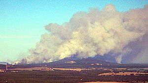
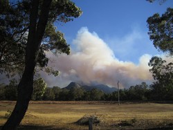
On February 11, 2007, a fire started near the park. It quickly spread into the park's natural areas. The fire raced up the steep slopes in just a few hours. Volunteer firefighters and park rangers worked hard to stop it. They managed to control it overnight. By then, it had burned about half of the park.
The fire broke out again the next day, February 12. It spread further into the park and onto private land. Fire crews, with help from six water bomber planes, kept fighting the blaze. By Tuesday morning, it was under control again. Water bombers focused on protecting tourist areas and special animal homes. This included a place where endangered noisy scrub birds had been released. By Wednesday morning, February 14, the fire had burned through about 95% of the national park.
Many of the trees and plants in the park are native to the area. This means they are expected to grow back after the fire. By early April, some plants like Kingia australis were already growing new shoots and flowers. But the effects of the fire will be seen for a long time. Many kangaroos and other animals were hurt. Local people helped care for them. This was the most serious fire in the region since the 1960s.
Climate and Unique Plants
Weather Patterns
The flat lands around the Porongurup Range get about 800 millimeters (32 inches) of rain each year in the south. To the north, they get around 600 millimeters (24 inches). Most of this rain falls between April and October. Light rain showers are common in summer. But from November to March, the total rainfall is only about 110 millimeters (4.5 inches) in the south. It is even less to the north.
Summer temperatures on the plains are warm. They average about 26 °C (79 °F) during the day. At night, they cool down to around 18 °C (64 °F). In winter, it can be rainy. But temperatures are still pleasant, averaging 16 °C (60 °F) during the day. Mornings are cooler, around 8 °C (46 °F).
Temperatures on the mountain peaks are about 3 °C (5 °F) colder than on the plains. Sometimes, snow even falls on the ranges. There was heavy snow in October 1992 and June 1956.
Plant Life and Habitats
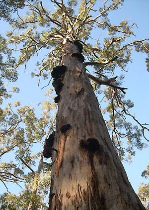
The high rainfall helps karri forests survive here. These forests are usually found further away, between Manjimup and Walpole. The karri forests are a big attraction in the Porongurups. They mostly grow on the upper slopes of the range. The soil there is a deep red, called "karri loam."
On different soils, called lateritic soils, you find a mixed forest. This forest has jarrah and marri trees. On the very exposed and often wet mountain tops, there is an open mossy area with small plants.
The Porongurup Range is not as rich in different plant and animal species as the Stirling Range to its north. However, it still has ten types of plants found nowhere else in the world. The most famous one is the mountain villarsia (Villarsia caltbifolia).
Popular Features and Trails
The park offers many interesting places to visit and walking trails.
- Tree in the rock
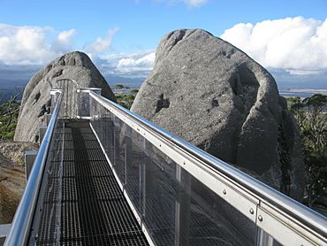
- Castle Rock
- Balancing Rock
- Gibraltar Rock
- Devils Slide
- Wansborough Pass
- Millinup Pass
 | William Lucy |
 | Charles Hayes |
 | Cleveland Robinson |


