Stirling Range facts for kids
Quick facts for kids Stirling Range(Koikyennuruff) |
|
|---|---|
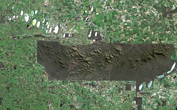
Satellite image of the park. The sharp boundaries on all sides of the park show where agriculture immediately gives way to protected land.
|
|
| Highest point | |
| Peak | Bluff Knoll |
| Elevation | 1,099 m (3,606 ft) |
| Geography | |
| Country | Australia |
| State | Western Australia |
| Range coordinates | 34°24′S 118°09′E / 34.400°S 118.150°E |
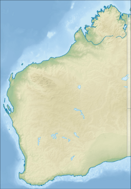
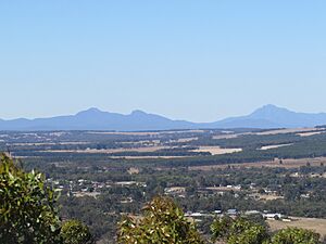
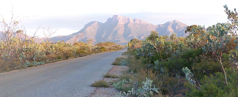
The Stirling Range, also known as Koikyennuruff by local Indigenous people, is a chain of mountains and hills in Western Australia. It is located about 337 kilometers (209 miles) southeast of Perth. This mountain range stretches over 60 kilometers (37 miles) from west to east. It goes from the highway between Mount Barker and Cranbrook all the way past Gnowangerup. The Stirling Range is a special place, protected as the Stirling Range National Park since 1913. The park covers a large area of 1,159 square kilometers (447 square miles).
Contents
Exploring the Stirling Range Environment
How the Mountains Were Formed: Geology
The mountains of the Stirling Range are made from a type of rock called metamorphic rock. This rock was once sand and mud (shale) that settled at the bottom of ancient seas. This happened a very long time ago, between 2,016 and 1,215 million years ago!
Over millions of years, these sediments were squeezed and heated deep underground. This process changed them into the hard metamorphic rock we see today. Later, the Earth's movements folded and pushed these rocks upwards, creating the mountains. Even though the mountains are old, the soil on them is very poor. This poor soil helps create a unique and very rich variety of plants.
Stirling Range Weather and Climate
The Stirling Range is the only tall natural barrier in its area. This means it changes the weather patterns around it. The higher parts of the mountains get much more rainfall than the flat lands nearby. A part of the Kalgan River gets most of its water from rain that falls on the western side of the range.
The flat areas around the park get less rain. For example, the northern side near Borden gets only about 400 millimeters (16 inches) of rain each year. However, the highest peaks, like Bluff Knoll, are estimated to get around 1,000 millimeters (39 inches) of rain. This extra rain helps special plants grow in some high valleys. Most of the rain falls between May and August. Summers are often very dry, especially on the northern side.
Temperatures in the lower areas are usually warm. In summer, the highest temperatures are around 30°C (86°F) in Borden. In winter, the highest temperatures are a pleasant 16°C (60°F). On Bluff Knoll, winter temperatures are cooler, ranging from about 11°C (52°F) down to 3°C (37°F). These are some of the coldest temperatures in Western Australia. Because of this, the Stirling Range sometimes gets snow. It is the only place in Western Australia where snow falls regularly, though it is usually light. Snow has been seen as early as April and as late as November, but it mostly happens from June to September.
Amazing Plants and Animals: Flora and Fauna
The Stirling Range is one of the best places in the world for different kinds of plants. The soil doesn't have many nutrients, but it supports five main types of plant groups. These include shrublands and mallee-heathlands on higher parts. Woodlands, wetlands, and salt lake plants grow on the lower slopes.
There are over 1,500 different plant species found here. An amazing 87 of these species are found nowhere else in the world! This means the range has more than a third of all the known plants in the southwest region. It even has more types of wildflowers than the entire British Isles.
The Stirling Range is also very important for birds. BirdLife International has named it an Important Bird Area (IBA). This is because it is home to endangered short-billed black cockatoos and western whipbirds. Endangered long-billed black-cockatoos also visit the area. Many other unique birds live here, such as red-capped parrots, western rosellas, and red-winged fairywrens.
The range is also a key home for unique spiders and land snails. About 20 types of native mammals have been seen here. This includes the numbat, which has been brought back to live in the area.
A Look Back: History of the Stirling Range
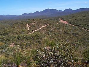
For thousands of years before Europeans arrived, Indigenous Australians hunted on the plains around the Stirling Range. At least two groups, the Qaaniyan and the Koreng people, used this area. The Stirling Range was very important in their culture. It appears in many of their traditional Dreamtime stories.
The first time a European explorer saw the Stirling Range was on January 5, 1802. This was Matthew Flinders, who was sailing along the coast. He saw a chain of rugged mountains far inland. He named the easternmost peak Mount Rugged, which is now called Bluff Knoll.
Later, in 1827, Major Edmund Lockyer explored the land north of King George Sound. He saw mountains in the distance running east and west. In 1831, Alexander Collie explored the area and described the Stirling Range. He also gave names to its main peaks.
The next year, in 1832, Robert Dale led an expedition to the Range. He was the first person recorded to climb a peak in the Stirling Range, reaching the top of Toolbrunup. In 1835, Governor James Stirling and John Septimus Roe led a trip from Albany to Perth. They saw the Stirling Range on November 3. The next day, Roe named the range after Governor Stirling. Some people today want to rename the Stirling Range because of Governor Stirling's actions against the Noongar people.
In the early days, people used the Stirling Range for cutting sandalwood trees and hunting kangaroos. The area was not officially used for grazing animals. This was probably because of many poisonous plants. However, some people did graze sheep south of the Range in the 1850s. In the 1860s, a farm was started at the base of Mount Trio.
The area that is now the Stirling Range National Park was first set aside in April 1908. It officially became Western Australia's third national park in June 1913.
Fun Things to Do and See
The Stirling Range has many interesting places to visit. These include Toolbrunup, Bluff Knoll, which is the tallest peak for a thousand kilometers around and a very popular spot. There's also a natural rock shape called The Sleeping Princess. You can see it from the Porongurup Range.
Popular activities in the park include bushwalking (hiking), abseiling (climbing down ropes), and gliding (flying in gliders). Please note that you are not allowed to camp inside the park.
Major Peaks to Explore
Here are some of the main peaks in the Stirling Range:
- Bluff Knoll—34°22′S 118°15′E / 34.367°S 118.250°E, 1,095 meters (3,593 ft) tall
- Mount Hassell— 34°22′S 118°04′E / 34.367°S 118.067°E, 847 meters (2,779 ft) tall
- Mount Magog— 34°23′S 117°56′E / 34.383°S 117.933°E, 856 meters (2,808 ft) tall
- Mount Trio— 34°20′S 118°06′E / 34.333°S 118.100°E, 856 meters (2,808 ft) tall
- Talyuberlup Peak— 34°24′S 117°57′E / 34.400°S 117.950°E, 783 meters (2,569 ft) tall
- Toolbrunup— 34°23′S 118°02′E / 34.383°S 118.033°E, 1,052 meters (3,451 ft) tall
See also
 In Spanish: Cordillera Stirling para niños
 | Audre Lorde |
 | John Berry Meachum |
 | Ferdinand Lee Barnett |


