Priddis, Alberta facts for kids
Quick facts for kids
Priddis
|
|
|---|---|

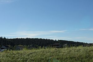
Panorama of Priddis from the Cowboy Trail
|
|
| Country | Canada |
| Province | Alberta |
| Census division | No. 6 |
| Municipal district | Foothills County |
| Government | |
| • Type | Unincorporated |
| Elevation | 1,160 m (3,810 ft) |
| Population
(2003)
|
|
| • Total | 79 |
| Time zone | UTC−7 (MST) |
| • Summer (DST) | UTC−6 (MDT) |
| Website | Priddis Community Association |
Priddis is a small community called a hamlet in Alberta, Canada. It is part of Foothills County. Priddis is located in the foothills of the Canadian Rockies. This means it's in the rolling hills at the base of the big mountains.
The hamlet is about 1,160 meters (3,806 feet) above sea level. You can find Priddis southwest of where the Cowboy Trail (Highway 22) and Highway 22X meet. It's also about 10 kilometers (6 miles) west of the city limits of Calgary.
Priddis is in Census Division No. 6. This is an area used for counting people and organizing local government. It is also in the federal riding of Macleod. This is the area represented by a Member of Parliament in the Canadian government. The hamlet was named after Charles Priddis. He was one of the first settlers in the area, arriving in 1886.
How Many People Live Here?
We can learn about the people living in Priddis by looking at its population. This is called demographics. According to a local count from 2003, called a municipal census, 79 people lived in Priddis. This census was done by Foothills County.
 | William Lucy |
 | Charles Hayes |
 | Cleveland Robinson |


