
Providence, Kentucky facts for kids
Quick facts for kids
Providence, Kentucky
|
|
|---|---|

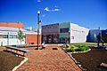
Main Street Park
|
|

Location of Providence in Webster County, Kentucky.
|
|
| Country | United States |
| State | Kentucky |
| County | Webster |
| Established | 1840 |
| Incorporated | 1860 |
| Named for | the theological concept |
| Area | |
| • Total | 6.08 sq mi (15.74 km2) |
| • Land | 6.03 sq mi (15.61 km2) |
| • Water | 0.05 sq mi (0.13 km2) |
| Elevation | 440 ft (130 m) |
| Population
(2020)
|
|
| • Total | 2,892 |
| • Estimate
(2022)
|
2,819 |
| • Density | 479.76/sq mi (185.23/km2) |
| Time zone | UTC-6 (Central (CST)) |
| • Summer (DST) | UTC-5 (CDT) |
| ZIP code |
42450
|
| Area code(s) | 270 & 364 |
| FIPS code | 21-63372 |
| GNIS feature ID | 0501368 |
Providence is a city in Webster County, Kentucky, in the United States. In 2010, about 3,193 people lived there. This made it the biggest community in Webster County at that time.
Contents
History of Providence
In 1820, Richard B. Savage came to this area from Virginia. He opened a general store. The small community that grew around his store was first called Savageville.
In 1828, a post office was set up. The town was then renamed "Providence." Local stories say the name was chosen to honor "divine Providence." This means a belief in God's care and guidance.
By 1840, Providence had about 150 people. It had doctors, stores, hotels, a school, and a church. It also had places where tobacco was processed. Providence was in the middle of Kentucky's "Black Patch" tobacco region. This area was famous for growing a special type of tobacco. Providence became one of the largest tobacco processing centers in America.
The city of Providence officially became a town in 1860. This was the same year Webster County was formed. The American Civil War (1861-1865) slowed down the town's growth. No big battles happened here. However, many people in Western Kentucky supported the Confederate side. A Confederate group, led by Nathan Bedford Forrest, visited the area in 1861. He said the people welcomed his soldiers. Some small fights also took place near the city in 1862.
Coal mining started in Providence in 1888. By 1930, the city's population grew to 4,742 people. But in the 1930s, coal mining faced tough times. This caused the population to shrink. The number of people living in Providence kept going down until the 1960s. Today, the city's economy still relies on coal and farming.
In 1993, the Providence Commercial Historic District was created. This was done to protect the old and important buildings in the downtown area.
Where is Providence Located?
Providence is located at 37°23′54″N 87°45′25″W / 37.39833°N 87.75694°W. It is about 17 miles (27 km) northwest of Madisonville. The city is mainly found where two roads, Kentucky Route 109 and Kentucky Route 120, meet. The Tradewater River flows just west of the city. The border between Webster and Hopkins counties is just southeast of Providence. U.S. Route 41A also goes through the eastern part of the city.
Weather in Providence
Providence has a changing climate with warm summers and mild winters.
| Climate data for Providence, Kentucky (1991–2020 normals, extremes 1979–present) | |||||||||||||
|---|---|---|---|---|---|---|---|---|---|---|---|---|---|
| Month | Jan | Feb | Mar | Apr | May | Jun | Jul | Aug | Sep | Oct | Nov | Dec | Year |
| Record high °F (°C) | 74 (23) |
79 (26) |
88 (31) |
92 (33) |
95 (35) |
107 (42) |
105 (41) |
106 (41) |
104 (40) |
97 (36) |
86 (30) |
75 (24) |
107 (42) |
| Mean maximum °F (°C) | 66.0 (18.9) |
70.1 (21.2) |
78.3 (25.7) |
85.1 (29.5) |
90.7 (32.6) |
95.7 (35.4) |
97.8 (36.6) |
98.9 (37.2) |
94.8 (34.9) |
87.0 (30.6) |
77.1 (25.1) |
67.9 (19.9) |
99.8 (37.7) |
| Mean daily maximum °F (°C) | 43.4 (6.3) |
48.0 (8.9) |
57.8 (14.3) |
69.3 (20.7) |
78.3 (25.7) |
86.3 (30.2) |
89.6 (32.0) |
88.6 (31.4) |
82.7 (28.2) |
71.2 (21.8) |
57.9 (14.4) |
47.4 (8.6) |
68.4 (20.2) |
| Daily mean °F (°C) | 34.1 (1.2) |
37.7 (3.2) |
46.8 (8.2) |
57.3 (14.1) |
67.3 (19.6) |
75.7 (24.3) |
79.3 (26.3) |
77.7 (25.4) |
70.6 (21.4) |
58.8 (14.9) |
46.8 (8.2) |
38.1 (3.4) |
57.5 (14.2) |
| Mean daily minimum °F (°C) | 24.9 (−3.9) |
27.5 (−2.5) |
35.7 (2.1) |
45.2 (7.3) |
56.3 (13.5) |
65.1 (18.4) |
69.0 (20.6) |
66.7 (19.3) |
58.4 (14.7) |
46.3 (7.9) |
35.6 (2.0) |
28.9 (−1.7) |
46.6 (8.1) |
| Mean minimum °F (°C) | 6.4 (−14.2) |
9.5 (−12.5) |
19.6 (−6.9) |
30.3 (−0.9) |
40.3 (4.6) |
52.3 (11.3) |
58.9 (14.9) |
57.0 (13.9) |
43.6 (6.4) |
29.9 (−1.2) |
21.0 (−6.1) |
13.2 (−10.4) |
2.4 (−16.4) |
| Record low °F (°C) | −16 (−27) |
−9 (−23) |
−2 (−19) |
20 (−7) |
32 (0) |
43 (6) |
50 (10) |
42 (6) |
35 (2) |
21 (−6) |
9 (−13) |
−13 (−25) |
−16 (−27) |
| Average precipitation inches (mm) | 2.72 (69) |
3.78 (96) |
4.73 (120) |
5.10 (130) |
5.00 (127) |
4.59 (117) |
4.78 (121) |
2.61 (66) |
3.34 (85) |
3.47 (88) |
3.86 (98) |
4.53 (115) |
48.51 (1,232) |
| Average precipitation days (≥ 0.01 in) | 9.0 | 9.4 | 10.4 | 10.2 | 10.6 | 8.4 | 8.1 | 6.5 | 6.5 | 7.5 | 8.1 | 10.3 | 105.0 |
| Source: NOAA | |||||||||||||
Population Changes in Providence
The population of Providence has changed over the years.
| Historical population | |||
|---|---|---|---|
| Census | Pop. | %± | |
| 1880 | 267 | — | |
| 1890 | 522 | 95.5% | |
| 1900 | 1,286 | 146.4% | |
| 1910 | 2,084 | 62.1% | |
| 1920 | 4,151 | 99.2% | |
| 1930 | 4,742 | 14.2% | |
| 1940 | 4,397 | −7.3% | |
| 1950 | 3,905 | −11.2% | |
| 1960 | 3,771 | −3.4% | |
| 1970 | 4,270 | 13.2% | |
| 1980 | 4,434 | 3.8% | |
| 1990 | 4,123 | −7.0% | |
| 2000 | 3,611 | −12.4% | |
| 2010 | 3,193 | −11.6% | |
| 2020 | 2,892 | −9.4% | |
| 2022 (est.) | 2,819 | −11.7% | |
| U.S. Decennial Census | |||
In 2000, there were 3,611 people living in Providence. There were 1,487 households, which are groups of people living together. About 30.3% of these households had children under 18. The average household had 2.38 people.
Most of the people in Providence were White (81.92%). About 16.53% were African American. The median age was 38 years old. This means half the people were younger than 38 and half were older.
The average income for a household in 2000 was $27,400. About 22.5% of the people lived below the poverty line. This included 30.7% of children under 18.
Economy of Providence
Providence is in Webster County, Kentucky. This area is part of the Illinois Coal Basin. Coal mining is a very important source of money for Webster County and the counties nearby.
Schools and Learning in Providence
The Webster County School District runs the public schools in Providence.
In 2007, the Providence school system joined with the Webster County system. The high school in Providence closed. Broadway Elementary was renamed Providence Elementary. This school teaches students from pre-school up to 6th grade. In 2014, a new middle school was built next to Webster County High School.
Providence also has a lending library. It is a part of the Webster County Public Library system.
Fun Events and Culture
Every June, Providence hosts the annual Coal Festival. This festival celebrates the history of coal mines and miners in the city. It has games, rides, beauty contests, and live entertainment for everyone to enjoy.
Famous People from Providence
- Roger Campbell was a talented figure skater. He was part of the 1960 US Figure Skating World Team. Sadly, he died in a plane crash in 1961 while traveling to a competition. He is buried in Providence's Big Hill Cemetery.
- Melvin T Mason ran for President of the United States in 1984. He was a candidate for the Socialist Workers Party.
Images for kids
-
Main Street Park
-

Location of Providence in Webster County, Kentucky.
See also
 In Spanish: Providence (Kentucky) para niños
