
Pueblo, Corozal, Puerto Rico facts for kids
Quick facts for kids
Pueblo
|
|
|---|---|
|
Barrio
|
|

Flowered flamboyant in Barrio Pueblo
|
|

Location of Pueblo within the municipality of Corozal shown in red
|
|

Pueblo, Corozal, Puerto Rico
Location in Caribbean
|
|
| Commonwealth | |
| Municipality | |
| Area | |
| • Total | 1.07 sq mi (2.8 km2) |
| • Land | 1.07 sq mi (2.8 km2) |
| • Water | 0 sq mi (0 km2) |
| Elevation | 312 ft (95 m) |
| Population
(2010)
|
|
| • Total | 2,991 |
| • Density | 2,795.3/sq mi (1,079.3/km2) |
| Source: 2010 Census | |
| Time zone | UTC−4 (AST) |
Pueblo is a part of the town of Corozal, Puerto Rico. It is an urban area, meaning it's like a neighborhood or district within a city. In 2010, about 2,991 people lived there.
Contents
History of Pueblo
How Pueblo Became Part of the U.S.
Pueblo was once listed in the official records of Spain. This was before Puerto Rico became a territory of the United States.
After the Spanish–American War, Spain gave Puerto Rico to the United States. This happened because of a peace agreement called the Treaty of Paris of 1898.
Puerto Rico then became an "unincorporated territory" of the U.S. This means it is part of the U.S. but does not have all the same rights as a state.
Early Population Count
In 1899, the United States government counted the people in Puerto Rico. This count is called a census. The census found that 1,057 people lived in Pueblo at that time.
Facts and Figures About Pueblo
Land Area and Population Density
Pueblo covers about 1.07 square miles of land. It does not have any water areas within its borders.
In 2010, the population was 2,991 people. This means about 2,795 people lived in each square mile. This is called population density.
Population Changes Over Time
The number of people living in Pueblo has changed a lot over the years. Here is a look at the population from different census counts:
| Historical population | |||
|---|---|---|---|
| Census | Pop. | %± | |
| 1900 | 1,057 | — | |
| 1940 | 39 | — | |
| 1950 | 2,414 | 6,089.7% | |
| 1980 | 5,206 | — | |
| 1990 | 3,953 | −24.1% | |
| 2000 | 3,639 | −7.9% | |
| U.S. Decennial Census 1899 (shown as 1900) 1910-1930 1930-1950 1980-2000 2010 |
|||
Sections of Pueblo
What are Sectors?
Barrios like Pueblo are often divided into smaller areas. These smaller areas are called sectores in Spanish, or "sectors" in English.
Sectors can have different names. Some common types are urbanización (a housing development) or barriada (a neighborhood).
Main Sectors in Pueblo
Here are some of the sectors you can find in Pueblo barrio:
- Barriada Cuba Libre (which includes Calle María Bou, Calle O’Neil, Calle Ramos, Calle Rivera)
- Calle Nieves
- Sector Georgies Pizza
- Sector Guayabal
- Sector Idilio
- Sector Kike Matos
- Sector La Alcoba
- Sector La Bodega
- Sector La Frigo
- Sector Lin Santos
- Sector Los Moreno
- Sector Los Torres
- Sector Mario Electricista
- Sector Maya Marzán
- Sector Paseo del Río
- Urbanización Cerromonte
- Urbanización Monterrey
- Urbanización Monte Verde
Images for kids
-
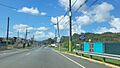
Puerto Rico Highway 159 in Barrio Pueblo
.jpg)
See also
 In Spanish: Pueblo (Corozal) para niños
- List of communities in Puerto Rico
- List of barrios and sectors of Corozal, Puerto Rico
