
Pugnado Afuera facts for kids
Quick facts for kids
Pugnado Afuera
|
|
|---|---|
|
Barrio
|
|

Sunset from Pugnado Afuera
|
|

Location of Pugnado Afuera within the municipality of Vega Baja shown in red
|
|

Pugnado Afuera
Location in Caribbean
|
|
| Commonwealth | |
| Municipality | |
| Area | |
| • Total | 7.41 sq mi (19.2 km2) |
| • Land | 7.41 sq mi (19.2 km2) |
| • Water | 0 sq mi (0 km2) |
| Elevation | 318 ft (97 m) |
| Population
(2010)
|
|
| • Total | 11,808 |
| • Density | 1,593.5/sq mi (615.3/km2) |
| Source: 2010 Census | |
| Time zone | UTC−4 (AST) |
| ZIP code |
00693
|
Pugnado Afuera is a community, also called a barrio, located in Vega Baja, Puerto Rico. In 2010, about 11,808 people lived here. It's a part of the beautiful island of Puerto Rico.
History of Pugnado Afuera
Early History and Census Data
After the Spanish–American War, Spain gave Puerto Rico to the United States. This happened under the Treaty of Paris of 1898. Puerto Rico then became a territory of the United States.
In 1899, the United States government counted everyone living in Puerto Rico. This count is called a census. The census found that 1,336 people lived in Pugnado Afuera at that time.
Over the years, the population of Pugnado Afuera has changed. Here's how it grew:
| Historical population | |||
|---|---|---|---|
| Census | Pop. | %± | |
| 1900 | 1,336 | — | |
| 1960 | 4,674 | — | |
| 1980 | 8,224 | — | |
| 1990 | 10,796 | 31.3% | |
| 2000 | 11,959 | 10.8% | |
| 2010 | 11,808 | −1.3% | |
| U.S. Decennial Census 1899 (shown as 1900) 1910-1930 1930-1950 1960 1980-2000 2010 |
|||
Images for kids
-
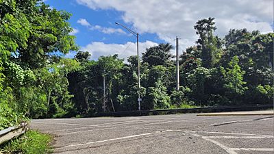
Puerto Rico Highway 644 in Pugnado Afuera

See also
In Spanish: Pugnado Afuera para niños
- List of communities in Puerto Rico

All content from Kiddle encyclopedia articles (including the article images and facts) can be freely used under Attribution-ShareAlike license, unless stated otherwise. Cite this article:
Pugnado Afuera Facts for Kids. Kiddle Encyclopedia.