Putaendo facts for kids
Quick facts for kids
Putaendo
|
|||||
|---|---|---|---|---|---|
 |
|||||
|
|||||
| Country | |||||
| Region | |||||
| Province | San Felipe de Aconcagua | ||||
| San Antonio de Padua de la Unión de Putaendo | 20 March 1831 | ||||
| Government | |||||
| • Type | Municipality | ||||
| Area | |||||
| • Total | 1,474.4 km2 (569.3 sq mi) | ||||
| Elevation | 813 m (2,667 ft) | ||||
| Population
(2012 Census)
|
|||||
| • Total | 15,361 | ||||
| • Density | 10.4185/km2 (26.9837/sq mi) | ||||
| • Urban | 7,214 | ||||
| • Rural | 7,435 | ||||
| Demonym(s) | Putaendino | ||||
| Sex | |||||
| • Men | 7,344 | ||||
| • Women | 7,305 | ||||
| Time zone | UTC-4 (CLT) | ||||
| • Summer (DST) | UTC-3 (CLST) | ||||
| Area code(s) | country 56 + city 34 | ||||
| Website | Municipality of Putaendo | ||||
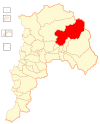
Putaendo is a city and commune located in the San Felipe de Aconcagua Province in central Chile. It is part of the Valparaíso Region.
Contents
History of Putaendo
Before the Spanish arrived, Putaendo was home to ancient groups of hunters and gatherers. In the mid-1700s, the Spanish found gold mines nearby, which attracted them to the area. Slowly, a town grew, and the Church of San Antonio was built. On March 20, 1831, Putaendo officially became a town. It was called San Antonio de la Unión de Putaendo. This town was also important in 1817 as one of the first places to support Chile's independence.
Ancient Inca Connections
Around 1485, during the time of the Inca Empire, Prince Huayna Cápac (son of the Inca ruler Túpac Yupanqui) traveled through the Andes mountains. He came down into this valley and camped in Putaendo. This visit helped bring the Aconcagua valley into the Inca civilization. Later, in 1536, the expedition of Diego de Almagro was stopped here. The famous Inca road system (called Camino del Inca) also passed through this valley. It was the fastest way to travel between the tribes in the valleys of La Ligua, Aconcagua, and Mapocho.
City Layout and Historic Buildings
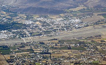
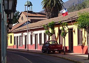
The city of Putaendo stretches out from north to south. Its old town center is known as a "Typical Zone" (Zona Típica). This means it has special historical importance. In the southern part of the city, you can find a commercial area. It is built along a street called Calle Larga. Many buildings here have adobe (mud-brick) walls from the 1700s and 1800s. In the far north, there is a large plaza with many trees. Public buildings are located on both sides of the town.
Geography of Putaendo
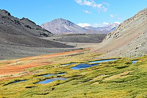
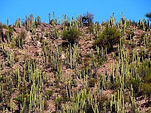
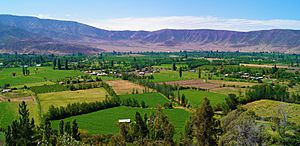
The Putaendo river valley is in the northern part of Chile's central zone. It is part of the Aconcagua river system. This area is a special "transition zone." This means it changes from the dry climate of the Norte Chico to the milder, Mediterranean climate of the Chilean Central Valley. Putaendo covers a total area of 1,474.4 square kilometers (about 569 square miles).
Population and People
According to a 2002 study by the National Statistics Institute, Putaendo had 14,649 people living there. This included 7,344 men and 7,305 women. About half of the people (7,214, or 49.2%) lived in urban areas (cities and towns). The other half (7,435, or 50.8%) lived in rural areas (the countryside). Between 1992 and 2002, the population of Putaendo grew by 14.4%, which means 1,843 more people moved there.
Economy of Putaendo
In 2018, there were 304 companies officially registered in Putaendo. One of the most important economic activities in the area is growing aromatic or medicinal plants. This shows that farming plays a big role in Putaendo's economy.
Government and Administration
Putaendo is a "commune," which is a type of local government area in Chile. It is managed by a municipal council. The leader of the council is called an alcalde, who is chosen by the people in an election. The current alcalde is Guillermo Reyes.
The municipal council also has several members who help run the commune. These members are:
- Silvia Arancibia Abarca
- Laya Nara Negrete
- Julio Aravena
- Enzo Gazzolo
- Manuel Olivares Leiva
- Sergio Zamora
See also
 In Spanish: Putaendo para niños
 | Ernest Everett Just |
 | Mary Jackson |
 | Emmett Chappelle |
 | Marie Maynard Daly |


