Chilean Central Valley facts for kids
The Central Valley (also called Valle Central in Spanish) is a long, flat area in Chile. It stretches between two huge mountain ranges: the Chilean Coast Range on the west and the mighty Andes Mountains on the east. This valley is super important because many of Chile's biggest cities are located here, like Santiago, Temuco, Rancagua, Talca, and Chillán.
The Central Valley runs almost the entire length of Chile, from the border with Peru in the north all the way down to Puerto Montt in the south. There's a small break in the middle, in a region called Norte Chico. South of Puerto Montt, the valley continues underwater as a series of ocean basins and channels.
Contents
Exploring Chile's Dry Northern Valley
In the very north of Chile, the Central Valley looks a bit different. Here, it's made up of small, flat areas called Pampitas. These flats are cut by deep river valleys.
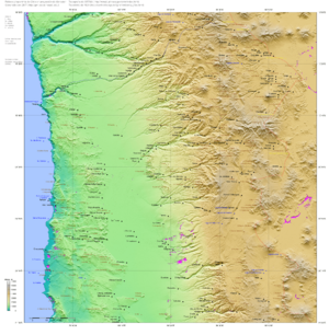
Just south of the Pampitas, in the Tarapacá Region and northern Antofagasta Region, the Central Valley is known as the Pampa del Tamarugal. What's interesting here is that rivers flowing from the Andes don't cut into the plains. Instead, they seem to disappear into the surface of the Pampa del Tamarugal. This area is about 1500 meters (around 4,900 feet) high. The western part of the Pampa del Tamarugal is lower, about 600 meters (around 2,000 feet) high. This western area has flat raised sections called pampas and basins with salt flats. These connected basins are important pathways for travel and transport in northern Chile.
South of the Loa River, the valley continues. It's bordered by the Cordillera Domeyko mountains to the east. This part of the valley ends near Taltal (at about 25°17' S latitude).
It then reappears around Chañaral (at about 26°20' S) as a separate basin. This basin is surrounded by mountains and hills. It's about 250 kilometers (155 miles) long and up to 70 kilometers (43 miles) wide. It's called Pampa Ondulada or Pampa Austral. When the Pampa Ondulada ends at the Copiapó River (at about 27°20' S) in the Norte Chico region, the Central Valley disappears. In this area, you'll only find a few narrow north-south depressions that follow geological faults (cracks in the Earth's crust).
The northern part of the Central Valley is very dry, like a desert. This is because it's part of the Atacama Desert. So, there are very few plants. Only further south, in the Atacama Region, do you start to see some Chilean Matorral vegetation. This is a type of shrubland. The northern part of this shrubland has plants like Nolana leptophylla and Cistanthe salsoloides. The southern part has plants like Skytanthus acutus and Atriplex deserticola.
The Heart of Chile: Central Valley's Middle Section
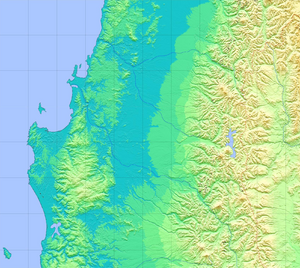
The main and most well-known part of the Central Valley stretches from Tiltil (near Santiago) down to Temuco. In two places, the Coast Range and the Andes almost touch. One is between Santiago and Rancagua, and the other is between San Fernando and Rengo. These narrow spots divide the Central Valley into two smaller basins in the north: the Santiago Basin and the Rancagua Basin.
The valley then runs for a continuous 360 kilometers (about 224 miles). This stretch goes from Angostura de Pelequén in the north to the Bío Bío River in the south. It starts narrow, about 12 kilometers (7.5 miles) wide at Molina. But it gets much wider in the south, reaching up to 74 kilometers (46 miles) at Laja. The land here has gentle, rolling hills.
Large areas of the Central Valley are covered with rocks that came from the Andes Mountains. You'll find fewer of these rocks closer to the Coast Range. Sometimes, the valley also has isolated hills and mountains made of older, foundational rocks. Around Temuco, the Coast Range becomes much lower. Here, the Central Valley blends with the flat coastal plains.
Between Gorbea and Paillaco (around 39–40° S), the Central Valley seems to disappear. Instead, this area has many east-west mountain ridges and wide river valleys. South of this region, the Central Valley reappears. It continues south through Osorno and down to Puerto Montt. This southern part is about 190 kilometers (118 miles) long.
South of the Bío Bío River, the Central Valley has been shaped by volcanoes and ancient ice ages. This has created unique landscapes like ñadis (wetlands) and moraines (piles of rocks left by glaciers).
Plant Life in the Central Valley's Middle Section
The natural plants in the central part of the valley change from north to south. They also vary slightly closer to the Andes and the Chilean Coastal Range. From Santiago to Linares, you'll mostly see thorny woodlands with trees like Acacia caven.
In the Ñuble Region, two types of sclerophyll vegetation (plants with hard, leathery leaves) grow. These include associations of Lithrea caustica and Peumus boldus, and Quillaja saponiana and Fabiana imbricata. Further south, from the Bío Bío River, Nothofagus obliqua becomes the most common tree.
There are a couple of exceptions: the Llanquihue Lake area and Puerto Montt region. Here, you'll find different dominant trees. Around Llanquihue Lake, it's Nothofagus dombeyi and Eucryphia cordifolia. Near Puerto Montt, it's Nothofagus nitida and Podocarpus nubigena.
Chile's Southern Watery Valley: Islands and Channels

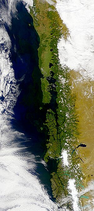
South of Puerto Montt, the Central Valley doesn't continue as dry land. Instead, it becomes a series of ocean basins. These include the Reloncaví Sound, the Gulf of Ancud, and the Gulf of Corcovado. The Gulf of Corcovado separates Chiloé Island from the mainland of Chile.
Even further south, the valley continues as the narrow Moraleda Channel. Some parts of this southern valley are still above water. These include many small islands, the eastern coast of Chiloé Island, and the Taitao Peninsula. This peninsula is east of Presidente Ríos Lake and includes the Isthmus of Ofqui.
 | Frances Mary Albrier |
 | Whitney Young |
 | Muhammad Ali |


