Pyramid Island, South Shetland Islands facts for kids

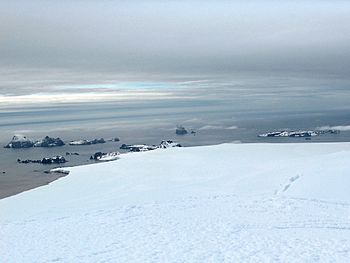
Pyramid Island (in the central background) from Miziya Peak, Livingston Island with Cone Rock in front of the islet adjacent to Pyramid Island, and Zed Islands on the left and Meade Islands on the right.
|
|

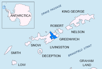
Location of McFarlane Strait in the South Shetland Islands
|
|
| Geography | |
|---|---|
| Location | Antarctica |
| Coordinates | 62°25′09.9″S 60°05′59.2″W / 62.419417°S 60.099778°W |
| Archipelago | South Shetland Islands |
| Area | 9 ha (22 acres) |
| Highest elevation | 205 m (673 ft) |
| Administration | |
| Administered under the Antarctic Treaty System | |
| Demographics | |
| Population | 0 |
Pyramid Island is a tall, rocky island in Antarctica. It looks like a pillar or a pyramid. This island rises 205 m (673 ft) high. It is located near the entrance of McFarlane Strait. The island is part of the South Shetland Islands.
Pyramid Island covers an area of about 9 hectares (22 acres). Near it, there is a smaller rock called Cone Rock. Cone Rock is about 6 m (19.7 ft) tall. It is located 1.33 km (0.83 mi) south of Pyramid Island.
Sailors first visited this area a long time ago. Captain William Smith explored the South Shetland Islands in 1819. Later, in the early 1800s, seal hunters also came to this region. Both Pyramid Island and Cone Rock were officially mapped and named in 1935. This was done by a group called Discovery Investigations. They gave the places names that described how they looked.
Where is Pyramid Island?
Pyramid Island is located at 62°25′09.9″S 60°05′59.2″W / 62.419417°S 60.099778°W. It is in the South Shetland Islands. This group of islands is off the coast of the Antarctic Peninsula.
Here are some distances to other nearby places:
- It is 4.8 km (3.0 mi) northwest of Duff Point. Duff Point is on Greenwich Island.
- The island is 3.36 km (2.09 mi) north by west of the Meade Islands.
- It is also 3.78 km (2.35 mi) north-northeast of Williams Point.
- Pyramid Island is 1.76 km (1.09 mi) northeast of Koshava Island. Koshava Island is part of the Zed Islands.
Many countries have mapped this area over the years. These include British maps from 1820, 1935, 1948, and 1968. Argentine maps were made in 1948 and 1954. Chile mapped it in 1971, and Spain in 1991. Bulgaria also created maps in 2005 and 2009.
Maps of the Area
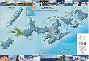
You can see Pyramid Island and the surrounding area on maps. These maps help us understand where everything is located.
- L.L. Ivanov et al. Antarctica: Livingston Island and Greenwich Island, South Shetland Islands. This is a detailed topographic map. It was made by the Antarctic Place-names Commission of Bulgaria in 2005.


