Quinton Township, New Jersey facts for kids
Quick facts for kids
Quinton Township, New Jersey
|
|
|---|---|
|
Township
|
|
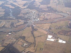
Aerial photo of Quinton
|
|
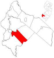
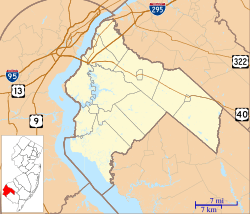
Quinton Township highlighted in Salem County. Inset map: Salem County highlighted in the State of New Jersey.
|
|
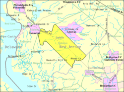
Census Bureau map of Quinton Township, New Jersey
|
|
| Country | |
| State | |
| County | |
| Incorporated | February 18, 1873 |
| Government | |
| • Type | Township |
| • Body | Township Committee |
| Area | |
| • Total | 24.27 sq mi (62.87 km2) |
| • Land | 23.79 sq mi (61.62 km2) |
| • Water | 0.48 sq mi (1.25 km2) 1.98% |
| Area rank | 113th of 565 in state 8th of 15 in county |
| Elevation | 69 ft (21 m) |
| Population
(2020)
|
|
| • Total | 2,580 |
| • Estimate
(2023)
|
2,614 |
| • Rank | 465th of 565 in state 10th of 15 in county |
| • Density | 108.4/sq mi (41.9/km2) |
| • Density rank | 536th of 565 in state 9th of 15 in county |
| Time zone | UTC−05:00 (Eastern (EST)) |
| • Summer (DST) | UTC−04:00 (Eastern (EDT)) |
| ZIP Code |
08072
|
| Area code(s) | 856 |
| FIPS code | 3403361470 |
| GNIS feature ID | 0882130 |
Quinton Township is a small community located in Salem County, New Jersey. It's a type of local government area called a township in the U.S. state of New Jersey. In 2020, about 2,580 people lived here.
Quinton Township became an official township on February 18, 1873. It was formed from parts of what is now Alloway Township. The name "Quinton" might come from an early settler, possibly Tobias or Edward Quinton. An interesting historical event happened here in March 1778. During the American Revolutionary War, a small battle took place at Quinton's Bridge.
Quinton Township is also known as a "dry township." This means that, by law, you cannot buy or sell alcohol within the township's borders.
Contents
Exploring Quinton Township's Geography
Quinton Township covers an area of about 24.27 square miles (62.87 square kilometers). Most of this area is land, with a small part being water.
A specific area within the township is called Quinton CDP. A CDP stands for "census-designated place." It's a community that the Census Bureau defines for gathering population data.
Other small communities found in Quinton Township include Berrys Chapel, Harmony, Mickles Mill, Pecks Corner, Woodmere, and Woods Upper Mill.
Quinton Township shares its borders with several other towns. These include Alloway Township, Lower Alloways Creek Township, Mannington Township, and Salem in Salem County. It also borders Stow Creek Township in Cumberland County.
Quinton Township's Population Over Time
| Historical population | |||
|---|---|---|---|
| Census | Pop. | %± | |
| 1880 | 1,390 | — | |
| 1890 | 1,307 | −6.0% | |
| 1900 | 1,280 | −2.1% | |
| 1910 | 1,091 | −14.8% | |
| 1920 | 956 | −12.4% | |
| 1930 | 1,166 | 22.0% | |
| 1940 | 1,313 | 12.6% | |
| 1950 | 1,821 | 38.7% | |
| 1960 | 2,440 | 34.0% | |
| 1970 | 2,567 | 5.2% | |
| 1980 | 2,887 | 12.5% | |
| 1990 | 2,511 | −13.0% | |
| 2000 | 2,786 | 11.0% | |
| 2010 | 2,666 | −4.3% | |
| 2020 | 2,580 | −3.2% | |
| 2023 (est.) | 2,614 | −2.0% | |
| Population sources: 1880–2000 1880–1920 1880–1890 1890–1910 1910–1930 1940–2000 2000 2010 2020 |
|||
The population of Quinton Township has changed over the years. In 2010, there were 2,666 people living there. By 2020, the population had slightly decreased to 2,580 people. This shows a small change of about 3.2% fewer people.
A Closer Look at the 2010 Population
In 2010, there were 1,036 households in the township. A household means all the people living in one home. The average household had about 2.57 people. The median age of people in Quinton Township was 41.5 years old. This means half the people were younger than 41.5 and half were older.
Schools in Quinton Township
Students in Quinton Township attend public schools through two different districts.
Quinton Township School District
The Quinton Township School District serves younger students. Children from pre-kindergarten up to eighth grade go to Quinton Township Elementary School. In the 2021–2022 school year, there were 276 students and about 30 teachers. This means there were roughly 9 students for every teacher.
Salem High School
For high school, students from Quinton Township go to Salem High School. This school is located in Salem City. Students from nearby towns like Elsinboro Township, Lower Alloways Creek Township, and Mannington Township also attend Salem High School. In the 2021–2022 school year, the high school had 399 students and 39 teachers.
Getting Around Quinton Township
Quinton Township has many roads that help people travel. As of 2010, there were over 52 miles of roads in total. The local township maintains some roads, while others are kept up by Salem County or the state of New Jersey.
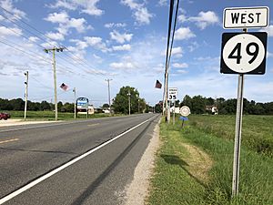
Important roads that go through Quinton Township include Route 49. This route travels from the northwest to the southeast parts of the township. Other key roads are County Route 540 and County Route 581.
Famous People from Quinton Township
Some notable individuals have connections to Quinton Township:
- George Agnew Chamberlain (1879–1966) was a novelist and a former diplomat.
- Shameka Marshall (born 1983) is a long jumper. She won a gold medal at the 2007 NACAC Championships in Athletics.
See also
 In Spanish: Municipio de Quinton para niños
 | Selma Burke |
 | Pauline Powell Burns |
 | Frederick J. Brown |
 | Robert Blackburn |


