
Salem, New Jersey facts for kids
Quick facts for kids
Salem, New Jersey
|
||
|---|---|---|
|
City
|
||

The Old Salem County Courthouse
|
||
|
||

Location of Salem in Salem County, New Jersey
|
||

Salem, New Jersey
Location in Salem County, New Jersey

Salem, New Jersey
Location in New Jersey

Salem, New Jersey
Location in the United States
|
||
| Country | ||
| State | ||
| County | Salem | |
| Formed | October 1675 | |
| Incorporated | February 21, 1798 (as township) | |
| Incorporated | February 25, 1858 (as city) | |
| Government | ||
| • Type | City | |
| • Body | City Council | |
| Area | ||
| • Total | 2.81 sq mi (7.29 km2) | |
| • Land | 2.34 sq mi (6.07 km2) | |
| • Water | 0.47 sq mi (1.22 km2) 16.73% | |
| Area rank | 353rd of 565 in state 12th of 15 in county |
|
| Elevation | 10 ft (3 m) | |
| Population
(2020)
|
||
| • Total | 5,296 | |
| • Estimate
(2023)
|
5,325 | |
| • Rank | 371st of 565 in state 4th of 15 in county |
|
| • Density | 2,259.4/sq mi (872.4/km2) | |
| • Density rank | 278th of 565 in state 3rd of 15 in county |
|
| Time zone | UTC−05:00 (Eastern (EST)) | |
| • Summer (DST) | UTC−04:00 (Eastern (EDT)) | |
| ZIP Code |
08079
|
|
| Area code(s) | 856 exchanges 339, 878, 935 | |
| FIPS code | 3403365490 | |
| GNIS feature ID | 0885385 | |

Salem is a city in New Jersey. It's the main town, or "county seat," of Salem County, which is the most rural county in New Jersey. The name Salem comes from the Hebrew word shalom, which means peace.
In 2020, about 5,296 people lived in Salem. This was a small increase from 2010, but fewer people than in 2000. Salem is part of the larger Philadelphia area, also known as the Delaware Valley.
The town was started in 1675 by John Fenwick. It officially became a township on February 21, 1798. Later, on February 25, 1858, it was changed to Salem City.
Contents
History of Salem City
Salem was founded by John Fenwick, who was a Quaker. He sailed to the Delaware Bay and started a settlement. Fenwick faced some challenges in proving his right to the land. But he eventually showed his claims were valid and continued to govern the area. Salem grew steadily over time.
In October 1693, the people of Salem were allowed to choose their own leaders.
Revolutionary War Events
In 1778, during the American Revolutionary War, the British attacked the local American fighters in what was called the Salem Raid. During this attack, a judge named William Hancock was accidentally killed by British troops. This event is known as the Hancock House Massacre.
After the war, trials were held at the county courthouse. People suspected of helping the British were put on trial for treason. Four men were found guilty and sentenced to death. However, the governor pardoned them, and they were sent away from New Jersey.
Salem officially became a township on February 21, 1798. This was part of a group of 104 townships created by the New Jersey Legislature.
The Tomato Legend
There's a famous story about Colonel Robert Gibbon Johnson at the Old County Courthouse. Legend says that in 1820, he stood on the courthouse steps and ate tomatoes. At that time, many people thought tomatoes were poisonous! A large crowd watched him, amazed. However, this story didn't appear in books until 1948, so many historians doubt it really happened.
On February 25, 1858, Salem was officially changed from a township to Salem City.
Historic Buildings in Salem
The Old Salem County Courthouse is still used today as the main office for Salem City. It is the oldest courthouse still in use in New Jersey. It's also the second-oldest courthouse in continuous use in the entire United States!
The courthouse was built in 1735, during the time of King George II. It was made with bricks from the local area. The building was made bigger in 1817 and again in 1908. Its special bell tower looks much the same as it did long ago, and the original bell is still inside the courtroom.
Geography of Salem
Salem is located along the Salem River. The city covers about 2.81 square miles (7.29 square kilometers). Most of this area is land, with a small part being water.
Salem shares its borders with several other towns in Salem County. These include Elsinboro Township, Lower Alloways Creek Township, Mannington Township, Pennsville Township, and Quinton Township.
Climate in Salem
The weather in Salem has hot, humid summers. Winters are usually mild to cool. Salem has what is called a humid subtropical climate. This means it gets plenty of rain and has warm temperatures for much of the year.
Population and People
| Historical population | |||
|---|---|---|---|
| Census | Pop. | %± | |
| 1810 | 929 | — | |
| 1820 | 1,303 | 40.3% | |
| 1830 | 1,570 | 20.5% | |
| 1840 | 2,006 | 27.8% | |
| 1850 | 3,052 | 52.1% | |
| 1860 | 3,865 | 26.6% | |
| 1870 | 4,555 | 17.9% | |
| 1880 | 5,056 | 11.0% | |
| 1890 | 5,516 | 9.1% | |
| 1900 | 5,811 | 5.3% | |
| 1910 | 6,614 | 13.8% | |
| 1920 | 7,435 | 12.4% | |
| 1930 | 8,047 | 8.2% | |
| 1940 | 8,618 | 7.1% | |
| 1950 | 9,050 | 5.0% | |
| 1960 | 8,941 | −1.2% | |
| 1970 | 7,648 | −14.5% | |
| 1980 | 6,959 | −9.0% | |
| 1990 | 6,883 | −1.1% | |
| 2000 | 5,857 | −14.9% | |
| 2010 | 5,146 | −12.1% | |
| 2020 | 5,296 | 2.9% | |
| 2023 (est.) | 5,325 | 3.5% | |
| Population sources: 1810–2000 1810–1920 1840 1830–1870 1850 1870 1880–1890 1890–1910 1910–1930 1940–2000 2000 2010 2020 |
|||
Population Changes in Salem
The 2020 United States census showed that 5,296 people lived in Salem. This was a small increase from the 5,146 people counted in 2010.
The population of Salem is made up of people from different backgrounds. In 2020, about 24% of the people were White, and about 58% were Black or African American. About 11% of the population was Hispanic or Latino.
In 2010, there were 2,157 households in Salem. About 29% of these households had children under 18. The average household had 2.36 people.
Education in Salem
The Salem City School District provides public education for students from pre-kindergarten through twelfth grade. The district has three schools.
As of the 2021–22 school year, about 1,226 students were enrolled. There were 99 teachers, meaning about 12 students for every teacher.
The schools in the district are:
- John Fenwick Academy (PreK-2)
- Salem Middle School (grades 3-8)
- Salem High School (grades 9-12)
Students from nearby towns like Elsinboro, Lower Alloways Creek Township, Mannington Township, and Quinton Township also attend Salem High School.
Other Schools
There are also Catholic schools that accept students from Salem. Guardian Angels Regional School is a K-8 school. Its younger campus (PreK-3) is in Gibbstown, and its older campus (4-8) is in Paulsboro.
Salem Community College is located in nearby Carneys Point Township.
Transportation in Salem
The Port of Salem is an important part of the city. It was named a port of entry by the British in 1682. This means it was a place where goods could officially enter the country. The port is on the Salem River, which connects to the larger Delaware River.
Today, the Port of Salem handles many types of goods. This includes materials for construction, clothing, fishing gear, and farm products. The South Jersey Port Corporation runs the Salem Terminal.
A train line called the Glass House Spur connects to the Port of Salem. It helps move goods to and from the port.
_just_north_of_New_Jersey_State_Route_49_(Broadway)_in_Salem,_Salem_County,_New_Jersey.jpg)
Roads and Highways
As of 2010, Salem had about 24.79 miles (39.89 kilometers) of roads. Most of these roads are maintained by the city itself.
Important state highways that pass through Salem include Route 45 and Route 49. Other major roads nearby are Interstate 295, the New Jersey Turnpike, and the Delaware Memorial Bridge.
Public Transportation Options
NJ Transit offers bus service from Salem to Philadelphia on the 401 route. There is also a local bus service, the 468 route.
There used to be a ferry service between Salem and Delaware City, Delaware. This ferry was later rerouted to Fort Mott and is now called the Forts Ferry Crossing.
Notable People from Salem
Many interesting people have been born in, lived in, or are connected to Salem. Here are a few:
- Forman S. Acton (1920–2014), a computer scientist and author.
- Benjamin H. Brewster (1816–1888), who served as the United States Attorney General.
- John Chowning (born 1934), a musician and inventor who created FM synthesis for music.
- Johnny Gaudreau (1993–2024), a professional hockey player in the NHL.
- Goose Goslin (1900–1971), a famous Hall of Fame baseball player.
- William J. Hughes (1932–2019), who represented New Jersey in the United States House of Representatives.
- Orlando Jordan (born 1974), a retired professional wrestler.
- Lydell Mitchell (born 1949), a running back in the National Football League.
- Charles J. Pedersen (1904–1989), an organic chemist who won the 1987 Nobel Prize in Chemistry.
- John S. Rock (1826–1866), an African-American doctor, dentist, and lawyer who fought against slavery.
- Alice Barber Stephens (1858–1932), a painter and engraver known for her illustrations.
- Jonathan Taylor (born 1999), a running back for the Indianapolis Colts who set a New Jersey state record in high school.
Photo gallery
- Salem, New Jersey
-
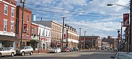
Broadway in downtown Salem in 2006
-
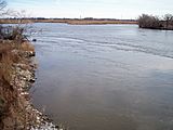
The Salem River in Salem in 2006
-
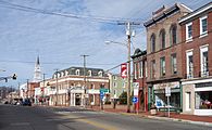
Broadway in downtown Salem in 2006
-
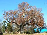
The historic Salem Oak, November 2012
-
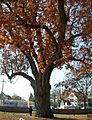
The historic Salem Oak, November 2012
-
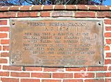
Salem Oak Commemorative Plaque, November 2012


See also
 In Spanish: Salem (Nueva Jersey) para niños
