Randalia, Iowa facts for kids
Quick facts for kids
Randalia, Iowa
|
|
|---|---|

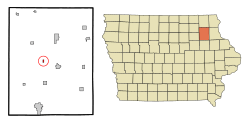
Location of Randalia, Iowa
|
|
| Country | |
| State | |
| County | Fayette |
| Area | |
| • Total | 0.19 sq mi (0.48 km2) |
| • Land | 0.19 sq mi (0.48 km2) |
| • Water | 0.00 sq mi (0.00 km2) |
| Elevation | 1,115 ft (340 m) |
| Population
(2020)
|
|
| • Total | 50 |
| • Density | 267.38/sq mi (103.44/km2) |
| Time zone | UTC-6 (Central (CST)) |
| • Summer (DST) | UTC-5 (CDT) |
| ZIP code |
52164
|
| Area code(s) | 563 |
| FIPS code | 19-65550 |
| GNIS feature ID | 0460519 |
Randalia is a small community located in Fayette County, Iowa, in the United States. It's not officially a city but a "census designated place." This means it's a special area defined for collecting population data. In 2020, about 50 people lived there.
Contents
Where is Randalia?
Randalia is located in the state of Iowa. You can find it at these coordinates: 42 degrees, 51 minutes, 44 seconds North and 91 degrees, 53 minutes, 13 seconds West.
The United States Census Bureau says that Randalia covers a total area of about 0.48 square kilometers (0.19 square miles). All of this area is land, with no water.
How Many People Live Here?
Randalia's population has changed a lot over the years. Here's a look at how many people have lived there:
| Historical populations | ||
|---|---|---|
| Year | Pop. | ±% |
| 1900 | 117 | — |
| 1910 | 123 | +5.1% |
| 1920 | 113 | −8.1% |
| 1930 | 123 | +8.8% |
| 1940 | 121 | −1.6% |
| 1950 | 132 | +9.1% |
| 1960 | 114 | −13.6% |
| 1970 | 85 | −25.4% |
| 1980 | 101 | +18.8% |
| 1990 | 88 | −12.9% |
| 2000 | 84 | −4.5% |
| 2010 | 68 | −19.0% |
| 2020 | 50 | −26.5% |
| Source: and Iowa Data Center Source: |
||
Randalia's Population in 2020
According to the census in 2020, there were 50 people living in Randalia. These people lived in 23 different households, and 12 of these were families.
The population density was about 103 people per square kilometer (267 people per square mile). Most residents, 90%, were White. About 10% were from two or more races.
- About 13% of households had children under 18.
- Many households (39.1%) were married couples living together.
- The average age of people in Randalia was 48.5 years old.
- About 24% of residents were under 20 years old.
- About 26% of residents were 65 years old or older.
- The population was split evenly, with 50% male and 50% female.
Randalia's Population in 2010
In the census of 2010, 68 people lived in Randalia. There were 29 households and 21 families. The population density was about 120 people per square kilometer (309 people per square mile).
Most people (94.1%) were White. About 5.9% were from two or more races.
- About 27.6% of households had children under 18.
- Most households (65.5%) were married couples living together.
- The average age was 41.5 years.
- About 17.6% of residents were under 18.
- About 17.6% were 65 years old or older.
- More males lived in Randalia than females, with 55.9% male and 44.1% female.
Changes Over Time
Locals in Randalia have noticed their community getting smaller over the years. For example, in October 2007, the town's post office closed down. Before that, the school and the general store had also closed.
Education
The West Central Community School District is in charge of the public schools in the Randalia area.
See also
 In Spanish: Randalia (Iowa) para niños
 | Delilah Pierce |
 | Gordon Parks |
 | Augusta Savage |
 | Charles Ethan Porter |

