Rapides du Cheval Blanc facts for kids
Quick facts for kids Rapides du Cheval Blanc |
|
|---|---|

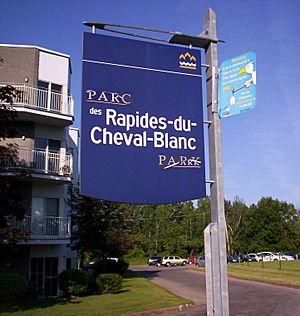
Rapides du Cheval Blanc Park
|
|
| Lua error in Module:Location_map at line 420: attempt to index field 'wikibase' (a nil value). | |
| Location | Pierrefonds-Roxboro, Montreal, Quebec, Canada |
| Operated by | City of Montreal |
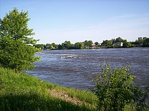
The Rapides du Cheval Blanc, also known as the White Horse Rapids, are a cool natural spot in Quebec, Canada. They are located between the north side of the Island of Montreal (in Pierrefonds-Roxboro) and Sainte-Dorothée, Laval. These rapids flow along the Rivière des Prairies.
The name "Rapides du Cheval Blanc" doesn't just mean the rapids themselves. It also refers to a protected forest, a public park right next to the rapids, and even a fault line deep underground. You can easily see the rapids from the public park.
Contents
History of the White Horse Rapids Area
The name "White Horse" or "Cheval Blanc" comes from some old legends. One story from the 1700s tells of a white horse that would appear from the Rivière des Prairies. This horse supposedly scared villagers and damaged their crops.
Another legend says a white horse was pulling a cart on a ferry. The ferry was crossing the river to Île Bizard. When the rope connecting the ferry to the shore broke, it drifted downstream. At the fastest part of the rapids, the horse managed to escape. There's also a story about a white horse carrying building materials for a church. It supposedly jumped onto a boat right in the middle of the rapids!
The land near the Rivière des Prairies has often experienced spring floods. This means the river water has risen and covered the land many times in the past.
Who Owns the River?
Both the Canadian federal government and the Quebec provincial government share ownership of the river. Fisheries and Oceans Canada, a federal group, looks after the water. The provincial government manages the riverbed and the land along both shores. During summer, floating buoys are placed in the river. These help boats navigate safely.
The river's water is usually quite clean. This is based on weekly tests done by the RSMA (Réseau de suivi du milieu aquatique). The Rapides du Cheval Blanc area is known as RDP-180 in their reports. You can also find the river's temperature in these reports. It can get as warm as 25 °C (77 °F) in July and August.
Who Owned the Land?
Long ago, the first owners of this land were the Aboriginal peoples, including the Algonquin people. Later, French explorers claimed the land and called it New France. The parish of Sainte-Geneviève was started in 1741.
After the Seven Years' War, the Treaty of Paris (1763) gave Canada and most of New France to Britain. In 1775-1776, the Island of Montreal faced attacks during a conflict with America. Fort Senneville was destroyed in 1776. The Treaty of Paris (1783) officially ended the American Revolutionary War. Canada became its own nation on July 1, 1867.
Old maps show how farmers divided their fields using the Seigneurial system. These maps, like one from 1879, show different family names linked to the land.
In 1947, aerial photos showed that the Cheval Blanc land was still used for farming. When the Deux-Montagnes railway was built between 1912 and 1918, it cut through many fields. This left some properties with unusual triangle shapes.
Even today, you can still see old stone walls in the undeveloped parts of the woods. These walls, about 3 feet wide and 3 feet tall, marked the old farm boundaries. You can also find many apple trees planted by the farmers long ago. People started building homes on this farmland in 1953.
The location in the river was officially named "Rapides du Cheval Blanc" in 1968. This was done by the Gouvernement du Québec and Natural Resources Canada. In 1968, the road called Sources Boulevard was extended north. This allowed building to begin on the land near the rapids.
In 1972, there was a plan to build a large apartment building on the land. A petition with over a thousand names was given to the mayor to protect the land. However, the petition was not acted upon. Later, in December 2015, the City of Montreal bought a piece of this land for $3,431,280. This land was originally considered a flood plain and not suitable for building.
Rapides du Cheval Blanc Park
The idea of making this land a public "Promenade" park came up as early as 1974. A public park was officially created in 1997. It was built on the site of an old sewage treatment plant. The current nature park, which is even bigger, was finally created in 2009.
On August 8, 2019, the City of Montreal announced exciting news. They plan to include the Rapides du Cheval Blanc Park in the future Grand Parc de L’Ouest. This will make it part of a much larger park system.
Keeping the Park Clean
Some areas of the park, especially near 5th Avenue North, have construction debris like old red bricks. However, in June and July, you can see fireflies in this area after sunset. They glow beautifully from the bicycle path.
Near the street "Rue du Sureau," you might also see some cement and rebar debris. This is on the side of the road, east of the Canada Post mailboxes.
Wildlife at the Rapids
Many different wild animals live near the Rapides du Cheval Blanc. You might spot rabbits, squirrels, snakes, and chipmunks. Turtles are also common.
Bird watchers can enjoy seeing cardinals, seagulls, and sandpipers. Herons, ducks, geese, chickadees, and finches also make their home here.
 | Leon Lynch |
 | Milton P. Webster |
 | Ferdinand Smith |


