
Rivière des Prairies facts for kids
Quick facts for kids Rivière des Prairies |
|
|---|---|

Aerial view looking east, of Rivière des Prairies with Louis Bisson Bridge in the foreground. The island "Ile aux Chats" can be seen near the centre.
|
|
| Country | Canada |
| Province | Quebec |
| Region | Montreal and Laval |
| Physical characteristics | |
| Main source | Lake of Two Mountains |
| River mouth | Saint Lawrence River |
The Rivière des Prairies is a river in southwestern Quebec, Canada. Its name means River of the Prairies in French. Some people also call it the Back River in English. Long ago, the first people living on the Island of Montreal called it Skowanoti. This name meant "River behind the island." The river acts like a natural border, separating the cities of Laval and Montreal.
Contents
River's Path and Islands
The Rivière des Prairies flows from west to east. It starts in the Lake of Two Mountains. The river then goes around Île Bizard, which is part of Montreal. After that, it divides the Island of Montreal to the south from Île Jésus (where Laval is) to the north. Finally, it flows into the Saint Lawrence River at the eastern tip of the Island of Montreal.
The river is home to many islands. Some of these islands are Île Bizard and the Îles Laval. The Îles Laval include Île Bigras, Île Pariseau, Île Verte, and Île Ronde. Montreal also has its own island in the river, called Île de la Visitation. This island is a beautiful nature park. Other islands in the river have names like Île Mercier, Île Ménard, Île Jasmin, Île Barwick, Île de Roxboro, Île aux Chats, Île Paton, Île Perry, Île Lapierre, Île Boutin, Île Rochon, and Île Gagné.
River Rapids
The Rivière des Prairies has many fast-flowing parts called rapids. Old maps from 1879 and 1924 show these rapids in several spots. Starting from the west, some of the named rapids are the "Rapides de Cap-Saint-Jacques." Then there are the Lalemant (Dutchman) Rapids, found between Île Bizard and Laval. You can even take a ferry across the river near these rapids.
Further east, you'll find the "Rapides du Cheval Blanc" (Whitehorse rapids). These are located between the areas of Pierrefonds-Roxboro and Sainte-Dorothée. There are also the Laval rapids and the "Sault-au-Récollet Rapids" near Bordeaux Prison. The last set of rapids are called the "Rapides de la Rivière des Prairies."
Past Riverfront Beaches
In the past, the riverfront in the West Island area was well-known for its lovely beaches. People enjoyed swimming and relaxing along the river. Some of these popular beaches were called "Crystal," "Noel/Roy," "Riviera," and the Roxboro municipal beach.
Keeping the River Clean
For many years, the Rivière des Prairies faced challenges with pollution. In the past, a lot of water from homes and streets in Montreal went into the river without being cleaned. This problem was noticed as early as 1911.
However, things have changed a lot! Today, modern ways of cleaning water are used. This has helped to make the river much cleaner. Since 1998, most of the water is treated before it goes into the river. This means it's much safer for the environment.
Drinking Water from the River
Montreal has six special plants on the island that take water from the Rivière des Prairies and Lac Saint Louis. This water is then cleaned and made safe for drinking. The drinking water in Montreal and Quebec City is regularly tested to make sure it is safe for everyone.
Ongoing Efforts
Even though the river is much cleaner now, some parts are still not safe for swimming. For example, one area called Rive-Boisée had problems with dirty water since 1971. This was because some pipes that carry rainwater were accidentally connected to pipes that carry water from homes. Fixing these connections costs money and takes time. Reports from 2015 showed that the problem in the Rive-Boisée area was still being worked on.
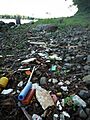
To help keep the river clean, special screens are used at the places where rainwater and other things flow into the river. These screens help to catch plastic bags, paper, and other trash. This stops them from getting into the river and making it look messy. People are working hard to make sure the Rivière des Prairies stays clean and healthy for everyone to enjoy.
Images for kids
-
The shoreline of Rivière des Prairies and the Rapides du Cheval Blanc near the Island of Montreal.

See also
 In Spanish: Rivière des Prairies para niños
