Raynolds Peak facts for kids
Quick facts for kids Raynolds Peak |
|
|---|---|
| Highest point | |
| Elevation | 10,915 ft (3,327 m) |
| Prominence | 750 ft (230 m) |
| Geography | |
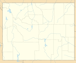
| Location | Grand Teton National Park, Teton County, Wyoming, U.S. |
| Parent range | Teton Range |
| Topo map | USGS Mount Moran |
Raynolds Peak is a tall and impressive mountain located in the northern part of the Teton Range. You can find it within the beautiful Grand Teton National Park in Wyoming, USA. This peak stands at about 10,915 feet (3,327 m) high, making it a significant landmark in the park. It's a wild and rugged area, perfect for exploring if you love nature and adventure.
Contents
Where is Raynolds Peak Located?
Raynolds Peak is nestled in the stunning Grand Teton National Park. This park is famous for its dramatic mountain scenery and amazing wildlife. The peak itself rises just north of a large valley called Moran Canyon. It is also about 5 miles (8 km) west of Moran Bay, which is on the shores of Jackson Lake. Jackson Lake is one of the largest lakes in the park.
Unique Mountain Features
The north side of Raynolds Peak has many deep, bowl-shaped valleys. These are called cirques. They were carved out by glaciers a very long time ago. These cirques are found above another area known as Snowshoe Canyon. Because this area is so wild, there are no official trails to the summit of Raynolds Peak. This means that reaching the top is a challenging adventure for experienced climbers.
Who Was William F. Raynolds?
Raynolds Peak is named after a very important person named William F. Raynolds. He was an American explorer and engineer. In the years 1859 and 1860, Raynolds led a big journey called the Raynolds Expedition. This expedition explored parts of the American West, including the area where the Teton Mountains are located today.
The Raynolds Expedition
The Raynolds Expedition was a scientific and mapping trip. Its goal was to explore the Yellowstone and Missouri River regions. Raynolds and his team gathered important information about the geography, plants, and animals of these areas. They also mapped the land, which was very helpful for future settlers and explorers. Naming the peak after him was a way to honor his contributions to understanding this part of the United States.
 | Misty Copeland |
 | Raven Wilkinson |
 | Debra Austin |
 | Aesha Ash |


