Redding, Iowa facts for kids
Quick facts for kids
Redding, Iowa
|
|
|---|---|
 |
|

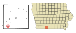
Location of Redding, Iowa
|
|
| Country | |
| State | |
| County | Ringgold |
| Area | |
| • Total | 1.00 sq mi (2.59 km2) |
| • Land | 0.99 sq mi (2.56 km2) |
| • Water | 0.01 sq mi (0.02 km2) |
| Elevation | 1,135 ft (346 m) |
| Population
(2020)
|
|
| • Total | 63 |
| • Density | 63.70/sq mi (24.58/km2) |
| Time zone | UTC-6 (Central (CST)) |
| • Summer (DST) | UTC-5 (CDT) |
| ZIP code |
50860
|
| Area code(s) | 641 |
| FIPS code | 19-66000 |
| GNIS feature ID | 2396339 |
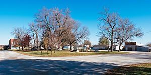
Redding is a small city located in the southwestern part of Ringgold County, in the state of Iowa, United States. In 2020, about 63 people lived there.
Contents
About Redding's Location
Redding covers a total area of about 1 square mile (2.59 square kilometers). Most of this area is land, with a very small part being water. The city is located in the United States and is part of Iowa, a state known for its farming.
People of Redding
| Historical populations | ||
|---|---|---|
| Year | Pop. | ±% |
| 1880 | 85 | — |
| 1890 | 214 | +151.8% |
| 1900 | 311 | +45.3% |
| 1910 | 269 | −13.5% |
| 1920 | 289 | +7.4% |
| 1930 | 272 | −5.9% |
| 1940 | 246 | −9.6% |
| 1950 | 200 | −18.7% |
| 1960 | 129 | −35.5% |
| 1970 | 111 | −14.0% |
| 1980 | 91 | −18.0% |
| 1990 | 119 | +30.8% |
| 2000 | 78 | −34.5% |
| 2010 | 82 | +5.1% |
| 2020 | 63 | −23.2% |
| Source: and Iowa Data Center Source: |
||
Redding's Population in 2020
In 2020, a census counted 63 people living in Redding. These people lived in 34 households, and 22 of these were families. The city had about 63.7 people per square mile. Most residents (95.2%) were White. A small number (3.2%) were from two or more racial backgrounds.
About 35.3% of the households had children under 18 living with them. Many households (44.1%) were married couples living together. The average age of people in Redding was 56.5 years old. About 25.4% of residents were under 20, and 30.2% were 65 or older. The population was slightly more female (55.6%) than male (44.4%).
Redding's Population in 2010
Back in 2010, the census showed that 82 people lived in Redding. There were 37 households in the city. The population density was about 82 people per square mile. All residents were identified as White.
In 2010, 21.6% of households had children under 18. About 48.6% of households were married couples. The average age in Redding was 51.5 years. About 24.4% of residents were under 18, and 20.7% were 65 or older. The number of males and females was almost equal, with 50% male and 50% female.
Schools in Redding
The Mount Ayr Community School District is responsible for running the public schools that serve the community of Redding. This means students in Redding attend schools within this district.
See also
 In Spanish: Redding (Iowa) para niños
 | Misty Copeland |
 | Raven Wilkinson |
 | Debra Austin |
 | Aesha Ash |

