Regulbium facts for kids
Quick facts for kids Regulbium |
|
|---|---|

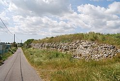
Remains of the perimeter wall
of Regulbium Roman Fort |
|
| Location | |
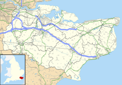
| Coordinates | 51°22′44″N 1°12′00″E / 51.379°N 1.200°E |
| Town | Reculver |
| County | Kent |
| Country | England |
| Reference | |
| UK-OSNG reference | TR228693 |
Regulbium was an old Roman fort near the town of Reculver in Kent, England. It was part of the Saxon Shore forts, which were built to protect the coast. The name Regulbium comes from an old local language and means "great headland."
Contents
History of Regulbium Fort
The Romans first built a small fort here right after they invaded Britain. This was during the time of Emperor Claudius. This early fort was protected by earthworks, which are walls made of earth.
A road connected this fort to Durovernum (which is now Canterbury). The fort was in a very important spot. It was at the entrance of the Wantsum Channel. This channel was a busy waterway for ships.
The fort might have had a signal tower or even a lighthouse. This would have helped guide ships. Roman coins from the time of Emperor Nero were found here. This shows the fort was used until at least the late 60s AD.
Building the Stone Fort
A much larger stone fort was built in the early 3rd century. This was probably around the year 210 AD. A stone inscription found at the fort mentions Aulus Triarius Rufinus. He was the governor of Britain at that time.
Many cities and important places in Europe were being strengthened then. This was because of more attacks from barbarian groups. The fort at Regulbium was also made stronger.
Archaeologists have found signs of a lot of activity later on. This was towards the end of the 3rd century, during the Carausian Revolt. There was also activity in the first half of the 4th century. However, it seems the Roman army left the fort after 360 AD.
Roman Army and Fort Design
The stone fort at Reculver was built quite early for its type and location. It is similar in age and design to forts at Brancaster and Caister-on-Sea in Norfolk. This suggests that the east coast needed protection before the south coast. The Roman navy, called the Classis Britannica, patrolled the south coast.
The design of Regulbium fort is also like those along Hadrian's Wall in northern England. An old Roman document, the Notitia Dignitatum, mentions the soldiers at Reculver. It says the Cohors I Baetasiorum was stationed there.
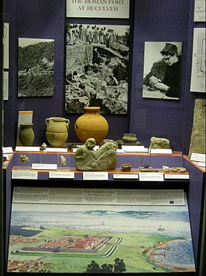
Tiles found at the fort have the letters "CIB" stamped on them. This stands for Cohors I Baetasiorum. This group of soldiers was previously at Maryport in Cumbria. They probably built the fort at Reculver. This could explain why it looks similar to forts on Hadrian's Wall.
After the Romans
After the Anglo-Saxons came to Britain, people still lived at the site. It was then called Raculf. It became a home for the Kings of Kent.
In 669 AD, King Ecgberht of Kent started a monastery at the fort site. This monastery was very important. In 690 AD, its abbot, Berhtwald, became the Archbishop of Canterbury.

Location and Construction
The fort stood on the mainland side of the northern entrance to the Wantsum Channel. This channel was about a mile wide. It separated the Isle of Thanet from the mainland.
The Wantsum Channel was a popular route for ships. The fort was built to control this channel. It also acted as a marker for ships to navigate by.
Fort Design
The fort's construction was typical for a Saxon Shore fort. It was square-shaped with rounded corners. The main wall was about 10 feet (3 meters) thick at the bottom. It became thinner at the top, about 8 feet (2.4 meters) thick. The wall was probably around 20 feet (6 meters) tall.
An earthen rampart was built inside the fort to make it even stronger. Outside the fort, there were two ditches. The fort covered an area of about 3.06 hectares (7.56 acres). However, almost half of this area has been lost to the sea over time due to erosion.
 | John T. Biggers |
 | Thomas Blackshear |
 | Mark Bradford |
 | Beverly Buchanan |


