Rickard Hollow facts for kids
Quick facts for kids Rickard Hollow |
|
|---|---|

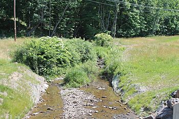
Rickard Hollow in its lower reaches looking upstream
|
|
| Physical characteristics | |
| Main source | deep valley in Fishing Creek Township, Columbia County, Pennsylvania between 1,000 and 1,020 feet (300 and 310 m) |
| River mouth | Green Creek in Greenwood Township, Columbia County, Pennsylvania 636 ft (194 m) 41°07′30″N 76°25′29″W / 41.1249°N 76.4247°W |
| Length | 2.6 mi (4.2 km) |
| Basin features | |
| Progression | Green Creek → Fishing Creek → Susquehanna River → Chesapeake Bay |
| Basin size | 2.22 sq mi (5.7 km2) |
| Tributaries |
|
Rickard Hollow is a small stream in Columbia County, Pennsylvania, in the United States. It flows into Green Creek. The stream is about 2.6 miles (4.2 km) long. It flows through Fishing Creek Township. The area of land that drains into Rickard Hollow is about 2.22 square miles (5.7 km2). The stream has two smaller streams, called tributaries, that flow into it. We don't know exactly how Rickard Hollow got its name.
Contents
Where Rickard Hollow Flows
Rickard Hollow starts in a deep valley in Fishing Creek Township. This spot is a short distance west of Stillwater. The stream first flows southwest for a little while. Then, it turns to flow south-southwest for several tenths of a mile.
After that, Rickard Hollow turns west for a short distance. Here, it gets water from one of its unnamed tributaries. It also flows through a small pond. The stream then turns south-southwest again. It flows next to a road called T-633 and crosses it once.
Eventually, Rickard Hollow gets water from its second unnamed tributary. It then enters Greenwood Township and flows through Rohrsburg. It keeps flowing south-southwest. The stream crosses Rohrsburg Road and then turns mostly south. A little further downstream, it joins Green Creek. Rickard Hollow meets Green Creek about 3.56 miles (5.73 km) before Green Creek itself ends.
Streams Joining Rickard Hollow
Rickard Hollow does not have any named tributaries. However, it does have two smaller streams that flow into it. These are called unnamed tributaries.
Land and Water Around Rickard Hollow
The land around where Rickard Hollow joins Green Creek is about 636 feet (194 m) above sea level. Where the stream begins, the land is higher. It is between 1,000 feet (300 m) and 1,020 feet (310 m) above sea level. Rickard Hollow is near a larger valley called Greenwood Valley. It is also close to another valley known as Davis Hollow.
Understanding the Watershed
The land area that collects water for Rickard Hollow is called its watershed. This watershed covers about 2.22 square miles (5.7 km2). Both the beginning and end of the stream are in an area mapped by the United States Geological Survey called Benton.
Water Quality and Management
The local water authority, the Greenwood Township Municipal Authority, has a special permit. This permit allows them to release a small amount of treated water into Rickard Hollow. The United States Department of Environmental Protection has approved this. It is considered a very small release, with about 7,500 gallons of treated water released each day.
History of the Stream's Name
Rickard Hollow was officially added to the Geographic Names Information System on August 2, 1979. This system helps keep track of names for places like streams and mountains. Its special ID number in the system is 1185024.
The exact reason for the name Rickard Hollow is not known. However, it is thought that the stream was named after a farmer or landowner who lived in the area a long time ago.
 | May Edward Chinn |
 | Rebecca Cole |
 | Alexa Canady |
 | Dorothy Lavinia Brown |

